 Print-Friendly Version Print-Friendly Version
|
|
Meeting time has changed! Section 5 on the Benton MacKaye trail | |||||||
| The Basics: | |||||||
| Event Type: | |||||||
| Event Location: | Benton MacKaye Trail | ||||||
| Date(s) & Time: | Sat, Feb 19 2005 9:00 am >> N/A | ||||||
| Registration Opens: | Mon, Jan 1 2007 12:00 am | ||||||
| Registration Cut Off: | Thu, Feb 17 2005 11:59 pm | ||||||
| Event Duration: | per itinerary | ||||||
| Difficulty Rating: | D5: Difficult | ||||||
| Trip Leader(s): | Bruce Email Trip Leader(s) Email Trip Leader(s)
You must be logged in to get the Trip Leader contact information. | ||||||
| Member Cost: | None | ||||||
| Participant Info: | |||||||
| Who's Invited: | Members Only, 21 And Older Only | ||||||
| Maximum Group Size: | 8 | ||||||
| Minimum Group Size: | 2 | ||||||
| Number Registered So Far: | 9 / 0 (To see who's signed up, log in to the Member Area) | ||||||
| Are Dogs Permitted: | No | ||||||
| Itinerary: | |||||||
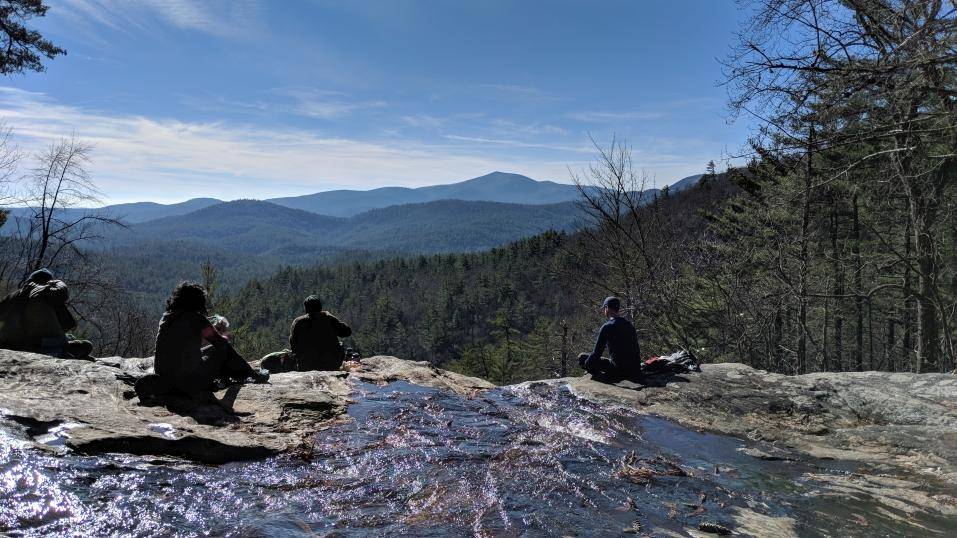
| strenuous to more strenuous 6-mile hike This will be a shared hike with Bruce’s old hiking group-SOA; with similar attendance limits. Wilscot GAP is our trailhead for the 6-mile workout and walk over Tipton, Brawley and Garland Mountains. The hard work of much elevation change gained and lost repeatedly on this hike is repaid by constant distant scenic views and overlooks afforded by winters barren trees. At Brawley Mountain will have lunch from the abandoned firetower, which has a scenic overlook. On the way down Garland Mountain there will be views of the Toccoa River, we’ll draw close to when we drop down to Shallowford Bridge Road. As usual on Bruce’s trips there will be an optional dining experience, this time at the Toccoa Riverside restaurant, overlooking the Toccoa River. They serve fresh mountain trout five ways, and have various other selections. Please note: Your fearless leader has already started a workout program the last couple of weeks to be in good aerobic shape for this and other hikes. Being in fairly good shapes for the large amount of elevation change in this hike is important, more so than I can say here in words. | |||||||
| |||||||
| How to Get There: | |||||||
| Event Directions: | Fannin County, GA (South of Blue Ridge, GA) park and ride lot only, please From the Chastain CCT Road park and ride lot, we drive to I-575, and north on that highway to Ellijay, where we get onto Highway 52 east, to our turn onto Big Creek Road to the backcountry of Georgia’s mountains. There we will drop a shuttle vehicle at one end of the trail, and then take the rest of our vehicles out Dial Road to highway 60 and north to the parking area across from Wilscot GAP. | ||||||
| Notes: | |||||||
|
Are Dogs Permitted? No Will this event occur rain or shine? Not in bad weather, heavy rain or snow-light snow would be a bonus, welcome addition to the scenery on this hike. Other Notes: As always, please e-mail me if trip fills up, as I will have a waiting list in order e-mails are received; and will happily take those people when someone drops, cancels; and might take a few from the list for the usual couple of no-shows that occur on every hike. * We encourage all members to follow our Etiquette Guidelines while participating in AOC events. | |||||||
| Cost Includes: | shared gas expenses, and approximately $15 for dinner, if you choose to be among the dining crowd. | ||||||
Cancellation/Partial Attendance: Please review the AOC cancellation policy. | |||||||
 Calendar of Events
 Event Places