

 Print-Friendly Version Print-Friendly Version
|
Neels Gap to Hogpen Gap-New Date | |||||||
| The Basics: | |||||||
| Event Type: | Hike | ||||||
| Event Location: | AT Neels Gap to Hogpen Gap | ||||||
| Date(s) & Time: | Sat, Dec 14 2024 8:30 am >> Sat, Dec 14 2024 4:00 pm (Carpool Departure: 7:00 am *log in for location*) | ||||||
| Registration Opens: | Mon, Nov 25 2024 11:50 am | ||||||
| Registration Cut Off: | Fri, Dec 13 2024 6:00 pm | ||||||
| Event Duration: | 7 Hours 30 Minutes | ||||||
| Difficulty Rating: | D6: Advanced | ||||||
| Distance: | 16.1 Miles | ||||||
| Pace: | Moderate | ||||||
| Trip Leader(s): | Pam M Email Trip Leader(s) Email Trip Leader(s)
You must be logged in to get the Trip Leader contact information. | ||||||
| Member Cost: | None | ||||||
| Participant Info: | |||||||
| Who's Invited: | Members Only, 21 And Older Only | ||||||
| Maximum Group Size: | 6 | ||||||
| Minimum Group Size: | 2 | ||||||
| Number Registered So Far: | 9 / 0 (To see who's signed up, log in to the Member Area) | ||||||
| Are Dogs Permitted: | Yes | ||||||
| Itinerary: | |||||||
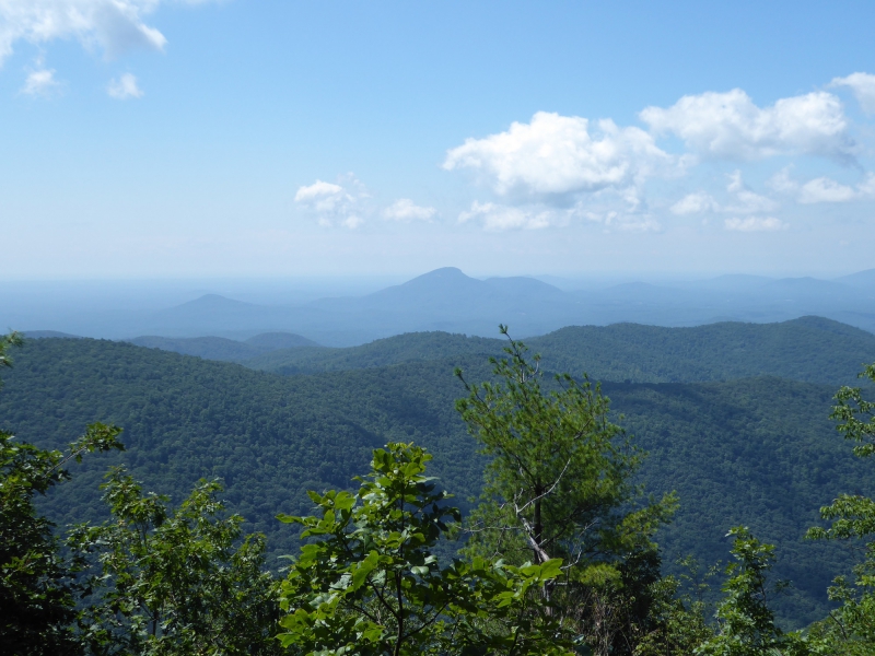
<<< Distance and Ascent >>> Starting from Neels Gap in the south to Hogpen Gap. The out and back round trip is 16 miles on AT with 4,547 feet elevation gain. These measurements are provided by AllTrails. Our total distance for the day is 16.1 miles <<< Itinerary >>> We’ll meet and start from Byron Reece parking lot. We’ll take US-19 to go about 0.5 miles to Neels Gap. We’ll start our AT (Appalachian Trail) trekking from Neels Gap following NoBo (North Bound) to Levelland Mt. at 1.5 miles; Cowrock Mt. at 5 miles; Tesnatee Gap next to GA-348 at 5.8 miles; and then Hogpen Gap around mile 8. We’ll then retrace our steps to go back to our cars. We’ll take short breaks and lunch break at those scenic spots. <<< Important Notes >>> Our duration time is an estimate, so please have some flexibility. Please only register if you are comfortable hiking at a pace of 2.3 mph in the remote mountains environment, and have recent D5 experience.
| |||||||
| |||||||
| How to Get There: | |||||||
| Event Directions: | Byron Reece trailhead parking, Byron Reece Memorial Trail, Blairsville, GA 30512 Note: The following is just one of many different ways to go. Take GA-400 N to its end. Turn left onto US-19 N for 5.1 miles to Dahlonega. Turn right and follow US-19 N for 22 miles to reach destination. Note: Parking lot is on the left about 0.5 miles after passing Neels Gap general store building and parking lot. | ||||||
| Carpool to Event Distance (round trip): | 128Mile(s) | ||||||
| Carpool Departure Time: | 7:00 am | ||||||
| Carpool Location: | Log in for location | ||||||
| Carpool Directions: | Log in for directions | ||||||
| Carpool Cost: | Estimated cost per vehicle for this event is $51.20 using a reimbursement rate guideline of $0.400 per mile. The total amount should be divided by the number of people in the vehicle, including the driver. This is a guideline, not a rule, for drivers but the cost should not be higher unless there are extenuating circumstances. | ||||||
| Notes: | |||||||
|
1. This event may be cancelled or rescheduled if weather conditions are not satisfactory for an enjoyable outing. 2. Itinerary is subject to change at the discretion of the trip leader. * We encourage all members to follow our Etiquette Guidelines while participating in AOC events. | |||||||
Cancellation/Partial Attendance: Please review the AOC cancellation policy. | |||||||