 Print-Friendly Version Print-Friendly Version
|
|
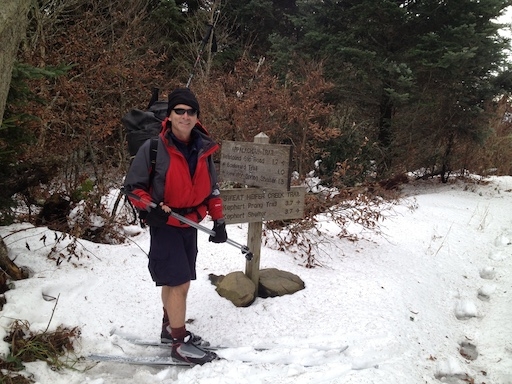
Mt. Guyot Peak Bagging | |||||||
| The Basics: | |||||||
| Event Type: | Backpacking | ||||||
| Event Location: |
Smoky Mountain National Park


| ||||||
| Date(s) & Time: | Thu, Apr 17 2025 11:15 am >> Sat, Apr 19 2025 2:00 pm | ||||||
| Registration Opens: | Fri, Jan 3 2025 6:30 pm | ||||||
| Registration Cut Off: | Sun, Mar 30 2025 10:38 am | ||||||
| Event Duration: | 2 Days 2 Hours 45 Minutes | ||||||
| Difficulty Rating: | D6: Advanced (Exploratory) | ||||||
| Pace: | Fast | ||||||
| Trip Leader(s): | Mark Email Trip Leader(s) Email Trip Leader(s)
You must be logged in to get the Trip Leader contact information. | ||||||
| Member Cost: | $31.00/Person (See Detailed Cost Info Below) | ||||||
| Participant Info: | |||||||
| Who's Invited: | Members Only, 21 And Older Only | ||||||
| Maximum Group Size: | 4 | ||||||
| Minimum Group Size: | 2 | ||||||
| Number Registered So Far: | 4 / 0 (To see who's signed up, log in to the Member Area) | ||||||
| Are Dogs Permitted: | No | ||||||
|
Note: This is an "EXPLORATORY" trip. This means that there are parts of this trip, or perhaps the whole trip, that is new to your Trip Leader(s). However, they are confident that this will not be an issue. This note is here so that you can make an informed decision. When a Trip Leader isn't personally familiar with a trip, there is an increased chance of things not going as planned and you need to be prepared. The Trip Leader may have additional details in the itinerary. | |||||||
| Itinerary: | |||||||
This is a D7 hike involving backpacking and climbing some off-trail steep terrain. Any participant should have strong experience backpacking and at least some experience hiking off-trail to be prepared for the difficulty of hiking off-trail. Expect the trip leader to interview every participant to determine whether they meet the requirements for this hike. Safety: When off-trail, all hikers will be required to stay together well within eyesight of one another. All hikers will be required to run All Trails or a similar GPS tracker while hiking. When hiking off-trail, we may decrease speed to as little as a half mile per hour to choose the best route and avoid mishaps. As an extra precaution, we will carry surveyor tape to use as breadcrumbs as necessary. All tape will be retrieved on the return trip. Now is the opportunity to experience a real peak bagging adventure in the Smokies that will take us to an area where 6k peaks abound, but where no trails cross the peaks. The main goal is to climb the 2nd highest mountain in the Smokies, Mt. Guyot. This mountain, at 6625 feet is 50 feet higher than Mt. LeConte. It requires about 3/4 of a mile of bushwhacking. Over 3 days, we will complete a loop that begins and ends at Round Bottom. Day 1 - 11.1 Miles (vertical) Hike from Newfound Gap to Pecks Corner Shelter. This will be our easiest day, so we can take our time to enjoy sights such as Charlies Bunion. Day 2 - 11.1 miles of which a little over a mile is off-trail. (2,779 ft vertical) This is the Peak bagging day. We will leave our heavy backpacking gear at Tricorner Knob Shelter during the 2nd half of the day. We will mostly follow the AT. First, we will hike north from Pecks Corner Shelter where we will go off-trail to climb Mt. Chapman (6431 feet). We may stash packs and use daypacks for the 0.16 miles up Mt. Chapman. We will continue north on the AT to Tricorner Knob Shelter where we will leave our backpacks and proceed with daypacks north on the AT to Mt. Guyot and Old Black. Next is a 0.7 mile off-trail to the top of Guyot. This will be by far most vertical and distance and the hardest peak bag. Next we continue north on the AT to bag Old Black (6361 feet). Finally, we turn south and hike the AT back to pick Tricorner Knob Shelter where we will spend the 2nd night. Day 3 - 15.7 miles. (7 Hours) After a 7 AM start, we will try to finish by 2 PM. Hike from Tricorner Knob Shelter to Newfound Gap | |||||||
| |||||||
| How to Get There: | |||||||
| Event Directions: | Google Route from Indian Trail Park and Ride to Newfound Gap https://maps.app.goo.gl/XPBE3JPfsMuECtSD8
Overview of Route I-85 North to I-985 North to US 23 North near Dillsboro take US 74 toward Cherokee Take 441 to Cherokee Proceed on 441 to Newfound Gap. ( Look for the AT. That's where you stop going up before you start going down again.) | ||||||
| Notes: | |||||||
|
Day 2 Route with Mt. Chapman, Mt. Guyot, and Old Black Peak Bags
* We encourage all members to follow our Etiquette Guidelines while participating in AOC events. | |||||||
| Member Cost: | $31.00/Person | ||||||
| Cost Includes: | Payment for the backcountry permit will be due by February 27th because permits for April will open on March 1st and are non-refundable. 2 nights' backcountry permit and parking permit - $16 ($8 per night) 1 week parking pass - $15 (GSMNP requires week pass for anything over 1 day) Carpool and Parking Pass will be divided by cars. | ||||||
| Make a Payment: | Although there is a cost for this event, you do not pay through the AOC. Please review the event details carefully for information about how/where to make your payment. | ||||||
Cancellation/Partial Attendance: Please review the AOC cancellation policy. | |||||||
 Calendar of Events
 Event Places