 Print-Friendly Version Print-Friendly Version
|
West Face of Blood Mountain from Lake Winfield Scott | |||||||
| The Basics: | |||||||
| Event Type: | Hike | ||||||
| Event Location: |
Lake Winfield Scott


| ||||||
| Date(s) & Time: | Sat, Nov 15 2025 10:00 am >> Sat, Nov 15 2025 2:40 pm (Carpool Departure: 8:20 am *log in for location*) | ||||||
| Registration Opens: | Sat, Nov 1 2025 7:00 am | ||||||
| Registration Cut Off: | Fri, Nov 14 2025 7:00 pm | ||||||
| Event Duration: | 4 Hours 40 Minutes | ||||||
| Difficulty Rating: | D4: Moderate to Difficult | ||||||
| Distance: | 8 Miles | ||||||
| Pace: | Moderate | ||||||
| Trip Leader(s): | Chuck M Email Trip Leader(s) Email Trip Leader(s)
You must be logged in to get the Trip Leader contact information. | ||||||
| Member Cost: | None | ||||||
| Participant Info: | |||||||
| Who's Invited: | Members Only, 21 And Older Only | ||||||
| Maximum Group Size: | 12 | ||||||
| Minimum Group Size: | 2 | ||||||
| Number Registered So Far: | 12 / 0 (To see who's signed up, log in to the Member Area) | ||||||
| Are Dogs Permitted: | No | ||||||
| Itinerary: | |||||||
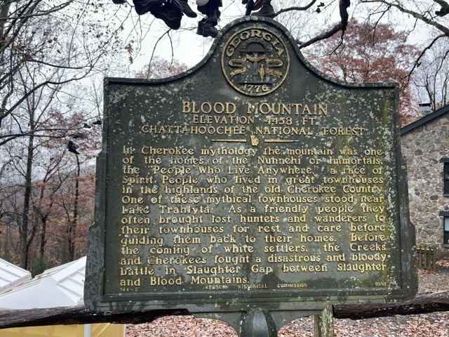
Come joint me on a moderate 8 mile loop hike to Blood Mountain. It is rated D4 because it involves about 1,800 feet of climbing. Beginning at Lake Winfield Scott, we'll hike up the Jarrad Gap trail to the Appalachian Trail, and hike along the AT to the shelter on Blood Mountain. We will have lunch on top of Blood Mountain. After having lunch and soaking in the views at the highest elevation on the AT in Georgia, we'll head back down the AT until we get to the junction with the Slaughter Creek trail. We will then turn onto Slaughter Creek trail and follow the creek on its evolution from a mere wet spot by the trail to a substantial creek. We cross the creek at least seven times (no need to get feet wet)! This trail is very enjoyable and scenic, and its gradual descent is a great way to recover from the climb to Blood Mountain (although this is the easiest ascent of Blood Mountain). You must have recent AOC events that demonstrate your ability to enjoy this event at the 2.8 MPH pace we will aim for. If you have relevant experience only outside the club, you may email the trip leader with documation. If the trip leader is not confident that you can have fun and keep up, he will move you to the waitlist. There are no bathrooms at the trailhead. There is a privy at the shelter. Plan accordingly. | |||||||
| |||||||
| How to Get There: | |||||||
| Event Directions: | North on GA 400. Take a left onto SR 60/19 toward Dahlonega. At the fork of SR 60 and SR 19, go straight on SR 60 to Suches. Take a right on SR 180. Lake Winfield Scott is approximately 7-8 miles on SR 180. Go past the bridge next to the lake and we'll park on the left. The trailhead is across the road. See the map link above for the precise location. NOTE: there is no cell service at the trailhead! | ||||||
| Carpool to Event Distance (round trip): | 118Mile(s) | ||||||
| Carpool Departure Time: | 8:20 am | ||||||
| Carpool Location: | Log in for location | ||||||
| Carpool Directions: | Log in for directions | ||||||
| Carpool Cost: | Estimated cost per vehicle for this event is $47.20 using a reimbursement rate guideline of $0.400 per mile. The total amount should be divided by the number of people in the vehicle, including the driver. This is a guideline, not a rule, for drivers but the cost should not be higher unless there are extenuating circumstances. | ||||||
| Notes: | |||||||
|
The parking fee is $5 if you don't have an annual federal park pass. * We encourage all members to follow our Etiquette Guidelines while participating in AOC events. | |||||||
Cancellation/Partial Attendance: Please review the AOC cancellation policy. | |||||||
 Calendar of Events
 Event Places