 Print-Friendly Version Print-Friendly Version
|
|
Currahee Mountain Climbing | |||||||
| The Basics: | |||||||
| Event Type: | Outdoor Climb | ||||||
| Event Location: | Currahee Mountain, Toccoa, GA | ||||||
| Date(s) & Time: | Sun, Oct 24 2010 10:00 am >> N/A | ||||||
| Registration Opens: | Wed, Oct 13 2010 8:45 pm | ||||||
| Registration Cut Off: | Thu, Oct 21 2010 10:00 pm | ||||||
| Event Duration: | arppox 7 hours | ||||||
| Difficulty Rating: | D3: Moderate | ||||||
| Trip Leader(s): | Dave Email Trip Leader(s) Email Trip Leader(s)
You must be logged in to get the Trip Leader contact information. | ||||||
| Member Cost: | None | ||||||
| Participant Info: | |||||||
| Who's Invited: | Members Only, 21 And Older Only | ||||||
| Maximum Group Size: | 10 | ||||||
| Minimum Group Size: | 4 | ||||||
| Number Registered So Far: | 6 / 0 (To see who's signed up, log in to the Member Area) | ||||||
| Are Dogs Permitted: | No | ||||||
| Itinerary: | |||||||
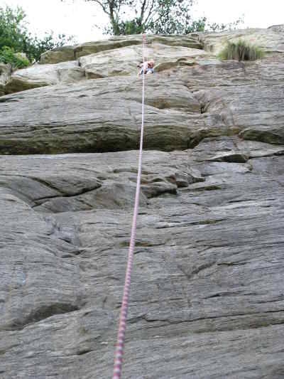
This is a Top-Rope style climbing trip, Currahee Mountain is a great place to start climbing outside and anyone that can climb at an indoor level 5.7 or higher will have options here (we will be mixing in some higher level climbs as well) This trip is weather dependent and will be canceled in the event of rain. If you are willing to bring a rope/anchors to the climb to share with your AOC friends for the day, please contact the trip leader as this would open the trip up to having more participants.Note: this event will not have an official carpool...I will need to be onsite in advance of the climbers to have a few ropes up when the group arrives. But I am fine with helping to coordinate an unofficial one. Meet at the cellphone/fire tower along the road near the top of the mountain (directions below). I will meet the group there for the hike in. | |||||||
| |||||||
| How to Get There: | |||||||
| Event Directions: | Take I-85 North to I-985 North. This will eventually become US Highway 441. Take the first Toccoa exit (17/365) and turn right. Follow this down the mountain to a traffic light/intersection (there is a Shell station to the left). Turn right and proceed about three miles. Turn left onto a gravel road (with a small brown national park sign), just before a manufacturing plant, and follow it to the top of Currahee Mountain. The trail skirts the edge of the fenced tower and goes sharply downhill to the top of the Slab Area. Meet at the cellphone/fire tower along the road near the top of the mountain, | ||||||
| Notes: | |||||||
|
* We encourage all members to follow our Etiquette Guidelines while participating in AOC events. | |||||||
Cancellation/Partial Attendance: Please review the AOC cancellation policy. | |||||||
 Calendar of Events
 Event Places