 Print-Friendly Version Print-Friendly Version
|
|
Frodo’s Valley Loop, long version | |||||||
| The Basics: | |||||||
| Event Type: | Hike | ||||||
| Event Location: | Boling Park, 1098 Marietta Highway, Canton GA 30114 | ||||||
| Date(s) & Time: | Sat, Feb 7 2026 9:00 am >> Sat, Feb 7 2026 12:30 pm | ||||||
| Registration Opens: | Mon, Jan 26 2026 9:00 pm | ||||||
| Registration Cut Off: | Sat, Feb 7 2026 7:00 am | ||||||
| Event Duration: | 3 Hours 30 Minutes | ||||||
| Difficulty Rating: | D3: Moderate | ||||||
| Distance: | 8 Miles | ||||||
| Pace: | Moderate | ||||||
| Trip Leader(s): | Richard Email Trip Leader(s) Email Trip Leader(s)
You must be logged in to get the Trip Leader contact information. | ||||||
| Member Cost: | None | ||||||
| Participant Info: | |||||||
| Who's Invited: | Members Only, 21 And Older Only | ||||||
| Maximum Group Size: | 15 | ||||||
| Minimum Group Size: | 3 | ||||||
| Number Registered So Far: | 13 / 0 (To see who's signed up, log in to the Member Area) | ||||||
| Are Dogs Permitted: | Yes | ||||||
| Itinerary: | |||||||
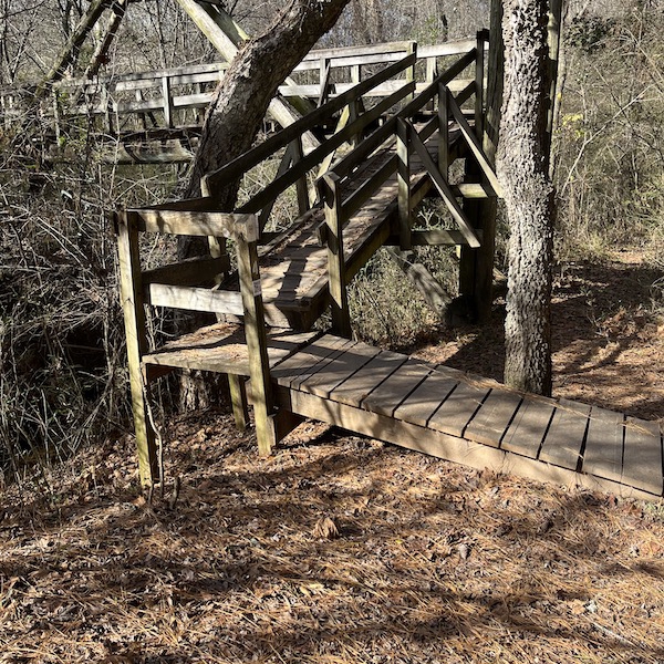
The Etowah Hiking Trails trail system was conceived at the time of the American Bicentennial, when local authorities expressed an interest in restoring the Trace trail, the road that was integral to linking local communities to one another. Boy Scout Troop 241 undertook the task of restoring the road as a woodland trail. The trail proved so popular the Boy Scouts later added other trails, eventually leading to the trail network that exists today. Boy Scout Troop 241 and the Sutallee Trace Trail Stewards work cooperatively to restore, maintain, and expand the Etowah Hiking Trails. In this loop we will walk parts of several of the trails in the park. For a description of the trails please go to www.etowahhikingtrails.org We will start our hike on the public trail that runs on the margin of the Etowah river, following it downstream until Trace Trail, cross over the Pucket Creek bridge (see the promo picture) and reach Yellow Trail, which we follow along Frodo's Valley until Purple Trai; we follow Purple Trail until the Orange trail, which we follow until Hightower Church and the Trace trail. We then follow Green Loop in a counterclockwise direction for about 2 miles until we reach the Trace Trail again. We follow this trail until the Purple trail, which we follow back to its intersection with Orange trail. We then turn right on Orange trail, which we follow until its end at Trace trail, and back to the parking lot. The trails are well maintained. There are footbridges over all stream crossings, except for two over Orange Trail, which don't need them. | |||||||
| |||||||
| How to Get There: | |||||||
| Event Directions: | 1098 Marietta Highway is between the Etowah River and Canton High School. Traveling North on Marietta Highway cross the bridge over Etowah River AND TAKE AN IMMEDIATE LEFT. You will be at the beginning of a short and narrow road that runs next to the river bank. Boling Park is at the end of this road. | ||||||
| Notes: | |||||||
|
Dogs should be on leash * We encourage all members to follow our Etiquette Guidelines while participating in AOC events. | |||||||
Cancellation/Partial Attendance: Please review the AOC cancellation policy. | |||||||
 Calendar of Events
 Event Places