 Print-Friendly Version Print-Friendly Version
|
|
Pinhoti Trail - Johns Mountain | |||||||
| The Basics: | |||||||
| Event Type: | Hike | ||||||
| Event Location: |
Pocket Road Pinhoti Trail Parking Lot, Resaca


| ||||||
| Date(s) & Time: | Tue, Feb 10 2026 9:00 am >> Tue, Feb 10 2026 1:18 pm | ||||||
| Registration Opens: | Thu, Feb 5 2026 6:00 pm | ||||||
| Registration Cut Off: | Mon, Feb 9 2026 6:19 pm | ||||||
| Event Duration: | 4 Hours 18 Minutes | ||||||
| Difficulty Rating: | D4: Moderate to Difficult (Exploratory) | ||||||
| Distance: | 9.9 Miles | ||||||
| Pace: | Moderate | ||||||
| Trip Leader(s): | Mark Email Trip Leader(s) Email Trip Leader(s)
You must be logged in to get the Trip Leader contact information. | ||||||
| Member Cost: | None | ||||||
| Participant Info: | |||||||
| Who's Invited: | Members Only, 21 And Older Only | ||||||
| Maximum Group Size: | 12 | ||||||
| Minimum Group Size: | 3 | ||||||
| Number Registered So Far: | 1 / 0 (To see who's signed up, log in to the Member Area) | ||||||
| Are Dogs Permitted: | Yes | ||||||
|
Note: This is an "EXPLORATORY" trip. This means that there are parts of this trip, or perhaps the whole trip, that is new to your Trip Leader(s). However, they are confident that this will not be an issue. This note is here so that you can make an informed decision. When a Trip Leader isn't personally familiar with a trip, there is an increased chance of things not going as planned and you need to be prepared. The Trip Leader may have additional details in the itinerary. | |||||||
| Itinerary: | |||||||
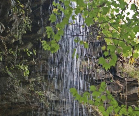
Johns Mountain and Keown Falls are highlights of this hike. If you are interested in completing another section of the Georgia Pinhoti and tired of the ol' out and back, here's your chance. We will shuttle between trailheads to avoid an out and back hike. For that reason we will need at least one volunteer besides myself to leave a car at the other end. | |||||||
| |||||||
| How to Get There: | |||||||
| Event Directions: | North on I-75. Use Google Route shown from I-75 / I-575 interchange toward Resaca, GA. Take exit 320 for GA-136 toward Resaca/Lafayette Left on GA 136 and proceed 12.5 miles Left on Furnace Creek Road Left on Pocket Road and 2.5 miles to Pilcher Pond Parking on your left
https://maps.app.goo.gl/fpVg4dU7bqefVQdW8
| ||||||
| Notes: | |||||||
|
* We encourage all members to follow our Etiquette Guidelines while participating in AOC events. | |||||||
Cancellation/Partial Attendance: Please review the AOC cancellation policy. | |||||||
|
 Calendar of Events
 Event Places