 Print-Friendly Version Print-Friendly Version
|
|
Three Forks Loop via AT and Benton MacKaye (with extra trip to a waterfall) | |||||||
| The Basics: | |||||||
| Event Type: | Hike | ||||||
| Event Location: |
Fannin County - Chattahoochee-Oconee National Forest


| ||||||
| Date(s) & Time: | Tue, Jul 14 2026 10:00 am >> Tue, Jul 14 2026 4:00 pm (Carpool Departure: 7:00 am *log in for location*) | ||||||
| Registration Opens: | Fri, Jun 26 2026 7:00 am | ||||||
| Registration Cut Off: | Mon, Jul 13 2026 5:00 pm | ||||||
| Event Duration: | 6 Hours | ||||||
| Difficulty Rating: | D5: Difficult | ||||||
| Distance: | 13.2 Miles | ||||||
| Pace: | Moderate | ||||||
| Trip Leader(s): | Chuck M Email Trip Leader(s) Email Trip Leader(s)
You must be logged in to get the Trip Leader contact information. | ||||||
| Member Cost: | None | ||||||
| Participant Info: | |||||||
| Who's Invited: | Members Only, 21 And Older Only | ||||||
| Maximum Group Size: | 12 | ||||||
| Minimum Group Size: | 3 | ||||||
| Number Registered So Far: | 1 / 0 (To see who's signed up, log in to the Member Area) | ||||||
| Are Dogs Permitted: | No | ||||||
| Itinerary: | |||||||
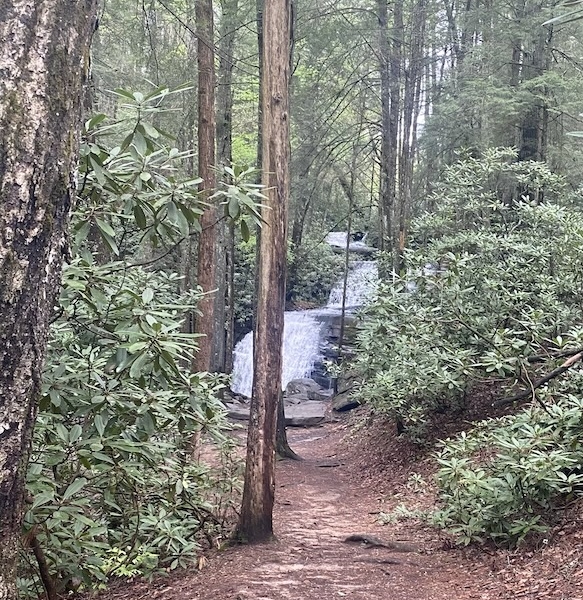
Enjoy a triple loop hike from Three Forks to Springer Mountain and back to Long Creek Falls. We will take the Benton MacKaye Southbound to Springer and take a break for lunch. Then the return trip will be via the AT. We will pass our vehicles and continue an additonal .8 miles (1.6 round trip) to Long Creek Falls to cool down in the water. This hike is approximately 13.2 miles with about 3,490 feet of elevation gain. We will go a moderate pace of about 2.5 miles/hour and stay together since there are multiple junctions with the Benton Mackaye and the AT in this area. Be sure to bring plenty of water and electrolytes if you use them. You may want to have water shoes and clothes for the dip in the falls at the end (you can pick them up at the car before we head to the falls). Copy and Paste the following link to view the map. https://www.alltrails.com/explore/map/three-forks-loop-via-appalachian-and-benton-mackaye-trail-14db622?u=i&sh=owxyek Please Note: If you are a carpool driver or meeting at the trailhead, your car will get very dusty and dirty. About 30-40 minutes of the drive is on a rough Forest Road. Low clearance vehicles can make the trip if you are very careful, but high clearance vehicles are recommended. | |||||||
| |||||||
| How to Get There: | |||||||
| Event Directions: | These links will take you to the trailhead: Apple Maps: https://maps.apple/p/XNyAqqELYN944J Google Maps: https://maps.app.goo.gl/AP6pu1inEWXCGDNL9?g_st=ic | ||||||
| Carpool to Event Distance (round trip): | 154Mile(s) | ||||||
| Carpool Departure Time: | 7:00 am | ||||||
| Carpool Location: | Log in for location | ||||||
| Carpool Directions: | Log in for directions | ||||||
| Carpool Cost: | Estimated cost per vehicle for this event is $61.60 using a reimbursement rate guideline of $0.400 per mile. The total amount should be divided by the number of people in the vehicle, including the driver. This is a guideline, not a rule, for drivers but the cost should not be higher unless there are extenuating circumstances. | ||||||
| Notes: | |||||||
|
* We encourage all members to follow our Etiquette Guidelines while participating in AOC events. | |||||||
| Cost Includes: |
| ||||||
Cancellation/Partial Attendance: Please review the AOC cancellation policy. | |||||||
 Calendar of Events
 Event Places