
 Print-Friendly Version Print-Friendly Version
 Add this event to your calendar (Outlook, iCalendar)
Add REGISTRATION REMINDER to your calendar Add this event to your calendar (Outlook, iCalendar)
Add REGISTRATION REMINDER to your calendar
|
Rabun Bald & Flint Knob via Bartram Trail | |||||
| The Basics: | |||||
| Event Type: |  | Hike | | ||
| Event Location: | |
Bartram Trail - Trailhead State Line


| | ||
| Date(s) & Time: | | Sat, Aug 29 2026 8:30 am >> Sat, Aug 29 2026 2:30 pm (Carpool Departure: 6:15 am *log in for location*) | | ||
| Registration Opens: | | Wed, Aug 26 2026 5:55 pm | | ||
| Registration Cut Off: | | Fri, Aug 28 2026 4:44 pm | | ||
| Event Duration: | | 6 Hours | | ||
| Difficulty Rating: | | D5: Difficult | | ||
| Distance: | | 12 Miles | | ||
| Pace: | | Moderate | | ||
| Trip Leader(s): | | Deema Email Trip Leader(s) Email Trip Leader(s)
You must be logged in to get the Trip Leader contact information. | | ||
| Member Cost: | | None | |||
| Participant Info: | |||||
| Who's Invited: | | Members Only, 21 And Older Only | | ||
| Maximum Group Size: | | 10 | |||
| Minimum Group Size: | | 4 | |||
| Number Registered So Far: | | 8 / 0 (To see who's signed up, log in to the Member Area) | |||
| Are Dogs Permitted: | | No | |||
| Itinerary: | |||||
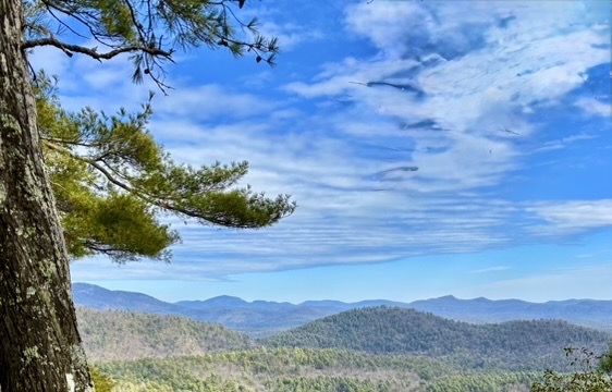
This one is an AOC classic. Out and back trail, a bit more than 11 miles, around 2800 ft elevation gain. Rabun Bald is Georgia's second-highest peak reachable via Bartram Trail that winds through northeast Georgia. Legend has it the mountain is inhabited by fire-breathing demon people according to Native American legend. At the top there's a historic stone fire tower — built by Georgia's first forest ranger — operated by the Forest Service until the early 1970s. The observation tower gives what many consider the most spectacular view from any single point in the Georgia mountains, with views extending over 100 miles on clear days into the Piedmont. We will keep going to Flint Knob for lunch.
If you haven't been to this trailhead before, you might not figure out how to get there. Let's try our best to carpool or meet at Ingles in Clayton to consolidate cars, the trailhead has very limited parking available.
| |||||
| |||||
| How to Get There: | |||||
| Event Directions: | |
Trailhead Location in Google Map: https://maps.app.goo.gl/1UpEvvE6TTpsKMCz7 | | ||
| Carpool to Event Distance (round trip): | | 212Mile(s) | |||
| Carpool Departure Time: | | 6:15 am | |||
| Carpool Location: | | Log in for location | |||
| Carpool Directions: | | Log in for directions | |||
| Carpool Cost: | | Estimated cost per vehicle for this event is $84.80 using a reimbursement rate guideline of $0.400 per mile. The total amount should be divided by the number of people in the vehicle, including the driver. This is a guideline, not a rule, for drivers but the cost should not be higher unless there are extenuating circumstances. | |||
| Notes: | |||||
|
* We encourage all members to follow our Etiquette Guidelines while participating in AOC events. | |||||
Cancellation/Partial Attendance: Please review the AOC cancellation policy. | |||||
 Calendar of Events
 Event Places