 Print-Friendly Version Print-Friendly Version
 Add this event to your calendar (Outlook, iCalendar)
Add REGISTRATION REMINDER to your calendar Add this event to your calendar (Outlook, iCalendar)
Add REGISTRATION REMINDER to your calendar
|
Jacks Gap to Georgias Top | |||||||
| The Basics: | |||||||
| Event Type: |  | Hike | | ||||
| Event Location: | |
Jack's Gap Parking lot


| | ||||
| Date(s) & Time: | | Mon, Sep 7 2026 10:00 am >> Mon, Sep 7 2026 1:00 pm (Carpool Departure: 7:30 am *log in for location*) | | ||||
| Registration Opens: | | Wed, Sep 2 2026 6:00 pm | | ||||
| Registration Cut Off: | | Sun, Sep 6 2026 6:00 pm | | ||||
| Event Duration: | | 3 Hours | | ||||
| Difficulty Rating: | | D4: Moderate to Difficult | | ||||
| Distance: | | 6.1 Miles | | ||||
| Pace: | | Moderate | | ||||
| Trip Leader(s): | | Christa Email Trip Leader(s) Email Trip Leader(s)
You must be logged in to get the Trip Leader contact information. | | ||||
| Member Cost: | | None | |||||
| Participant Info: | |||||||
| Who's Invited: | | Members Only, 21 And Older Only | | ||||
| Maximum Group Size: | | 10 | |||||
| Minimum Group Size: | | 2 | |||||
| Number Registered So Far: | | 9 / 0 (To see who's signed up, log in to the Member Area) | |||||
| Are Dogs Permitted: | | No | |||||
| Itinerary: | |||||||
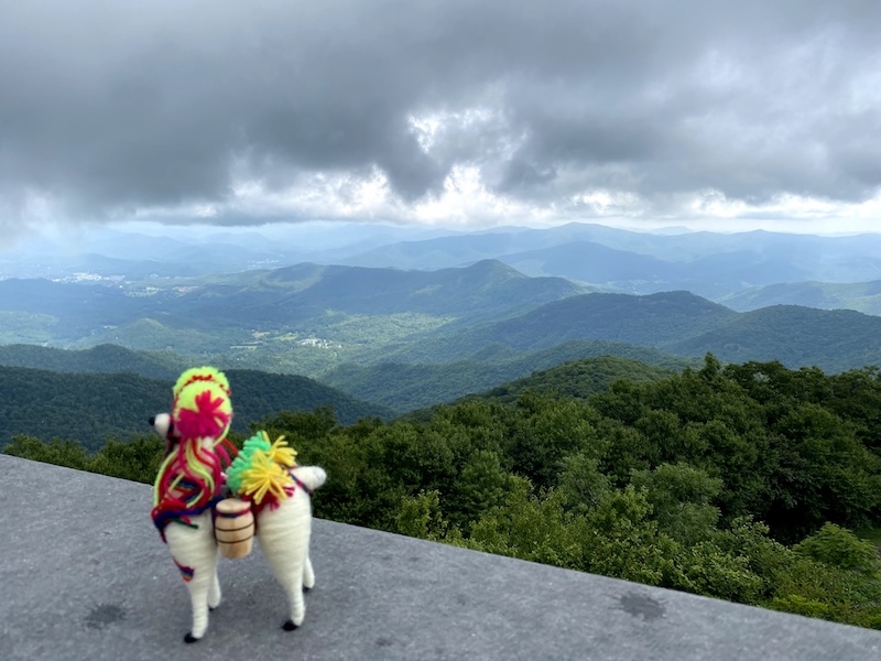
Ready to climb to the top of Georgia? Join me for a beautiful mountain adventure to Brasstown Bald, Georgia's highest point at 4,784 feet! We'll start our hike at Jack's Gap and follow the Jack's Knob Trail toward Brasstown Bald. The trail takes us steadily uphill through beautiful North Georgia forest, with plenty of elevation gain along the way. This is definitely a hike that will get our legs working with a steep ascent and descent. Lets count those switchbacks on our way up and down and ensure we all got the right count. We'll maintain a comfortable, steady pace and there will be opportunities to catch our breath, enjoy the forest, and take in the changing scenery as we climb higher. We might average 2.5 mph for the whole hike. Restrooms are available once we reach the main parking lot getting out of the woods before our final ascent to the summit. Once we reach the summit, we will enjoy our lunch along with the views from Georgia's highest point. We'll spend some time at the top before beginning our descent back to Jack's Gap. This is a smaller parking lot. So, consider carpooling as applicable. This is a higher end D4 hike with 6.1 miles distance and 2200+ elevation gain. The trip leader reserves the right to consider participant's past history and to make the final determination for participation on this hike. | |||||||
| |||||||
| How to Get There: | |||||||
| Event Directions: | | DRIVING DIRECTIONS FROM Bass Pro Shops Get onto I-75 North toward Chattanooga. Take I-575 North toward Canton/Blue Ridge. Continue on GA-515 / US-76 East through Ellijay and Blairsville. Take US-19/US-129 South toward Cleveland. Follow GA-180 toward Brasstown Bald. Continue to Jack's Gap. | | ||||
| Carpool to Event Distance (round trip): | | 110Mile(s) | |||||
| Carpool Departure Time: | | 7:30 am | |||||
| Carpool Location: | | Log in for location | |||||
| Carpool Directions: | | Log in for directions | |||||
| Carpool Cost: | | Estimated cost per vehicle for this event is $44.00 using a reimbursement rate guideline of $0.400 per mile. The total amount should be divided by the number of people in the vehicle, including the driver. This is a guideline, not a rule, for drivers but the cost should not be higher unless there are extenuating circumstances. | |||||
| Notes: | |||||||
|
We'll park at the Jack's Gap parking area, a small gravel pull-off along GA-180 near the trailhead for Jacks Knob Trail. Jack's Gap Parking: If you're driving directly to the trailhead, please use the Jack's Gap parking coordinates rather than navigating to the main Brasstown Bald Visitor Center. * We encourage all members to follow our Etiquette Guidelines while participating in AOC events. | |||||||
Cancellation/Partial Attendance: Please review the AOC cancellation policy. | |||||||
 Calendar of Events
 Event Places