
 Print-Friendly Version Print-Friendly Version
 Add this event to your calendar (Outlook, iCalendar)
Add REGISTRATION REMINDER to your calendar Add this event to your calendar (Outlook, iCalendar)
Add REGISTRATION REMINDER to your calendar
|
Fall Balds! Wayah Bald to Siler Bald | |||||||
| The Basics: | |||||||
| Event Type: |  | Hike | | ||||
| Event Location: | | Wayah Bald, NC | | ||||
| Date(s) & Time: | | Sun, Nov 8 2026 10:00 am >> Sun, Nov 8 2026 4:00 pm (Carpool Departure: 7:00 am *log in for location*) | | ||||
| Registration Opens: | | Fri, Oct 30 2026 6:00 pm | | ||||
| Registration Cut Off: | | Sat, Nov 7 2026 6:00 pm | | ||||
| Event Duration: | | 6 Hours | | ||||
| Difficulty Rating: | | D5: Difficult | | ||||
| Distance: | | 12 Miles | | ||||
| Pace: | | Moderate | | ||||
| Trip Leader(s): | | Joseph Wang Email Trip Leader(s) Email Trip Leader(s)
You must be logged in to get the Trip Leader contact information. | | ||||
| Member Cost: | | None | |||||
| Participant Info: | |||||||
| Who's Invited: | | Members Only, 21 And Older Only | | ||||
| Maximum Group Size: | | 8 | |||||
| Minimum Group Size: | | 2 | |||||
| Number Registered So Far: | | 0 / 0 (To see who's signed up, log in to the Member Area) | |||||
| Are Dogs Permitted: | | No | |||||
| Itinerary: | |||||||
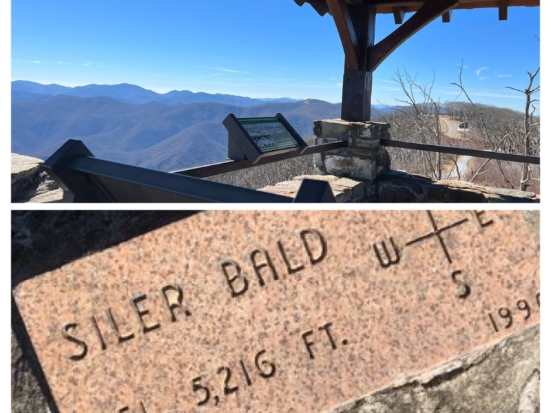
Join me for a scenic Appalachian Trail hike featuring two beautiful North Carolina summits: Wayah Bald and Siler Bald! We’ll meet at the Indian Trail Park and Ride for a carpool departure at 7:00 AM. We’ll drive to Franklin, NC, for a final pit stop at Ingles before continuing to the Wayah Bald Parking Area, where we’ll begin our hike at 10:00 AM. From the parking lot, we’ll head northbound on the Appalachian Trail for approximately a quarter of a mile toward the Wayah Bald Lookout Tower. The historic 53-foot, three-story stone tower was built by the Civilian Conservation Corps (CCC) in 1937 and offers panoramic views of the Appalachian Mountains spanning North Carolina, South Carolina, Georgia, and Tennessee. After taking in the views, we’ll retrace our steps southbound along the AT, passing our starting point and continuing toward Siler Bald. The trail climbs steadily through the forest before reaching a grassy clearing. We’ll follow the short side trail to Siler Bald’s summit, where we’ll enjoy panoramic views of the surrounding mountains and take a well-deserved lunch break. After enjoying the summit, we’ll retrace our steps back to the Wayah Bald Parking Area. This is a challenging hike with sustained climbs, descents, and uneven terrain. We’ll hike approximately 12 miles round-trip with a total elevation gain of approximately 2,400 feet. Participants should be comfortable hiking this distance in mountainous terrain while maintaining a moderate group pace. Since this is a D5 hike, participants must have prior D4/D5 hiking experience or a history of backpacking. The Trip Leader reserves the right to move participants to the waitlist if they do not have adequate experience. | |||||||
| |||||||
| How to Get There: | |||||||
| Event Directions: | | Take 85N to 985N Continue straight on 985N/US23N/Hwy 441 into North Carolina Continue on US23N/US441N into Franklin, North Carolina Drive west on US-64 for about 4 miles, turn right toward the Wayah Bald sign, then take the first left onto Wayah Road (NC 1310) for 9.1 miles to Wayah Gap, and turn right onto gravel Forest Service Road 69 to the top. | | ||||
| Carpool to Event Distance (round trip): | | 256Mile(s) | |||||
| Carpool Departure Time: | | 7:00 am | |||||
| Carpool Location: | | Log in for location | |||||
| Carpool Directions: | | Log in for directions | |||||
| Carpool Cost: | | Estimated cost per vehicle for this event is $102.40 using a reimbursement rate guideline of $0.400 per mile. The total amount should be divided by the number of people in the vehicle, including the driver. This is a guideline, not a rule, for drivers but the cost should not be higher unless there are extenuating circumstances. | |||||
| Notes: | |||||||
|
* We encourage all members to follow our Etiquette Guidelines while participating in AOC events. | |||||||
Cancellation/Partial Attendance: Please review the AOC cancellation policy. | |||||||
 Calendar of Events
 Event Places