 Print-Friendly Version Print-Friendly Version
|
Bell Knob and Eagle Mountain | |||||||
| The Basics: | |||||||
| Event Type: | Hike | ||||||
| Event Location: | Hiawassee, GA | ||||||
| Date(s) & Time: | Sat, Jan 22 2011 8:30 am >> N/A (Carpool Departure: 8:45 am *log in for location*) | ||||||
| Registration Opens: | Wed, Jan 19 2011 8:45 pm | ||||||
| Registration Cut Off: | Fri, Jan 21 2011 10:00 pm | ||||||
| Event Duration: | per itinerary | ||||||
| Difficulty Rating: | D5: Difficult | ||||||
| Trip Leader(s): | Tony C Email Trip Leader(s) Email Trip Leader(s)
You must be logged in to get the Trip Leader contact information. | ||||||
| Member Cost: | None | ||||||
| Participant Info: | |||||||
| Who's Invited: | Members Only, 21 And Older Only | ||||||
| Maximum Group Size: | 12 | ||||||
| Minimum Group Size: | 3 | ||||||
| Number Registered So Far: | 8 / 0 (To see who's signed up, log in to the Member Area) | ||||||
| Are Dogs Permitted: | No | ||||||
| Itinerary: | |||||||
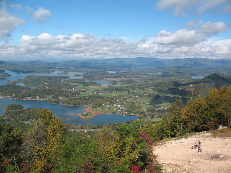
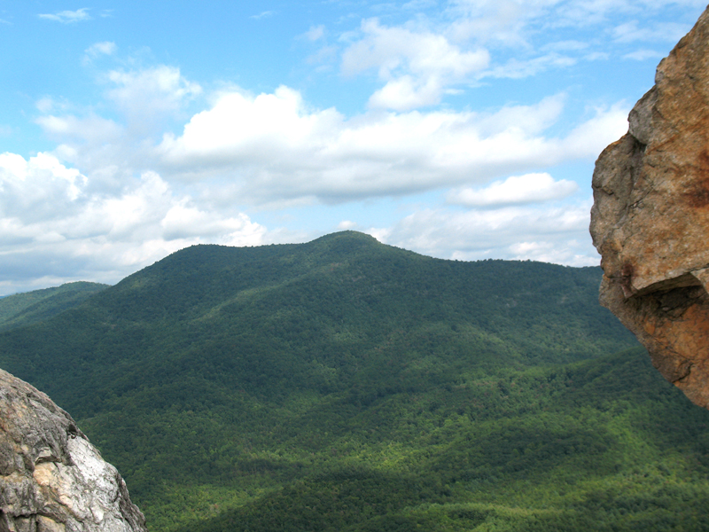
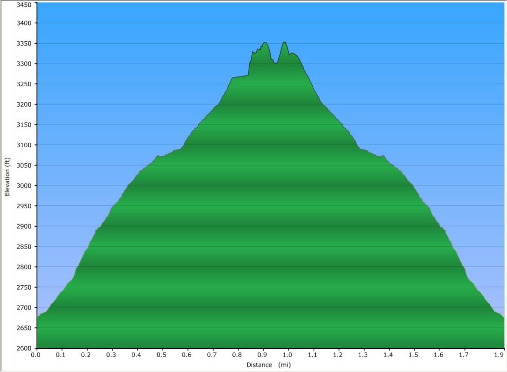
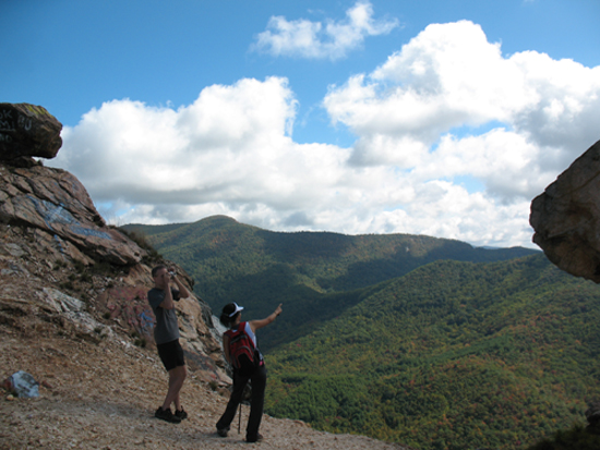
These are two very cool North GA hikes that aren't that well known, for whatever reasons. Eagle Mtn is the 9th tallest in GA (using the Colorado Rule) and it's a good challenging hike with some nice views at the top. Eagle Mtn is 4240' above sea level with 600' of clean prominence. It is on the western end of the sub chain that includes Hightower Bald near its eastern end. All of our hike will be along old logging roads...this means the trail is relatively wide but also not maintained. The distance is about 8.5 miles round trip with 1900' of ascent on the way up but only 100' of descent...so as you can see from the elevation profile below, it is a fairly steady uphill climb. When we scouted out this hike, we did not expect any views from the top, but we were pleasantly surprised to find some rock outcroppings on the southwest side just below the summit. This will be a great location for a long lunch break and provides sweet views of Brasstown Bald, Bell Knob, and parts of Lake Hiawassee far below. And maybe some bonus views on the southern end of the ridge, if we can make it there. Summary: | |||||||
| |||||||
| How to Get There: | |||||||
| Event Directions: | Directions to trailhead will be given at carpool (or via email if meeting at event). | ||||||
| Carpool to Event Distance (round trip): | 195Mile(s) | ||||||
| Carpool Departure Time: | 8:45 am | ||||||
| Carpool Location: | Log in for location | ||||||
| Carpool Directions: | Log in for directions | ||||||
| Carpool Cost: | Estimated cost per vehicle for this event is $78.00 using a reimbursement rate guideline of $0.400 per mile. The total amount should be divided by the number of people in the vehicle, including the driver. This is a guideline, not a rule, for drivers but the cost should not be higher unless there are extenuating circumstances. | ||||||
| Notes: | |||||||
|
* We encourage all members to follow our Etiquette Guidelines while participating in AOC events. | |||||||
| Cost Includes: | NA | ||||||
Cancellation/Partial Attendance: Please review the AOC cancellation policy. *Note: NA | |||||||
 Calendar of Events
 Event Places