 Print-Friendly Version Print-Friendly Version
|
|
Arkaquah Trail to Brasstown Bald | |||||||
| The Basics: | |||||||
| Event Type: | Hike | ||||||
| Event Location: | Trackrock Gap parking lot | ||||||
| Date(s) & Time: | Sat, Jan 29 2011 9:30 am >> N/A (Carpool Departure: 7:45 am *log in for location*) | ||||||
| Registration Opens: | Tue, Jan 25 2011 8:00 pm | ||||||
| Registration Cut Off: | Fri, Jan 28 2011 5:00 pm | ||||||
| Event Duration: | 7-9 hours | ||||||
| Difficulty Rating: | D5: Difficult | ||||||
| Trip Leader(s): | Michael J Email Trip Leader(s) Email Trip Leader(s)
You must be logged in to get the Trip Leader contact information. | ||||||
| Member Cost: | None | ||||||
| Participant Info: | |||||||
| Who's Invited: | Members Only, 21 And Older Only | ||||||
| Maximum Group Size: | 12 | ||||||
| Minimum Group Size: | 4 | ||||||
| Number Registered So Far: | 10 / 0 (To see who's signed up, log in to the Member Area) | ||||||
| Are Dogs Permitted: | Yes | ||||||
| Itinerary: | |||||||
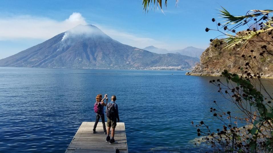
| The hike is approximately 12 miles round trip. We will start at Trackrock Gap (2280 ft), immediately climbing 1500 ft to Roost Ride. Following the ridge eastwards, we will pass Chimneytop Mtn (mile 4.4) to Brasstown Bald (mile 6.1; 4738 ft). We'll eat lunch on top of Brasstown Bald, while enjoying the view, then head back the way we came. We will stop in Dahlonega to eat on our way home. I originally did this hike with Stephan, and loved it, so am looking forward to doing it again, especially with the nice weather heading our way this weekend... | |||||||
| |||||||
| How to Get There: | |||||||
| Event Directions: | From the Park & Ride we will go north on Georgia 400 to Dahlonega. Continue on US Hwy 19 North past Vogel State Park, then take a right on State Road 180 East. Stay on 180 for 2.4 miles, turn left at Town Creek School Rd (the road sign has another name on east side of road, so if you pass Sleepy Hollow Circle, you've gone too far). After 2 miles, on Town Creek School Rd, turn right on Trackrock Church Rd. Go 3.2 miles take another right at T-intersection onto Trackrock Gap Rd (No road sign as of 1/11). The parking lot at the trailhead is on the left before cresting the hill about .5 mile. The trail head has a brown sign. | ||||||
| Carpool to Event Distance (round trip): | 155Mile(s) | ||||||
| Carpool Departure Time: | 7:45 am | ||||||
| Carpool Location: | Log in for location | ||||||
| Carpool Directions: | Log in for directions | ||||||
| Carpool Cost: | Estimated cost per vehicle for this event is $62.00 using a reimbursement rate guideline of $0.400 per mile. The total amount should be divided by the number of people in the vehicle, including the driver. This is a guideline, not a rule, for drivers but the cost should not be higher unless there are extenuating circumstances. | ||||||
| Notes: | |||||||
|
Will this event occur rain or shine? Yes -We encourage all members to follow our Etiquette Guidelines at all times while participating in AOC events. -Details of this event are subject to undergo a change at any point in time, with or without warning. -Questions about equipment or rentals? Send them to safety@atlantaoutdoorclub.com. -Notice any errors or problems in the information on this page? Please notify our Content Editor at content@atlantaoutdooraclub.com. * We encourage all members to follow our Etiquette Guidelines while participating in AOC events. | |||||||
Cancellation/Partial Attendance: Please review the AOC cancellation policy. *Note: Please review our Cancellation Policy carefully! | |||||||
 Calendar of Events
 Event Places