AtlantaOutdoorClub
sponsor
Print-Friendly Version
Add this event to your calendar (Outlook, iCalendar)
Add REGISTRATION REMINDER to your calendar


REGISTRATION REQUIRED: Once you've reviewed the event details, and decided you'd like to join us, you MUST sign up at the bottom of this page.


Jacks Knob & Horse Trough Mountain + Brasstown Bald


The Basics:
Event Type:Explorer
Event Location: Chattahoochee National Forest
Date(s) & Time:Sat, Feb 12 2011  8:15 am >> N/A  (Carpool Departure: 8:30 am   *log in for location*)
Registration Opens: Thu, Feb 10 2011 8:15 pm
Registration Cut Off: Fri, Feb 11 2011 12:05 am
Event Duration:per itinerary
Difficulty Rating:D5: Difficult
Trip Leader(s):
Tony C
Scott Looper
Email Trip Leader(s)
You must be logged in to get the Trip Leader contact information.
Member Cost:None

Participant Info:
Who's Invited: Members Only, 21 And Older Only
Maximum Group Size:8
Minimum Group Size:3
Number Registered So Far: 7 / 0 (To see who's signed up, log in to the Member Area)
Are Dogs Permitted: No

Itinerary:

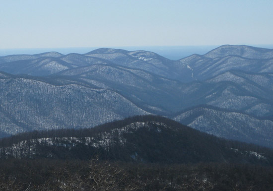
Ok we are going to try something slightly different for this one...going to mostly hike on the Jacks Knob trail and then the AT....but then going to veer off of it and try to bushwhack up to the top of Horse Trough Mountain.   Then do a short bushwhack to the top of Jacks Knob itself on the way back.   And then end with views from the summit of the highest mountain in GA, Brasstown Bald...maybe even a sunset from up there if the timing is right.
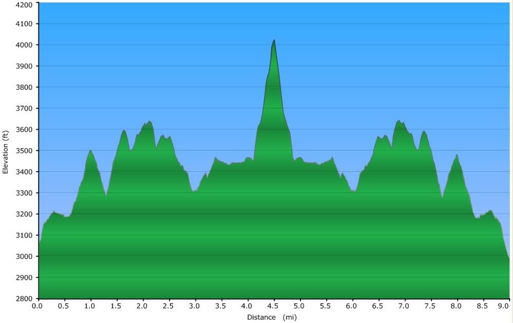
The Jacks Knob trail is the steepest route up Brasstown Bald, but we aren't even going to hike the toughest, most switchbacky part of it.  Instead, we are going to head south from Jacks Gap and towards Chattahoochee Gap.   This is is the spot where the headwaters of the river of the same name supposedly originate...it's just a little trickle from a mountain spring but we can hike down and check it out on the way out if anyone has an interest.

But the Jacks Knob trail has some really nice winter views.  I haven't been on this section in about four years, so looking forward to returning.  

From Chatt Gap, we head south on the AT to a northeast ridge of Horse Trough Mtn.. This mountain has an elevation of 4040', but a topographical prominence of 1008' which is the 21st most in GA.  Ok doesn't sound like it's very significant, but if you look at a satellite view of the area or look at this region from another mtn in the area, Horse Trough Mtn definitely stands out (as you would expect).  So it's just another prominent GA peak to climb to the top of, which is what we will try to do.

The summit is about a third of a mile off of the AT...but it will be a steep third of a mile, gaining about 550' of elevation.   We will take our time on this portion and keep the group together...also that's why this is listed as an Explorer hike with a max group size of 8.   

I don't know if there are any views from the top...probably not, but again some good winter views through the trees and along the entire trail.  

After savoring our Horse Trough summit,, we will head back to to Chatt Gap.  But the summit of Jacks Knob itself is just about a tenth of a mile off the trail and just about 150' up, so we'll run up there, back down and back to Jacks Gap where we started.  So that portion of the hike is about 9.0 miles with roughly 2500' of total ascent.   We could hike another 1800- up Brasstown Bald from there, but I'm not feeling that ambitious (or masochistic), so instead we will drive up to the BB parking lot and hike the last 450' from there to the summit where we can enjoy the views.

If we get up there and the sunset is within about 45 min, we will probably stick around for it...but we may be up there way earlier or even too late...it's really impossible to predict how long the Horse Trough mtn bushwhack portion of the hike will take. 

Total distance (with BB) is about 10 miles
Total elevation gain/ascent (with BB) is about 3000'

Pace will be moderate...probably slower than most other D5 hikes but tough to say for sure.  It sure won't be a speed hike but figure maybe 2mph on the uphills and 2.5 mph on the flat and downhill areas.   But should be a fun little adventure either way and a nice long day in the N Ga mountains.

Click on elevation profile for larger version


PLEASE NOTE:

  • If rain is forecast, this hike will be rescheduled for a future date.
  • If you have not very recently completed some tough AOC hikes, we will be contacting you to determine your level of fitness and experience and if this is the right hike for you.
  •  


    Required Items to Bring:
  • emergency rain gear (even if chance of rain is minimal)
  • water
  • enough food to keep your energy level up
  • hiking boots or trail shoes
  • Recommended Items to Bring:
    Use our Event Checklists to make sure you have everything you need.
  • trekking poles
  • camera

  • How to Get There:
    Carpool to Event Distance (round trip):165Mile(s)
    Carpool Departure Time: 8:30 am
    Carpool Location:   Log in for location
    Carpool Directions:   Log in for directions
    Carpool Cost: Estimated cost per vehicle for this event is $66.00 using a reimbursement rate guideline of $0.400 per mile. The total amount should be divided by the number of people in the vehicle, including the driver. This is a guideline, not a rule, for drivers but the cost should not be higher unless there are extenuating circumstances.

    Notes:
    * We encourage all members to follow our Etiquette Guidelines while participating in AOC events.

    Cost Includes:NA

    Cancellation/Partial Attendance:   Please review the AOC cancellation policy.
    *Note: NA