 Print-Friendly Version Print-Friendly Version
|
Tray Mountain Explorer - Chimney Mountain and Brier Creek Bald | |||||||
| The Basics: | |||||||
| Event Type: | Explorer | ||||||
| Event Location: |
Chattahoochee National Forest


| ||||||
| Date(s) & Time: | Sun, Jan 29 2012 8:45 am >> Sat, Jan 28 2012 9:00 pm (Carpool Departure: 6:45 am *log in for location*) | ||||||
| Registration Opens: | Tue, Feb 15 2011 9:15 pm | ||||||
| Registration Cut Off: | Fri, Jan 27 2012 9:00 pm | ||||||
| Event Duration: | all day | ||||||
| Difficulty Rating: | D6: Advanced (Exploratory) | ||||||
| Distance: | 13 Miles | ||||||
| Pace: | Moderate | ||||||
| Trip Leader(s): | Danny Tony C  Email Trip Leader(s) Email Trip Leader(s)
You must be logged in to get the Trip Leader contact information. | ||||||
| Member Cost: | None | ||||||
| Participant Info: | |||||||
| Who's Invited: | Members Only, 21 And Older Only | ||||||
| Maximum Group Size: | 8 | ||||||
| Minimum Group Size: | 3 | ||||||
| Number Registered So Far: | 6 / 0 (To see who's signed up, log in to the Member Area) | ||||||
| Are Dogs Permitted: | No | ||||||
|
Note: This is an "EXPLORATORY" trip. This means that there are parts of this trip, or perhaps the whole trip, that is new to your Trip Leader(s). However, they are confident that this will not be an issue. This note is here so that you can make an informed decision. When a Trip Leader isn't personally familiar with a trip, there is an increased chance of things not going as planned and you need to be prepared. The Trip Leader may have additional details in the itinerary. | |||||||
| Itinerary: | |||||||
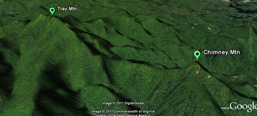
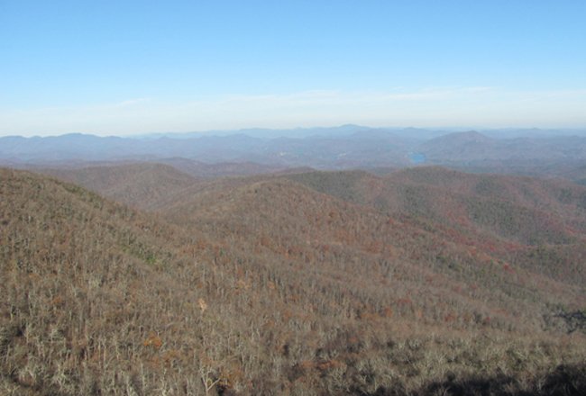
Ok it's time for another bushwhacking adventure. This should be a fun and challenging hike in an area of N GA that is very familiar, yet ripe for some further exploration. From there, we will begin the most challenging part of our hike. We will attempt to bushwhack about 2 1/2 miles down to Chimney Mountain. This little mtn (3356') is conspicuous near the bottom of a main ridge coming off Tray and it looks kind of rocky, so should be some unobstructed views from up there.
Total distance: ~12.5 to 13.0+ mi (~6 mi of it is off trail) 
PLEASE NOTE: If you have not very recently completed some tough AOC D4 & D5 hikes, we will be contacting you to determine if this is the right hike for you. | |||||||
| |||||||
| How to Get There: | |||||||
| Carpool to Event Distance (round trip): | 168Mile(s) | ||||||
| Carpool Departure Time: | 6:45 am | ||||||
| Carpool Location: | Log in for location | ||||||
| Carpool Directions: | Log in for directions | ||||||
| Carpool Cost: | Estimated cost per vehicle for this event is $67.20 using a reimbursement rate guideline of $0.400 per mile. The total amount should be divided by the number of people in the vehicle, including the driver. This is a guideline, not a rule, for drivers but the cost should not be higher unless there are extenuating circumstances. | ||||||
| Notes: | |||||||
|
* We encourage all members to follow our Etiquette Guidelines while participating in AOC events. | |||||||
| Cost Includes: | NA | ||||||
Cancellation/Partial Attendance: Please review the AOC cancellation policy. *Note: NA | |||||||
 Calendar of Events
 Event Places