 Print-Friendly Version Print-Friendly Version
|
|
Ellicott Rock Adventure | |||||||
| The Basics: | |||||||
| Event Type: | Backpacking | ||||||
| Event Location: | Georgia, South Carolina, North Carolina | ||||||
| Date(s) & Time: | Sat, Apr 30 2011 9:00 am >> N/A (Carpool Departure: 9:00 am *log in for location*) | ||||||
| Registration Opens: | Thu, Apr 14 2011 9:00 pm | ||||||
| Registration Cut Off: | Thu, Apr 28 2011 5:00 pm | ||||||
| Event Duration: | 2 days/1 night | ||||||
| Difficulty Rating: | D4: Moderate to Difficult | ||||||
| Trip Leader(s): | Lucy Clinton Jason Hicks  Email Trip Leader(s) Email Trip Leader(s)
You must be logged in to get the Trip Leader contact information. | ||||||
| Member Cost: | None | ||||||
| Participant Info: | |||||||
| Who's Invited: | Members Only, 21 And Older Only | ||||||
| Maximum Group Size: | 12 | ||||||
| Minimum Group Size: | 6 | ||||||
| Number Registered So Far: | 12 / 0 (To see who's signed up, log in to the Member Area) | ||||||
| Are Dogs Permitted: | Yes | ||||||
| Itinerary: | |||||||
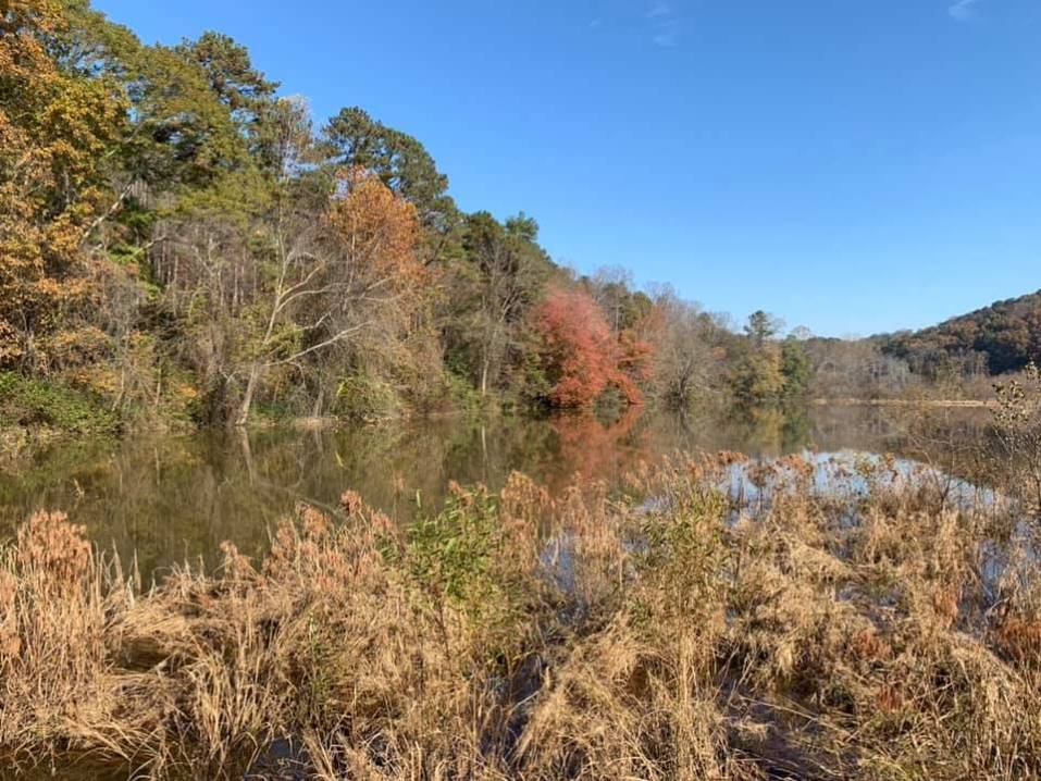
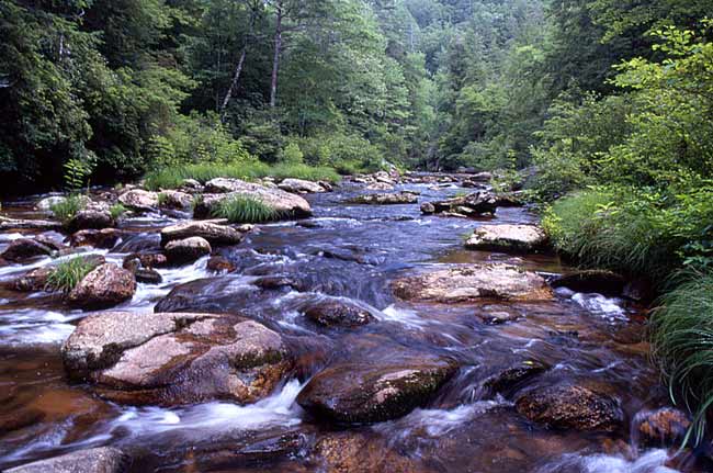 Ellicott Rock Wilderness lies where the mountainous regions of South Carolina, North Carolina, and Georgia converge. We will meet at the carpool and head up to Burrells Ford Bridge/parking lot over the Chattooga River. There we will leave half of our vehicles and pile into the other vehicles. We will then drive down Burrell Ford rd into SC and take a right onto Route 107 north up into NC. Once in NC the first rd on our left will be Bull Pen Road and travel down it for 6.7 miles cross over the Chattooga River and park our vehicles at the Ellicott Rock Wilderness Sign. Then we will put on our backpacks and step onto Ellicott Rock trail. We will hike about 4.3 miles and step onto the Chattooga River trail and begin our search for a campsite. Ellicott Rock trail is about 4.3 miles to Chattooga river trail so be prepared to hike about 4-6 miles the first day depending on where we find a good campsite. The next morning we will hike out to Burrell Ford where we left our cars the night before and get our cars. Relay up to the other cars and depart back home. Total mileage for the whole hike is aboaut 8.6 miles (depending on which guide you read). But plan on up to 10 miles total due to having to hunt for a campsite on the Chattooga river trail. Elevation change on the first day is about 700 feet and about 50 feet for the next day. | |||||||
| |||||||
| How to Get There: | |||||||
| Event Directions: | 85north to 985 north to 441 north to downtown Clayton to US 76. Turn right on Rickman Street, follow Rickman St approximately .5 miles to end. At Warwoman Road, go for about 13.5 miles to its eastern end at GA 28, then turn rt on GA 28 south. Go 1.8 miles before turning left onto signed Burrells ford Rd (FS646). Proceed on dirt-gravel Burrells Ford Rd for slightly less then 7 miles to the bridge over the Chattooga river. Once across go .4 miles to the trailhead parking lot. | ||||||
| Carpool to Event Distance (round trip): | 180Mile(s) | ||||||
| Carpool Departure Time: | 9:00 am | ||||||
| Carpool Location: | Log in for location | ||||||
| Carpool Directions: | Log in for directions | ||||||
| Carpool Cost: | Estimated cost per vehicle for this event is $72.00 using a reimbursement rate guideline of $0.400 per mile. The total amount should be divided by the number of people in the vehicle, including the driver. This is a guideline, not a rule, for drivers but the cost should not be higher unless there are extenuating circumstances. | ||||||
| Notes: | |||||||
|
* We encourage all members to follow our Etiquette Guidelines while participating in AOC events. | |||||||
Cancellation/Partial Attendance: Please review the AOC cancellation policy. *Note: If there is a serious chance of heavy rain this trip will be canceled. | |||||||
 Calendar of Events
 Event Places