 Print-Friendly Version Print-Friendly Version
|
|
Desoto Falls Trail Hike | |||||||
| The Basics: | |||||||
| Event Type: | Hike | ||||||
| Event Location: | Blood Mountain | ||||||
| Date(s) & Time: | Sat, Sep 17 2005 9:00 am >> N/A | ||||||
| Registration Opens: | Mon, Jan 1 2007 12:00 am | ||||||
| Registration Cut Off: | Thu, Sep 15 2005 11:59 pm | ||||||
| Event Duration: | per itinerary | ||||||
| Difficulty Rating: | D1: Easy | ||||||
| Trip Leader(s): |  Email Trip Leader(s) Email Trip Leader(s)
You must be logged in to get the Trip Leader contact information. | ||||||
| Member Cost: | None | ||||||
| Participant Info: | |||||||
| Who's Invited: | Members Only, 21 And Older Only | ||||||
| Maximum Group Size: | 20 | ||||||
| Minimum Group Size: | 8 | ||||||
| Number Registered So Far: | 21 / 0 (To see who's signed up, log in to the Member Area) | ||||||
| Are Dogs Permitted: | No | ||||||
| Itinerary: | |||||||
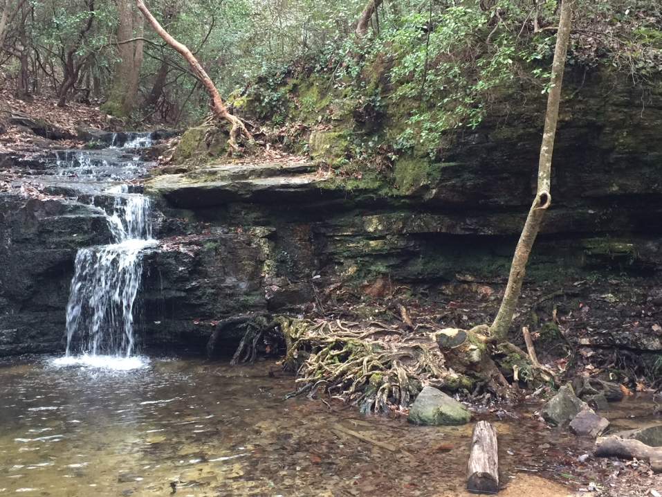
| Easy to strenuous 7 mile hike, approx 1,200 feet of elevation gain NOTE: My hikes are more leisurely....with plenty of breaks for water and snacks....if you are fast hiker and wants to hike fast, this may not be the hike for you. We also hike as a group, if you like to break off and do your own hike, this may not be the hike for you. We will be visiting 2 beautiful cascading waterfalls, just south of Blood Mountain (Both falls are on tributaries to Frogtown Creek, which begins near Walesi-yi in Neels Gap). The name Frogtown is a perversion of the Cherokee myth about a great frog, Walesi (or Walasi), who guarded Blood Mountain, which the Cherokee considered to be holy. The name Walasi-yi literally means Place of the Great Frog, and was the name of a small Cherokee village on the slopes of Blood Mountain. The gap above the falls was known as Frogtown Gap, until the Appalachian Trail was built perpendicular to Frogtown Gap Trail, an old Indian path, and became known as Neels Gap thereafter.) -georgiatrails Due to erosion control, the trail has been cut, so after hiking Desoto Falls, well be driving to Blood Mountain which is only few miles up the road, and well hike to the top of Blood Mountain and back which will add 5 miles to the hike. (Blood mountain is the 2nd tallest mountain Georgia, Tallest mountain on Georgia side of Applachian Trail) | |||||||
| |||||||
| How to Get There: | |||||||
| Event Directions: | Blairsville, GA 30512; 706-745-6928 10:00 am Parking lot at Desoto Falls From Park & Ride, go North on GA-400 until it ends, at the light, turn left on to 19, go through city of Dahlonega, few miles after city of Dahlonega you will come to Turners Corner, turn left on to 19/129/11 (going North) in approx 3.5-4 miles you will see the entrance to Desoto Falls on Left. | ||||||
| Notes: | |||||||
|
Are Dogs Permitted? No. Will this event occur rain or shine? No, not if heavy thunderstorms are forecast. NOTE: Please be considerate of others. If you sign-up and cannot attend, please e-mail the trip leader, so others that may be on a waiting list may attend. E-mail the trip leader to be put on a waiting list if the trip is at the max number of attendees. * We encourage all members to follow our Etiquette Guidelines while participating in AOC events. | |||||||
| Cost Includes: | Please share gas fare with your driver if you carpool since the gas price is high these days, $6 - $7 (we have had some issues with folks not helping out so please be kind). | ||||||
Cancellation/Partial Attendance: Please review the AOC cancellation policy. | |||||||
 Calendar of Events
 Event Places