 Print-Friendly Version Print-Friendly Version
|
|
Cohutta Wilderness Area: Jacks River Trail End to End | |||||||
| The Basics: | |||||||
| Event Type: | Backpacking | ||||||
| Event Location: |
Alaculsy Valley/Dally Gap


| ||||||
| Date(s) & Time: | Fri, Jun 10 2011 8:00 am >> Sun, Jun 12 2011 6:00 pm (Carpool Departure: 8:15 am *log in for location*) | ||||||
| Registration Opens: | Mon, Apr 25 2011 9:00 pm | ||||||
| Registration Cut Off: | Thu, Jun 9 2011 9:00 pm | ||||||
| Event Duration: | 2 Days 10 Hours | ||||||
| Difficulty Rating: | D5: Difficult | ||||||
| Pace: | Moderate | ||||||
| Trip Leader(s): | Grant Brown Email Trip Leader(s) Email Trip Leader(s)
You must be logged in to get the Trip Leader contact information. | ||||||
| Member Cost: | None | ||||||
| Participant Info: | |||||||
| Who's Invited: | Members Only, 21 And Older Only | ||||||
| Maximum Group Size: | 12 | ||||||
| Minimum Group Size: | 2 | ||||||
| Number Registered So Far: | 8 / 0 (To see who's signed up, log in to the Member Area) | ||||||
| Are Dogs Permitted: | No | ||||||
| Itinerary: | |||||||
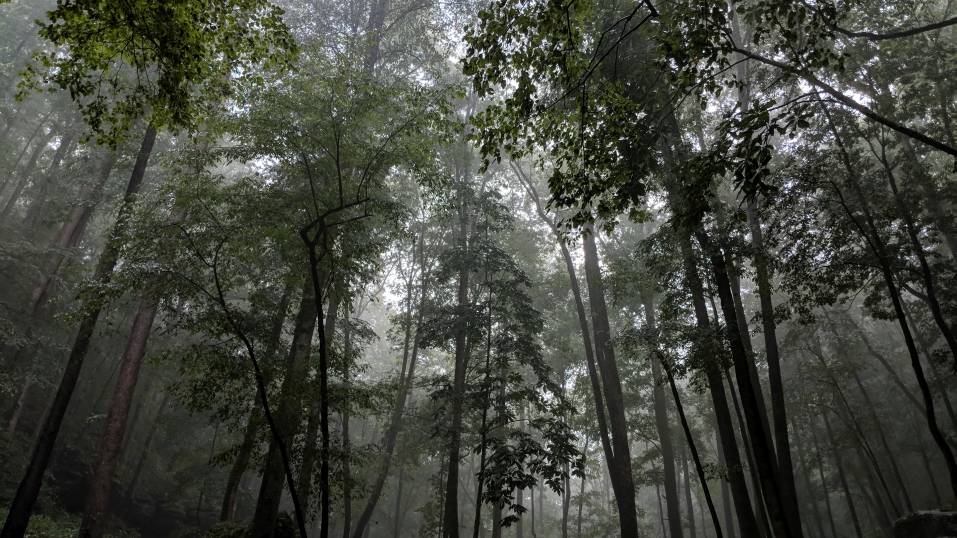
Cohutta Wilderness Area: Jacks River Trail End to End The Cohutta Wilderness is one of Georgia’s crown jewels. It is the most remote hiking location in our area. We will hike it’s most beautiful trail in it’s entirety. This hike is very wet and involves a bit of shuttle driving. We will only fill our cars half way so that we can drive to the Northwest trail-head in the Alaculsy Valley and drop one set of cars for shuttling back to Dally Gap. Make sure to review safety rules at end. Links: Here is the Trimble Trail Log for the Jacks River Trail [Thanks Mr. Scott Sanders!] General info Excellent trail description from Tim Homan Friday, June 10: Driving Directions: Kennesaw/Chattsworth/Alaculsy/Copper Hill/Dally - 3 hours 30 mins - 146 mi 8:15 Leave Chastain Road 9:30 Arrive bathroom break Chattsworth 10:30 Arrive Alaculsy Valley to drop half of the vehicles 11:45 Arrive Copper Hill, TN. Eat at local restaurant. 1:45 Arrive Dally Gap and hit the trail. 6:00 6.5 mile hike. Arrive first camp - Penitentiary Branch/Jacks River Trail intersection. It’s a large nice site. Saturday, June 11: 10:00 hit the trail for 2 mile hike Noon Arrive Jacks River Falls for lunch, sunning, swimming, relaxing 3:00 hit the trail to hike 3 miles to a random area to look for a site a ways passed Rice Camp intersection 5:30 begin scouting for good place to camp Sunday, June 12: 9:00 hit the trail for a 4 mile hike to the end Noon arrive vehicles, eat snack, drive to Copper Hill for lunch 2:00 pick up vehicles at Dally 6:00 back at Chastain Driving Directions: Alaculsy/Copper Hill/Dally/Kennesaw - 3 hours 37 mins - 151 mi Note: The mileage listed here is about 1.5 miles shy of the average. Most literature estimates the total miles between 15 and 16 or so. I used google earth and it came up a bit short. You should also take into account the altitude gains and losses listed on the Trimble page. So, these are general estimates, but they don’t vary too much. Safety Rules:
My Personal Plans:
DOWNLOAD! Grant’s Fun-time Campfire Songbook Now New and Improved w/clickable table of contents! [download it to your smart-phone and sing along!] | |||||||
| |||||||
| How to Get There: | |||||||
| Event Directions: | *See Google Map links in itenerary as well as directions in Tim Homan book pages links. | ||||||
| Carpool to Event Distance (round trip): | 300Mile(s) | ||||||
| Carpool Departure Time: | 8:15 am | ||||||
| Carpool Location: | Log in for location | ||||||
| Carpool Directions: | Log in for directions | ||||||
| Carpool Cost: | Estimated cost per vehicle for this event is $120.00 using a reimbursement rate guideline of $0.400 per mile. The total amount should be divided by the number of people in the vehicle, including the driver. This is a guideline, not a rule, for drivers but the cost should not be higher unless there are extenuating circumstances. | ||||||
| Notes: | |||||||
|
* We encourage all members to follow our Etiquette Guidelines while participating in AOC events. | |||||||
Cancellation/Partial Attendance: Please review the AOC cancellation policy. | |||||||
 Calendar of Events
 Event Places