 Print-Friendly Version Print-Friendly Version
|
|
Rabun Bald via Bartram trail Journey(18miles) (6 thinking hats) | |||||||
| The Basics: | |||||||
| Event Type: | Hike | ||||||
| Event Location: |
Rabun Bald, 15 miles northeast of Clayton, GA


| ||||||
| Date(s) & Time: | Sun, Jul 17 2011 6:30 am >> Sun, Jul 17 2011 9:45 pm (Carpool Departure: 7:00 am *log in for location*) | ||||||
| Registration Opens: | Thu, Jun 16 2011 10:45 am | ||||||
| Registration Cut Off: | Wed, Jul 6 2011 12:00 am | ||||||
| Event Duration: | 15 Hours 15 Minutes | ||||||
| Difficulty Rating: | D5: Difficult | ||||||
| Distance: | 18 Miles | ||||||
| Pace: | Fast | ||||||
| Trip Leader(s): | d merat Email Trip Leader(s) Email Trip Leader(s)
You must be logged in to get the Trip Leader contact information. | ||||||
| Member Cost: | None | ||||||
| Participant Info: | |||||||
| Who's Invited: | Members Only, 21 And Older Only | ||||||
| Maximum Group Size: | 8 | ||||||
| Minimum Group Size: | 4 | ||||||
| Number Registered So Far: | 7 / 0 (To see who's signed up, log in to the Member Area) | ||||||
| Are Dogs Permitted: | No | ||||||
| Itinerary: | |||||||
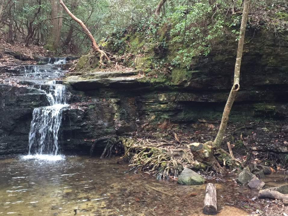
With a total distance of 18 miles and vertical rise of 4,700 feet. We will be summiting 2 mountains on this hike including Rabun Bald and Flat Top Mountain. Rabun Bald is the second-highest mountain in Georgia and the highest foot-access-only mountain. If features a 360 degree vista from a wooden deck perched above a rustic stone lockout tower at 4,696 feet. We will start at Warwoman Dell picnic area where we'll jump on the Bartram Trail. We'll hike by Becky Branch Falls and the larger more impressive Martins Creek Falls. Then it is some rolling terrain as we slowly gain in elevation over the 14 miles to the summit of Rabun Bald. The gaps are not that deep. There is an excellent overlook near Flat Top Mtn and then of course the views from the top of Rabun Bald, From the top of Rabun Bald it's another 3 miles downhill to the cars | |||||||
| |||||||
| How to Get There: | |||||||
| Event Directions: | Park & Ride | ||||||
| Carpool to Event Distance (round trip): | 214Mile(s) | ||||||
| Carpool Departure Time: | 7:00 am | ||||||
| Carpool Location: | Log in for location | ||||||
| Carpool Directions: | Log in for directions | ||||||
| Carpool Cost: | Estimated cost per vehicle for this event is $85.60 using a reimbursement rate guideline of $0.400 per mile. The total amount should be divided by the number of people in the vehicle, including the driver. This is a guideline, not a rule, for drivers but the cost should not be higher unless there are extenuating circumstances. | ||||||
| Notes: | |||||||
|
* We encourage all members to follow our Etiquette Guidelines while participating in AOC events. | |||||||
| Cost Includes: | Share gas expense with your carpool driver | ||||||
Cancellation/Partial Attendance: Please review the AOC cancellation policy. | |||||||
 Calendar of Events
 Event Places