 Print-Friendly Version Print-Friendly Version
|
|
Wayah and Siler Bald | |||||||
| The Basics: | |||||||
| Event Type: | Hike | ||||||
| Event Location: | Franklin area | ||||||
| Date(s) & Time: | Sat, Jun 18 2011 7:45 am >> Sat, Jun 18 2011 9:45 pm (Carpool Departure: 8:00 am *log in for location*) | ||||||
| Registration Opens: | Wed, Jun 1 2011 10:55 pm | ||||||
| Registration Cut Off: | Thu, Jun 16 2011 5:00 pm | ||||||
| Event Duration: | 14 Hours | ||||||
| Difficulty Rating: | D5: Difficult | ||||||
| Distance: | 12 Miles | ||||||
| Pace: | Moderate | ||||||
| Trip Leader(s): | Doug L Email Trip Leader(s) Email Trip Leader(s)
You must be logged in to get the Trip Leader contact information. | ||||||
| Member Cost: | None | ||||||
| Participant Info: | |||||||
| Who's Invited: | Members Only, 21 And Older Only | ||||||
| Maximum Group Size: | 8 | ||||||
| Minimum Group Size: | 2 | ||||||
| Number Registered So Far: | 7 / 0 (To see who's signed up, log in to the Member Area) | ||||||
| Are Dogs Permitted: | No | ||||||
| Itinerary: | |||||||
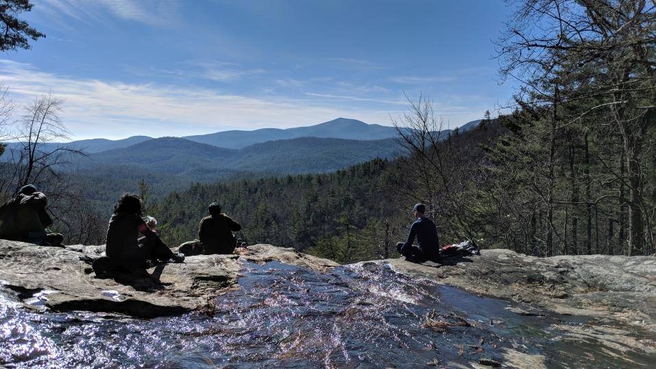
| This hike will start at the Wayah Crest campground between the 2 mountains. We will follow the Appalachian Trail north to the recently rebuilt tower on top of Wayah Bald where we will have lunch and look at Siler Bald, our next destination. After lunch we will go south on the AT to Siler Bald. After climbing Siler we will return to our cars. The tower on Wayah Bald and grassy peak of Siler Bald both offer a good views of the surrounding mountains.  At 12 miles and 3000 feet of elevation gain this will be a strenuous hike. We will be hiking at a moderate pace(by D5 standards). Faster hikers can go ahead but we will regroup at the tower, road crossings and Siler Bald to avoid getting too strung out. It is probably going to be hot so be sure to take plenty of water. Depending on the group this hike will probably take 6 to 8 hours. The drive is about 2.5 hours each way not counting the usual break on the way up or dinner on the way back. After the hike we will stop in Clayton for dinner at La Cabana if enough people are interested. NOTE: Because this a D5 event, if you have not very recently completed some tough AOC hikes, I will be contacting you to determine your level of fitness and experience to make sure this is the right hike for you. This hike will be cancelled if the chance of thunderstorms is 50% or greater or a steady all day rain is forecast. | |||||||
| |||||||
| How to Get There: | |||||||
| Event Directions: | Directions to trailhead will be given at carpool (or via email if "meeting at event"). | ||||||
| Carpool to Event Distance (round trip): | 245Mile(s) | ||||||
| Carpool Departure Time: | 8:00 am | ||||||
| Carpool Location: | Log in for location | ||||||
| Carpool Directions: | Log in for directions | ||||||
| Carpool Cost: | Estimated cost per vehicle for this event is $98.00 using a reimbursement rate guideline of $0.400 per mile. The total amount should be divided by the number of people in the vehicle, including the driver. This is a guideline, not a rule, for drivers but the cost should not be higher unless there are extenuating circumstances. | ||||||
| Notes: | |||||||
|
This hike will be cancelled if the chance of thunderstorms is 50% or greater or a steady all day rain is forecast. * We encourage all members to follow our Etiquette Guidelines while participating in AOC events. | |||||||
| Cost Includes: | NA | ||||||
Cancellation/Partial Attendance: Please review the AOC cancellation policy. *Note: NA | |||||||
 Calendar of Events
 Event Places