 Print-Friendly Version Print-Friendly Version
|
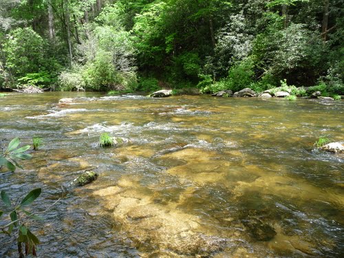
Ellicott Rock w/ Kings Creek Falls and Spoonauger Falls | |||||||
| The Basics: | |||||||
| Event Type: | Hike | ||||||
| Event Location: |
Chattooga River - Burrell's Ford


| ||||||
| Date(s) & Time: | Sun, Sep 11 2011 10:40 am >> Sun, Sep 11 2011 3:40 pm (Carpool Departure: 8:00 am *log in for location*) | ||||||
| Registration Opens: | Fri, Sep 2 2011 9:16 am | ||||||
| Registration Cut Off: | Fri, Sep 9 2011 7:00 pm | ||||||
| Event Duration: | 5-6 Hours (~11 including drive time) | ||||||
| Difficulty Rating: | D4: Moderate to Difficult (Exploratory) | ||||||
| Distance: | 12 Miles | ||||||
| Pace: | Moderate | ||||||
| Trip Leader(s): | Mark Bob J  Email Trip Leader(s) Email Trip Leader(s)
You must be logged in to get the Trip Leader contact information. | ||||||
| Member Cost: | None | ||||||
| Participant Info: | |||||||
| Who's Invited: | Members Only, 21 And Older Only | ||||||
| Maximum Group Size: | 12 | ||||||
| Minimum Group Size: | 4 | ||||||
| Number Registered So Far: | 14 / 0 (To see who's signed up, log in to the Member Area) | ||||||
| Are Dogs Permitted: | No | ||||||
|
Note: This is an "EXPLORATORY" trip. This means that there are parts of this trip, or perhaps the whole trip, that is new to your Trip Leader(s). However, they are confident that this will not be an issue. This note is here so that you can make an informed decision. When a Trip Leader isn't personally familiar with a trip, there is an increased chance of things not going as planned and you need to be prepared. The Trip Leader may have additional details in the itinerary. | |||||||
| Itinerary: | |||||||
Ellicott Rock Wilderness Area consists of 8,274 acres located in the States of Georgia, North Carolina, and South Carolina. In 1811, surveyor Andrew Ellicott determined the starting point for the North Carolina-Georgia state line and chiseled an inconspicuous mark on a rock on the east bank of the Chattooga River. After continued dispute, two years later, commissioners from SC and NC re-surveyed the area and marked another rock just 10 - 15 feet away as the border between the three states. This "commissioners rock" is commonly referred to as Ellicott Rock and is the official border between the three states. | |||||||
| |||||||
| How to Get There: | |||||||
| Event Directions: | There are several possible routes to Burrell's Ford, only varying by about 10 minutes in travel time (~ 2.5 hours from the Indian Trail P&R). If you choose to meet at the event, you should use the following coordinates to input into one of the online mapping sources to determine your route. Burrells Ford parking area: N34 58.290, W083 06.887 | ||||||
| Carpool to Event Distance (round trip): | 240Mile(s) | ||||||
| Carpool Departure Time: | 8:00 am | ||||||
| Carpool Location: | Log in for location | ||||||
| Carpool Directions: | Log in for directions | ||||||
| Carpool Cost: | Estimated cost per vehicle for this event is $96.00 using a reimbursement rate guideline of $0.400 per mile. The total amount should be divided by the number of people in the vehicle, including the driver. This is a guideline, not a rule, for drivers but the cost should not be higher unless there are extenuating circumstances. | ||||||
| Notes: | |||||||
|
If you happen to be registered for the Panther Creek trip on Saturday, you may wish to camp at Burrells Ford campground, or one of the other nearby Camping areas, to minimize travel time - not to mention, increase fun time. If you choose to do this, please note so in the notes section in the registration process. Or send the TLs an email. There will be approximately 1 mile section of the hike that will be off-trail (possible bushwhacking). Please read the event description in case you missed this. * We encourage all members to follow our Etiquette Guidelines while participating in AOC events. | |||||||
Cancellation/Partial Attendance: Please review the AOC cancellation policy. | |||||||
 Calendar of Events
 Event Places