 Print-Friendly Version Print-Friendly Version
|
|
Pickens Nose, Mt Albert and AT overlook | |||||||
| The Basics: | |||||||
| Event Type: | Hike | ||||||
| Event Location: |
Standing Indian area near Franklin, NC


| ||||||
| Date(s) & Time: | Sat, Oct 22 2011 8:00 am >> Sat, Oct 22 2011 9:00 pm (Carpool Departure: 8:00 am *log in for location*) | ||||||
| Registration Opens: | Thu, Sep 29 2011 10:40 pm | ||||||
| Registration Cut Off: | Fri, Oct 21 2011 8:00 pm | ||||||
| Event Duration: | 13 Hours | ||||||
| Difficulty Rating: | D4: Moderate to Difficult | ||||||
| Distance: | 12 Miles | ||||||
| Pace: | Moderate | ||||||
| Trip Leader(s): | Doug L Email Trip Leader(s) Email Trip Leader(s)
You must be logged in to get the Trip Leader contact information. | ||||||
| Member Cost: | None | ||||||
| Participant Info: | |||||||
| Who's Invited: | Members Only, 21 And Older Only | ||||||
| Maximum Group Size: | 8 | ||||||
| Minimum Group Size: | 2 | ||||||
| Number Registered So Far: | 7 / 0 (To see who's signed up, log in to the Member Area) | ||||||
| Are Dogs Permitted: | No | ||||||
| Itinerary: | |||||||
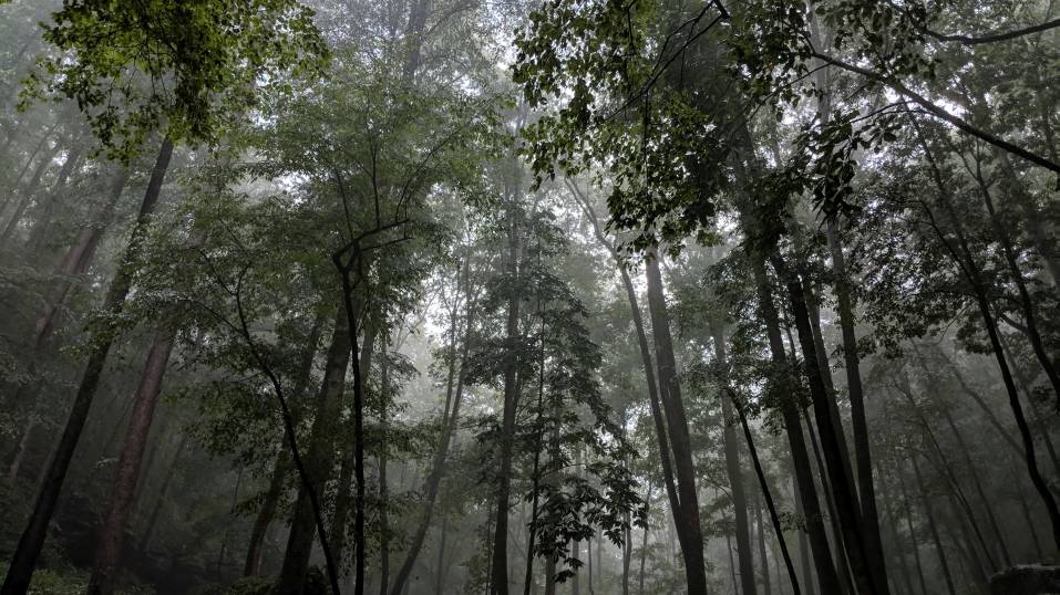
| This hike will provide 3 good views of NC mountains in fall colors. We will start with the short hike to Pickens Nose and then drive a couple of miles to the Betty Creek trailhead on the AT and go to Mt. Albert and a nice overlook on the AT. If the trees cooperate we should be seeing the fall colors at their peak. The picture below is from Pickens Nose in the spring:  At 12 miles and 2000 feet of elevation gain this hike will be quite strenuous for a D4. According to the AOC guidelines it is D5 for length but a D4 for elevation. We will be hiking at a moderate pace so I am rating it a D4. Faster hikers familiar with the trails can go ahead but we will regroup at the peaks, overlooks and road crossings to avoid getting too strung out. We will start by driving to the Pickens Nose trailhead and take the short (1.5 mile round trip) trail to the peak where we will checkout the view and take some pictures. This is an easy trail that is probably pretty popular this time of year. After returning to our cars we will drive 2 miles to the Betty Creek trailhead where we will head north for about 3 miles on the AT to Mt. Albert. This is the most difficult part of the hike with the last half mile being steep with large rocks. There is a tower at the summit which provides a great view in all directions. After having lunch we will head back. Since this is a D4 event we will head north a short distance on the AT and walk down a dirt road for a half mile to bypass the steep rocky section of the AT on the way back. We will then go south on the AT to an overlook that has a good view of Pickens Nose and the mountains to the south. After reaching this overlook we will hike back to Betty Creek and drive home. Depending on the group this hike will probably take 6 to 8 hours. The drive is about 2.5 hours each way not counting the usual break on the way up or dinner on the way back. After the hike we will stop in Clayton for dinner at if enough people are interested. NOTES: Because this a strenuous hike for a D4 event, if you have not very recently completed some tough AOC hikes, I will be contacting you to determine your level of fitness and experience to make sure this is the right hike for you. This hike will be cancelled if rain is forecast. I prefer hiking with a small group. If this event does fill up I will not increase the group size by adding people from the waiting list unless someone that is registered drops out. | |||||||
| |||||||
| How to Get There: | |||||||
| Event Directions: | Directions to trailhead will be given at carpool (or via email if "meeting at event"). | ||||||
| Carpool to Event Distance (round trip): | 250Mile(s) | ||||||
| Carpool Departure Time: | 8:00 am | ||||||
| Carpool Location: | Log in for location | ||||||
| Carpool Directions: | Log in for directions | ||||||
| Carpool Cost: | Estimated cost per vehicle for this event is $100.00 using a reimbursement rate guideline of $0.400 per mile. The total amount should be divided by the number of people in the vehicle, including the driver. This is a guideline, not a rule, for drivers but the cost should not be higher unless there are extenuating circumstances. | ||||||
| Notes: | |||||||
|
Because this a strenuous hike for a D4 event, if you have not very recently completed some tough AOC hikes, I will be contacting you to determine your level of fitness and experience to make sure this is the right hike for you. This hike will be cancelled if rain is forecast. I prefer hiking with a small group. If this event does fill up I will not increase the group size by adding people from the waiting list unless someone that is registered drops out. The last 10 miles of the drive will be over forest service roads. I have never had any trouble on these roads with my low clearance small car but they are dirt roads. * We encourage all members to follow our Etiquette Guidelines while participating in AOC events. | |||||||
| Cost Includes: | NA | ||||||
Cancellation/Partial Attendance: Please review the AOC cancellation policy. *Note: NA | |||||||
 Calendar of Events
 Event Places