 Print-Friendly Version Print-Friendly Version
|
|
Exploratory Backpacking Benton Mackaye Toccoa River | |||||||
| The Basics: | |||||||
| Event Type: | Backpacking | ||||||
| Event Location: | North Georgia Mountains | ||||||
| Date(s) & Time: | Sat, Nov 12 2011 9:00 am >> Sun, Nov 13 2011 4:30 pm (Carpool Departure: 9:00 am *log in for location*) | ||||||
| Registration Opens: | Thu, Oct 27 2011 9:00 pm | ||||||
| Registration Cut Off: | Thu, Nov 10 2011 8:00 pm | ||||||
| Event Duration: | 1 Days 7 Hours 30 Minutes | ||||||
| Difficulty Rating: | D4: Moderate to Difficult (Exploratory) | ||||||
| Distance: | 7 Miles | ||||||
| Pace: | Leisurely | ||||||
| Trip Leader(s): | Jason Hicks Email Trip Leader(s) Email Trip Leader(s)
You must be logged in to get the Trip Leader contact information. | ||||||
| Member Cost: | None | ||||||
| Participant Info: | |||||||
| Who's Invited: | Members Only, 21 And Older Only | ||||||
| Maximum Group Size: | 12 | ||||||
| Minimum Group Size: | 6 | ||||||
| Number Registered So Far: | 8 / 0 (To see who's signed up, log in to the Member Area) | ||||||
| Are Dogs Permitted: | Yes | ||||||
|
Note: This is an "EXPLORATORY" trip. This means that there are parts of this trip, or perhaps the whole trip, that is new to your Trip Leader(s). However, they are confident that this will not be an issue. This note is here so that you can make an informed decision. When a Trip Leader isn't personally familiar with a trip, there is an increased chance of things not going as planned and you need to be prepared. The Trip Leader may have additional details in the itinerary. | |||||||
| Itinerary: | |||||||
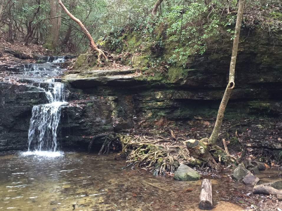
| Ok this is a new one that I am sure some people in the club have done. I have this book on the Benton Makaye trail. Well there is this cool bridge that goes over the Toccoa River. So met at the carpool.. drive up to the trailhead. Gear up and hike 3-4 miles to the large suspension bridge over the Toccoa river. The guides I have read (couple of them) say that there are plenty of campsites around there. This is the exploratory part... we have to find one! Then once we do we can relax or explore some more. But all the guides say there are plenty.. and a water source should not be a problem. Next morning get up.. pack up and hike out. Maybe get something to eat on the way back to Atlanta. The hike itself again is about 3.5 miles in, elevation change is little under 1000 feet. Oh yes and if there is a serious chance for rain I will cancel. I do not like to spend all day in my hammock or not being able to have a campfire. I mean how fun is that?? | |||||||
| |||||||
| How to Get There: | |||||||
| Event Directions: | From Dahlonega take US 19 and route 60 for 9 miles. Bear left on Route 60, where US 19 turns right. Then continue another 7 miles to Suches. From intersection of Route 180 and 60 in Suches, continue north on Route 60 for another 14.8 miles to the Route 60 trailhead. Roadside parking is along the side of the road just beyond the trail crossing. | ||||||
| Carpool to Event Distance (round trip): | 140Mile(s) | ||||||
| Carpool Departure Time: | 9:00 am | ||||||
| Carpool Location: | Log in for location | ||||||
| Carpool Directions: | Log in for directions | ||||||
| Carpool Cost: | Estimated cost per vehicle for this event is $56.00 using a reimbursement rate guideline of $0.400 per mile. The total amount should be divided by the number of people in the vehicle, including the driver. This is a guideline, not a rule, for drivers but the cost should not be higher unless there are extenuating circumstances. | ||||||
| Notes: | |||||||
|
* We encourage all members to follow our Etiquette Guidelines while participating in AOC events. | |||||||
Cancellation/Partial Attendance: Please review the AOC cancellation policy. | |||||||
 Calendar of Events
 Event Places