 Print-Friendly Version Print-Friendly Version
|
^^ Summit GA’s Highest Peaks: #3 - Hightower Bald (4568’) ^^ | |||||||
| The Basics: | |||||||
| Event Type: | Explorer | ||||||
| Event Location: |
Chattahoochee National Forest, near Hiawassee, GA


| ||||||
| Date(s) & Time: | Sat, Apr 14 2012 8:00 am >> Sat, Apr 14 2012 8:00 pm (Carpool Departure: 8:00 am *log in for location*) | ||||||
| Registration Opens: | Thu, Apr 5 2012 9:44 pm | ||||||
| Registration Cut Off: | Thu, Apr 12 2012 12:12 pm | ||||||
| Event Duration: | 12 Hours | ||||||
| Difficulty Rating: | D6: Advanced | ||||||
| Distance: | 8 Miles | ||||||
| Pace: | Moderate | ||||||
| Trip Leader(s): | Mark Email Trip Leader(s) Email Trip Leader(s)
You must be logged in to get the Trip Leader contact information. | ||||||
| Member Cost: | None | ||||||
| Participant Info: | |||||||
| Who's Invited: | Members Only, 21 And Older Only | ||||||
| Maximum Group Size: | 8 | ||||||
| Minimum Group Size: | 4 | ||||||
| Number Registered So Far: | 7 / 0 (To see who's signed up, log in to the Member Area) | ||||||
| Are Dogs Permitted: | No | ||||||
| Itinerary: | |||||||
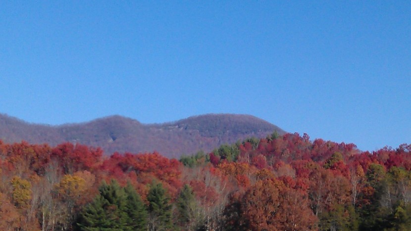
#3 - Hightower Bald
Standing 4568' above sea level with 808' of prominence, Hightower Bald is within the boundaries of the Southern Nantahala Wilderness Area of the Chattahoochee National Forest. It is the highest of a series of a half dozen mountain peaks all over 4,000 feet that run west to Eagle Mountain. This ridge line lying in the Southern Nantahala Wilderness is one of the most remote areas in the state due to the rugged terrain, lack of roads, and... did I mention... NO trails. Absolutely perfect for those who like a little more free-form adventure in their hiking. | |||||||
| |||||||
| How to Get There: | |||||||
| Event Directions: | Directions to trailhead will be given at carpool (or via email if "meeting at event"). | ||||||
| Carpool to Event Distance (round trip): | 214Mile(s) | ||||||
| Carpool Departure Time: | 8:00 am | ||||||
| Carpool Location: | Log in for location | ||||||
| Carpool Directions: | Log in for directions | ||||||
| Carpool Cost: | Estimated cost per vehicle for this event is $85.60 using a reimbursement rate guideline of $0.400 per mile. The total amount should be divided by the number of people in the vehicle, including the driver. This is a guideline, not a rule, for drivers but the cost should not be higher unless there are extenuating circumstances. | ||||||
| Notes: | |||||||
|
For more information on the other hikes in the series and the methodology used in making the list, click here. Because this a D6 event, if you have not recently completed some tough AOC hikes, we may be contacting you to determine your level of fitness and experience to make sure this is a suitable hike for you. * We encourage all members to follow our Etiquette Guidelines while participating in AOC events. | |||||||
| Cost Includes: | NA | ||||||
Cancellation/Partial Attendance: Please review the AOC cancellation policy. *Note: NA | |||||||
 Calendar of Events
 Event Places