 Print-Friendly Version Print-Friendly Version
|
|
^^ Summit GA’s Highest Peaks: #9 - Cowpen Mountain (4151’) ^^ | |||||||
| The Basics: | |||||||
| Event Type: | Hike | ||||||
| Event Location: |
Cohutta Wilderness, near Epworth, GA


| ||||||
| Date(s) & Time: | Sat, Apr 7 2012 8:00 am >> Sat, Apr 7 2012 5:00 pm (Carpool Departure: 8:00 am *log in for location*) | ||||||
| Registration Opens: | Thu, Mar 8 2012 9:19 pm | ||||||
| Registration Cut Off: | Fri, Apr 6 2012 12:00 pm | ||||||
| Event Duration: | 9 Hours | ||||||
| Difficulty Rating: | D4: Moderate to Difficult | ||||||
| Distance: | 9.5 Miles | ||||||
| Pace: | Moderate | ||||||
| Trip Leader(s): | Tanja B Sam L  Email Trip Leader(s) Email Trip Leader(s)
You must be logged in to get the Trip Leader contact information. | ||||||
| Member Cost: | None | ||||||
| Participant Info: | |||||||
| Who's Invited: | Members Only, 21 And Older Only | ||||||
| Maximum Group Size: | 12 | ||||||
| Minimum Group Size: | 4 | ||||||
| Number Registered So Far: | 10 / 0 (To see who's signed up, log in to the Member Area) | ||||||
| Are Dogs Permitted: | Yes | ||||||
| Itinerary: | |||||||
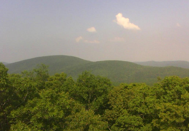
#9 - Cowpen Mountain
Standing 4151' above sea level with 1551' of clean prominence, Cowpen Mtn is the tallest in the Cohutta Wilderness and the 9th tallest in GA. This hike will combine Cowpen Mountain with a winter visit to Panther Falls, best view in the Cohuttas. We'll start at the Three Forks trailhead and hike ~1.5 miles north on East Cowpen Trail, an old logging road turned trail, which climbs up to the northern ridge of Cowpen Mountain. An easy 1/4 mile bushwhack along the ridge takes us to the summit of Cowpen. The summit is engulfed in a thicket of briars and young trees with no appreciable views so we will not dally long there. Returning to East Cowpen Trail, we'll continue another mile North, descending down Cowpen's northern ridge with taunting views through slumbering trees, to Panther Creek Trail. Descending steeply off a rib ridge, we meet Panther Creek a mile from its source and follow it to the top of Panther Falls. We will have a late lunch on top of the falls, possibly descending to the bottom of the falls. There will be an option to extend the hike a bit below the falls, depending on how the group feels, then we'll trace back our footsteps steeply back to the ridge and back to the cars. Distance: ~ 9.5+ miles
| |||||||
| |||||||
| How to Get There: | |||||||
| Event Directions: | Directions to trailhead will be given at carpool (or via email if "meeting at event"). | ||||||
| Carpool to Event Distance (round trip): | 150Mile(s) | ||||||
| Carpool Departure Time: | 8:00 am | ||||||
| Carpool Location: | Log in for location | ||||||
| Carpool Directions: | Log in for directions | ||||||
| Carpool Cost: | Estimated cost per vehicle for this event is $60.00 using a reimbursement rate guideline of $0.400 per mile. The total amount should be divided by the number of people in the vehicle, including the driver. This is a guideline, not a rule, for drivers but the cost should not be higher unless there are extenuating circumstances. | ||||||
| Notes: | |||||||
|
Access to Cowpen Mountain requires driving 10+ miles on awesome narrow, windy dirt/gravel roads. Please keep this in mind before you volunteer to drive your shiny, new, low-riding sportscar to the trailhead. This is an (almost) rain or shine event. Hiking in the rain can be a wonderful experience. Unless the forecast is for heavy rain and flooding, the hike will go on as planned. For more information on the other hikes in the series and the methodology used in making the list, click here. * We encourage all members to follow our Etiquette Guidelines while participating in AOC events. | |||||||
| Cost Includes: | NA | ||||||
Cancellation/Partial Attendance: Please review the AOC cancellation policy. *Note: NA | |||||||
 Calendar of Events
 Event Places