 Print-Friendly Version Print-Friendly Version
|
Awesome Hightower Bald Explorer | |||||||
| The Basics: | |||||||
| Event Type: | Explorer | ||||||
| Event Location: |
Approximately 10 miles East of Hiawassee, Ga


| ||||||
| Date(s) & Time: | Tue, Jan 24 2012 9:30 am >> Tue, Jan 24 2012 4:30 pm (Carpool Departure: 7:30 am *log in for location*) | ||||||
| Registration Opens: | Sun, Jan 22 2012 7:30 pm | ||||||
| Registration Cut Off: | Mon, Jan 23 2012 7:30 pm | ||||||
| Event Duration: | 7 Hours | ||||||
| Difficulty Rating: | D6: Advanced (Exploratory) | ||||||
| Pace: | Moderate | ||||||
| Trip Leader(s): | Mark Email Trip Leader(s) Email Trip Leader(s)
You must be logged in to get the Trip Leader contact information. | ||||||
| Member Cost: | None | ||||||
| Participant Info: | |||||||
| Who's Invited: | Members Only, 21 And Older Only | ||||||
| Maximum Group Size: | 8 | ||||||
| Minimum Group Size: | 4 | ||||||
| Number Registered So Far: | 6 / 0 (To see who's signed up, log in to the Member Area) | ||||||
| Are Dogs Permitted: | No | ||||||
|
Note: This is an "EXPLORATORY" trip. This means that there are parts of this trip, or perhaps the whole trip, that is new to your Trip Leader(s). However, they are confident that this will not be an issue. This note is here so that you can make an informed decision. When a Trip Leader isn't personally familiar with a trip, there is an increased chance of things not going as planned and you need to be prepared. The Trip Leader may have additional details in the itinerary. | |||||||
| Itinerary: | |||||||
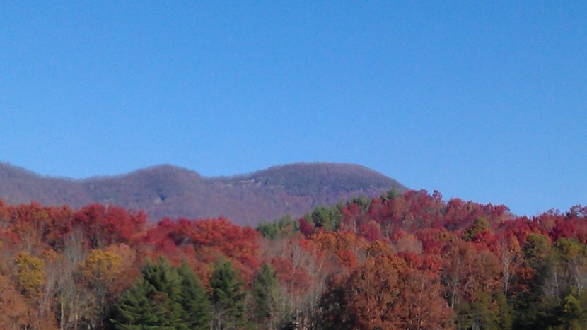
| This will be an explorer hike up to Hightower Bald (4,568')... Georgia's 3 highest peak (or 4th) depending on which prominence rule is used. This hike will be about 6 - 7 miles, depending on how much exploration we do. The plan is to hike up to Shooting Creek Bald (4,301') and then NE along a sharp ridgeline to Hightower. After reaching the summit of Hightower we will attempt to get to the cliffs on the south side of Hightower for what should be some great southerly views. Then, if possible, we will circle around to the base of the cliffs and circle back around to the "saddle" between Hightower and Shooting Creek Bald. From that point, we will return along the same route we ascended via Shooting Creek Bald.
The weather forecast has shaped up nicely and it is projected to be Sunny with a high of almost 60 in Hiawassee. I expect it to be the same on Hightower, except 6 to 7 degrees cooler due to the elevation. Although this hike is not long by D5/D6 standards, it is all off-trail with some very long steep climbs. If you do not have previous D5 hiking experience I WILL be contacting you to determine if this hike is appropriate for you. | |||||||
| |||||||
| How to Get There: | |||||||
| Event Directions: | If there is anyone who for some reason needs to meet at the event, I will provide directions via email. (These are the coordinates for the turnoff to the parking area - they will not get you to the "exact" parking area, but are very close just in case you want a general idea of where will will start from. 34.955212, -83.611826) | ||||||
| Carpool to Event Distance (round trip): | 200Mile(s) | ||||||
| Carpool Departure Time: | 7:30 am | ||||||
| Carpool Location: | Log in for location | ||||||
| Carpool Directions: | Log in for directions | ||||||
| Carpool Cost: | Estimated cost per vehicle for this event is $80.00 using a reimbursement rate guideline of $0.400 per mile. The total amount should be divided by the number of people in the vehicle, including the driver. This is a guideline, not a rule, for drivers but the cost should not be higher unless there are extenuating circumstances. | ||||||
| Notes: | |||||||
|
Every effort will be made to get us back to the cars before 4:30. But this is a wilderness explorer hike and I can not make a promise that it will not run a bit longer. It is then a 2 hour drive back. * We encourage all members to follow our Etiquette Guidelines while participating in AOC events. | |||||||
Cancellation/Partial Attendance: Please review the AOC cancellation policy. | |||||||
 Calendar of Events
 Event Places