 Print-Friendly Version Print-Friendly Version
|
|
Siler Bald & Wayah Bald on the AT | |||||||
| The Basics: | |||||||
| Event Type: | Hike | ||||||
| Event Location: |
west of Franklin, NC


| ||||||
| Date(s) & Time: | Sat, May 5 2012 7:30 am >> Sat, May 5 2012 9:00 pm (Carpool Departure: 7:30 am *log in for location*) | ||||||
| Registration Opens: | Tue, May 1 2012 12:00 pm | ||||||
| Registration Cut Off: | Fri, May 4 2012 6:00 pm | ||||||
| Event Duration: | per itinerary (about 13 hours) | ||||||
| Difficulty Rating: | D5: Difficult | ||||||
| Distance: | 12 Miles | ||||||
| Pace: | Moderate | ||||||
| Trip Leader(s): | Dorothea Email Trip Leader(s) Email Trip Leader(s)
You must be logged in to get the Trip Leader contact information. | ||||||
| Member Cost: | None | ||||||
| Participant Info: | |||||||
| Who's Invited: | Members Only, 21 And Older Only | ||||||
| Maximum Group Size: | 9 | ||||||
| Minimum Group Size: | 2 | ||||||
| Number Registered So Far: | 2 / 0 (To see who's signed up, log in to the Member Area) | ||||||
| Are Dogs Permitted: | No | ||||||
| Itinerary: | |||||||
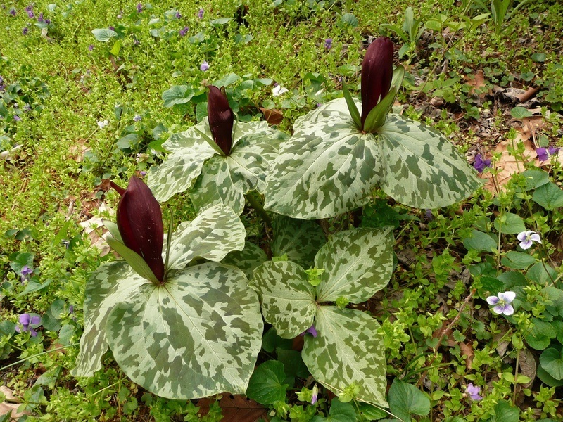
| Two magnificent views on a figure-8 hike. The center of the figure 8 is the parking lot at Wayah Gap (~4200 ft). To make the first loop we ascend Siler Bald (5216 ft), where we will enjoy a 360-degree view on a wide-open grassy crown, after which we return to Wayah Gap (4 miles, 2 hours). For the second loop, we cross the road and ascend Winespring Mountain and continue along the ridge to Wayah Bald (5350 ft), where we will enjoy another almost 360-degree view from the recently restored fire tower, before returning to Wayah Gap (8 miles, 4 hours). Total elevation gain about 3000 ft. Hopefully we will see some trilliums, if the wild pigs, of which there were copious signs last fall, have not chewed them all up. If there is interest, we will have dinner afterwards in Clayton. Since I will be meeting the carpoolers from Atlanta only in Clayton, I will ask for a volunteer to coordinate the carpooling at the Indian Trail park and ride. | |||||||
| |||||||
| How to Get There: | |||||||
| Event Directions: | From the Indian Trail park & ride, take I-85 North. After 11 miles bear left to take I-985 North. This road will change to GA 365, US 441, and US 23. Stay on it for 75 miles, then stop at the Burger King in Clayton for a pit-stop and to meet the leader. Once back on the 441, it is 21 miles to Franklin. Make a left onto US 64 West. Go 3.7 miles on US 64 and make a right onto Patton Rd, then an immediate left onto Wayah Rd, SR 1310, which is all paved. (There should be a sign for Wayah Bald on US 64.) From there it is 8.9 miles to the Appalachian Trail. Look for the hikers crossing sign at the top of Wayah Gap and turn left into the parking lot of the Wayah Crest campground. Travel time: 1.5 hours from Indian Trail park and ride to Clayton and another 45 minutes from Clayton to Wayah Gap. | ||||||
| Carpool to Event Distance (round trip): | 242Mile(s) | ||||||
| Carpool Departure Time: | 7:30 am | ||||||
| Carpool Location: | Log in for location | ||||||
| Carpool Directions: | Log in for directions | ||||||
| Carpool Cost: | Estimated cost per vehicle for this event is $96.80 using a reimbursement rate guideline of $0.400 per mile. The total amount should be divided by the number of people in the vehicle, including the driver. This is a guideline, not a rule, for drivers but the cost should not be higher unless there are extenuating circumstances. | ||||||
| Notes: | |||||||
|
* We encourage all members to follow our Etiquette Guidelines while participating in AOC events. | |||||||
Cancellation/Partial Attendance: Please review the AOC cancellation policy. | |||||||
 Calendar of Events
 Event Places