 Print-Friendly Version Print-Friendly Version
|
|
East Palisades - Long Route at a Quick Pace | |||||||
| The Basics: | |||||||
| Event Type: | Hike | ||||||
| Event Location: |
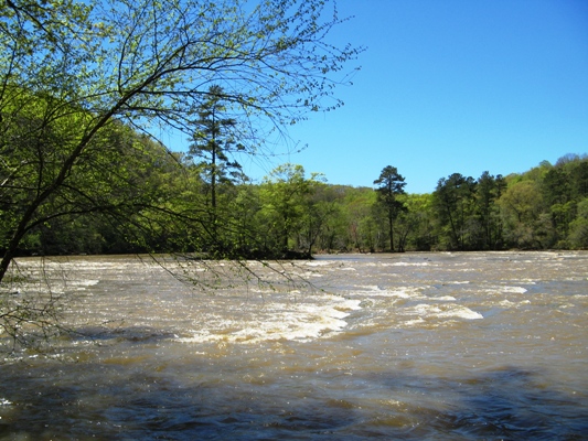
CNRA East Palisades Unit - Whitewater Creek Parking Area


| ||||||
| Date(s) & Time: | Thu, Jun 14 2012 9:55 am >> Thu, Jun 14 2012 12:30 pm | ||||||
| Registration Opens: | Wed, Jun 13 2012 12:44 am | ||||||
| Registration Cut Off: | Thu, Jun 14 2012 9:00 am | ||||||
| Event Duration: | 2 Hours 35 Minutes | ||||||
| Difficulty Rating: | D4: Moderate to Difficult | ||||||
| Pace: | Fast | ||||||
| Trip Leader(s): | Laura V Email Trip Leader(s) Email Trip Leader(s)
You must be logged in to get the Trip Leader contact information. | ||||||
| Member Cost: | None | ||||||
| Participant Info: | |||||||
| Who's Invited: | Members Only, 21 And Older Only | ||||||
| Maximum Group Size: | 10 | ||||||
| Minimum Group Size: | 4 | ||||||
| Number Registered So Far: | 10 / 0 (To see who's signed up, log in to the Member Area) | ||||||
| Are Dogs Permitted: | Yes | ||||||
| Itinerary: | |||||||
Join us for a relatively fast paced, longer, and more strenuous than usual East Palisades hike. We will be covering most all of the marked trails and quite a few unmarked trails for a total of 7.5 - 8 miles. Although the pace will be fast, we will still make a few 'brief' stops to appreciate the sights. The hike will begin at the Whitewater Creek parking lot and we will hike at a brisk pace (although not running or jogging) along many trails of the East Palisades Unit making a couple brief stops to hydrate. We will be hiking most all of the marked trails and also a couple miles of unmarked trails. With the planned route and lesser known trails, even those quite familiar with East Palisades will probably get to experience some different trails - at least have them combined in a different manner. This is not a beginner hike! The pace will be brisk, the hike longer than usual by EP standards, and we will climb some steep and hilly portions a number of times. I expect the total ascent on the hike to be 1,300 feet.
| |||||||
| |||||||
| How to Get There: | |||||||
| Event Directions: | GPS Coordinates:
From I-75 Northbound:
From U.S. 41 (Cobb Parkway) northbound:
From U.S. 41 (Cobb Parkway) southbound:
| ||||||
| Notes: | |||||||
With much appreciation to Mark for routing this hike and leading it many times. Thanks, also for letting me swipe your event description. * We encourage all members to follow our Etiquette Guidelines while participating in AOC events. | |||||||
Cancellation/Partial Attendance: Please review the AOC cancellation policy. | |||||||
 Calendar of Events
 Event Places