 Print-Friendly Version Print-Friendly Version
|
|
Happy Feet KM Hike/Trail-Run | |||||||
| The Basics: | |||||||
| Event Type: | Hike | ||||||
| Event Location: |
Kennesaw Mountain National Battlefield Park


| ||||||
| Date(s) & Time: | Wed, Jun 27 2012 6:00 pm >> Wed, Jun 27 2012 8:00 pm | ||||||
| Registration Opens: | Sun, Jun 24 2012 10:30 pm | ||||||
| Registration Cut Off: | Wed, Jun 27 2012 3:00 pm | ||||||
| Event Duration: | 2 Hours | ||||||
| Difficulty Rating: | D4: Moderate to Difficult | ||||||
| Distance: | 6 Miles | ||||||
| Pace: | Fast | ||||||
| Trip Leader(s): | Danny Email Trip Leader(s) Email Trip Leader(s)
You must be logged in to get the Trip Leader contact information. | ||||||
| Member Cost: | None | ||||||
| Participant Info: | |||||||
| Who's Invited: | Members Only, 21 And Older Only | ||||||
| Maximum Group Size: | 12 | ||||||
| Minimum Group Size: | 2 | ||||||
| Number Registered So Far: | 7 / 0 (To see who's signed up, log in to the Member Area) | ||||||
| Are Dogs Permitted: | Yes | ||||||
| Itinerary: | |||||||
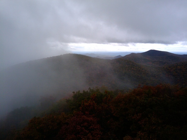
The promo shot is the view towards Standing Indian from the tower on Albert Mountain and not of KM just so you know :-) Do this hike every week and you'll have no problems climbing up to Albert Mountain on the weekends. Bring your happy feet to this event. http://www.youtube.com/watch?v=xnksquL557s Go as fast or slow as you want in these 2 hours. This is your hike for your own development. This hike/trail run is for those that already "own" Kennesaw "Mountain", know the trails, and consider it a rather easy climb. This is a very fast paced group trying to get back and forth across the "mountains" before the park closes. We go ~3 miles in the first hour and ~3 miles in the second hour with about a 1 minute break if you want one. We start and end at the Visitor Center, and haul ass the entire way! It is defined as a hike event because many of the participants choose to hike or run on the downhills, flats, and small ups. You can run or walk it, but you must know the trail and realize that we get very spread out. Please look over the directions below to possibly save yourself some time getting there.
Study the map, especially if you've never been there before. We'll be going from the Visitor Center to Burnt Hickory Road on what is called the East Trail. It goes over the mountains versus around the mountains. At every fork in the trail on the way over, choose right and you'll be alright. We tend to get spread out on this one, so it's best if you've been here before, but it's not a requirement.
| |||||||
| |||||||
| How to Get There: | |||||||
| Event Directions: | 1) I-75 North to exit 267B Hwy 5 Canton Road Connector | ||||||
| Notes: | |||||||
|
VERY IMPORTANT NOTES: * We encourage all members to follow our Etiquette Guidelines while participating in AOC events. | |||||||
| Cost Includes: | No cost. | ||||||
Cancellation/Partial Attendance: Please review the AOC cancellation policy. *Note: This is a rain or shine hike - we will hike regardless of the weather - except for thunder, tornadoes or earthquakes... | |||||||
 Calendar of Events
 Event Places