 Print-Friendly Version Print-Friendly Version
|
|
2nd Annual Loop-the-Hooch Labor Day Bouldering Hike | |||||||
| The Basics: | |||||||
| Event Type: | Adventure | ||||||
| Event Location: |
Chattahoochee NRA East & West Palisades in NW Atlanta


| ||||||
| Date(s) & Time: | Mon, Sep 3 2012 10:00 am >> Mon, Sep 3 2012 4:00 pm | ||||||
| Registration Opens: | Thu, Aug 23 2012 4:00 pm | ||||||
| Registration Cut Off: | Sun, Sep 2 2012 5:00 pm | ||||||
| Event Duration: | 6 Hours | ||||||
| Difficulty Rating: | D6: Advanced | ||||||
| Distance: | 7 Miles | ||||||
| Pace: | Moderate | ||||||
| Trip Leader(s): | Charlie Cottingham Email Trip Leader(s) Email Trip Leader(s)
You must be logged in to get the Trip Leader contact information. | ||||||
| Member Cost: | None | ||||||
| Participant Info: | |||||||
| Who's Invited: | Members Only, 21 And Older Only | ||||||
| Maximum Group Size: | 15 | ||||||
| Minimum Group Size: | 4 | ||||||
| Number Registered So Far: | 13 / 0 (To see who's signed up, log in to the Member Area) | ||||||
| Are Dogs Permitted: | No | ||||||
| Itinerary: | |||||||
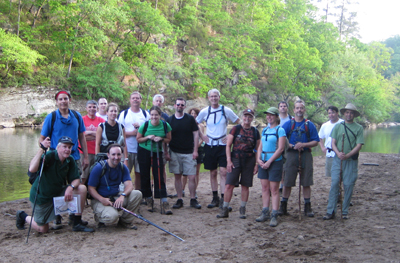
SPECIAL CAUTIONARY NOTE: This event is intended only for experienced hiker-boulderers in good physical condition who feel comfortable with climbing unroped up and down high rocky cliffs and don't mind bushwhacking through rugged brushy terrain. We consider this event a "D6 adventure" not for its distance or elevation gain but rather for its inherent elements of danger. IN A NUTSHELL: Several AOC adventurers who were part of our group for this bouldering and cliff climbing hike last Labor Day have requested that we offer it again, so here it is - our 2nd annual AOC "Loop the Hooch" Labor Day Bouldering Hike! This year's goal will be to "one-up" our 2011 feat as follows: As we did last Labor Day we'll plan to complete an entire 7-mile clockwise "Loop Route" of both the East and West Palisades near the riverbank. This year we'll plan also to ascend to the highest overlooks on both sides of the River - both about 1000' above sea level and 200' above the river. BACKGROUND: The ruggedly steep and beautiful East and West Palisades units of the CRNRA (Chattahoochee River Nat'l Rec. Area) are among the most popular of all North Georgia public areas for outdoor recreation. On opposite sides of the River between I-285 and US-41, the Palisades have been enjoyed on hundreds of AOC dayhikes over the years and make a spectacular wilderness backdrop for our "Happy Hour on the Hooch" floats in our kayaks, canoes and inflatables. For safety reasons, the CRNRA's official marked trail system avoids routes that take hikers up and over the numerous palisades (steep rocky cliffs) that rise from the water's edge. Despite this, adventurous local boulderers over the years have made numerous indistinct trails that connect to the formal trail system and make it possible to hike and climb quite close to the riverbank on both sides of the entire 3-mile length of the River through the Palisades. As discussed above, in order to hike directly by the riverbank we must cross several spots where “bouldering” (climbing over rocky cliffs) is required. Also we may choose to actually wade in the river in a few spots, so be prepared to get your shoes and legs wet! “RAIN OR SHINE EVENT”: We’ll plan to go ahead with the event unless unusually dangerous weather conditions are forecast. | |||||||
| |||||||
| How to Get There: | |||||||
| Event Directions: | WE'LL MEET IN THE FREE "RAY'S ON THE RIVER" PARKING LOT just beyond their main entrance. "As the crow flies" this is on the east bank of the Chattahoochee about 300 yards downstream of the I-285 bridge over the River).
IF DRIVING EASTWARD ON I-285 FROM THE I-75 INTERCHANGE in NW ATLANTA: 1. Get off I-285 at Exit #22, “Northside Drive, New Northside Drive, Powers Ferry Road.” 2. Turn Right onto Northside Drive and go just 0.1 mile to the next light. 3. Turn Right onto Powers Ferry Road and go 0.6 mile to the "Ray's on the River" sign (last left before you reach the Chattahoochee River). 4. Turn Left into the Ray's parking lot and proceed about 0.1 mile all the way to the rearmost parking spaces beyond the restaurant entrance. We'll park there during the hike. 1. Get off I-285 at Exit #22 “New Northside Drive/ Powers Ferry Rd” and at the end of the exit ramp continue straight ahead about 0.2 mile to the traffic light at Northside Drive. 2. Turn Left onto Northside Drive and go 0.2 mile to the traffic light at Powers Ferry Road.
| ||||||
| Notes: | |||||||
|
* We encourage all members to follow our Etiquette Guidelines while participating in AOC events. | |||||||
| Cost Includes: | Free Event with Free Parking at "Rays on the River!" | ||||||
Cancellation/Partial Attendance: Please review the AOC cancellation policy. | |||||||
 Calendar of Events
 Event Places