 Print-Friendly Version Print-Friendly Version
|
|
Laurel Valley to Lake Jocassee - NEW DATE | |||||||
| The Basics: | |||||||
| Event Type: | Hike | ||||||
| Event Location: |
Rocky Bottom, SC


| ||||||
| Date(s) & Time: | Sat, Sep 15 2012 7:45 am >> Sat, Sep 15 2012 10:00 pm (Carpool Departure: 7:45 am *log in for location*) | ||||||
| Registration Opens: | Thu, Aug 30 2012 8:01 pm | ||||||
| Registration Cut Off: | Fri, Sep 14 2012 6:00 pm | ||||||
| Event Duration: | 14 Hours 15 Minutes | ||||||
| Difficulty Rating: | D5: Difficult | ||||||
| Distance: | 16 Miles | ||||||
| Pace: | Moderate | ||||||
| Trip Leader(s): | Beth H Charlie Cottingham  Email Trip Leader(s) Email Trip Leader(s)
You must be logged in to get the Trip Leader contact information. | ||||||
| Member Cost: | None | ||||||
| Participant Info: | |||||||
| Who's Invited: | Members Only, 21 And Older Only | ||||||
| Maximum Group Size: | 12 | ||||||
| Minimum Group Size: | 4 | ||||||
| Number Registered So Far: | 7 / 0 (To see who's signed up, log in to the Member Area) | ||||||
| Are Dogs Permitted: | No | ||||||
| Itinerary: | |||||||
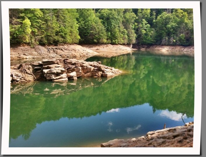
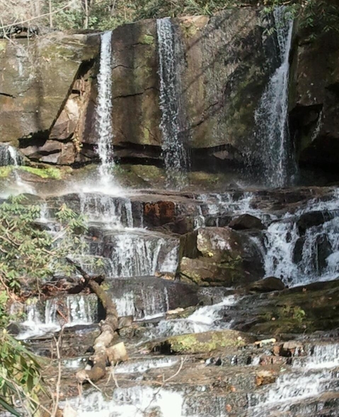
The Foothills trail is one of my favorite trails in the Carolinas because of all the waterfalls, rivers, & Lake Jocassee. It is a 77 mile trail that stretches from Oconee State Park to Table Rock State Park. Many of the trails are only accessible via backpacking or boat access. http://www.foothillstrail.org/ This hike starts at the Laurel Valley Parking lot in SC. It slowly climbs to the top of Flatrock Mountain (gain of 500 ft), goes along the top of the mountian & then descends quickly 1000 ft. to Laurel Fork Creek. About half way in we come to beautiful Virgina Hawkins Falls, pictured above. We will stop here for a bit & cool off. This trail has lots of water. The creeks have bridges, but there are occasional springs on the trail where your feet may get wet.Nothing major. Most can be hopped over. Please bring waterproof boots & or a change of socks
| |||||||
| |||||||
| How to Get There: | |||||||
| Event Directions: | From Indian Trail travel I-85 North approx 78 miles to SC 11 (Exit 1). Go North on SC 11 approx 47 miles to US 178. Turn left on US 178 & drive 7 miles to the town of Rocky Bottom. Just after the bridge over over Estoe Creek look for a gravel road (Laurel Valley Rd) on your left. Turn on to Laurel Valley Rd. The road will fork. Take the right gravel road for .5 miles to the Laurel Valley parking lot. | ||||||
| Carpool to Event Distance (round trip): | 266Mile(s) | ||||||
| Carpool Departure Time: | 7:45 am | ||||||
| Carpool Location: | Log in for location | ||||||
| Carpool Directions: | Log in for directions | ||||||
| Carpool Cost: | Estimated cost per vehicle for this event is $106.40 using a reimbursement rate guideline of $0.400 per mile. The total amount should be divided by the number of people in the vehicle, including the driver. This is a guideline, not a rule, for drivers but the cost should not be higher unless there are extenuating circumstances. | ||||||
| Notes: | |||||||
|
Driving to this trail head does involve a short .5 mile drive on a gravel road. Please keep this in mind if you volunteer to drive. * We encourage all members to follow our Etiquette Guidelines while participating in AOC events. | |||||||
Cancellation/Partial Attendance: Please review the AOC cancellation policy. *Note: Please review our Cancellation Policy carefully! Note: The registration cutoff for this hike is Friday Sept 14th at 6pm. If you need to change your RSVP after this time you will need to contact the trip leader directly. | |||||||
 Calendar of Events
 Event Places