 Print-Friendly Version Print-Friendly Version
|
|
Blood Mountain Via Jarrard Gap, AT, Freeman, and Mountain Crossings Store | |||||||
| The Basics: | |||||||
| Event Type: | Hike | ||||||
| Event Location: |
Suches, GA


| ||||||
| Date(s) & Time: | Sun, Oct 21 2012 9:30 am >> Sun, Oct 21 2012 6:15 pm (Carpool Departure: 7:51 am *log in for location*) | ||||||
| Registration Opens: | Tue, Oct 2 2012 8:00 pm | ||||||
| Registration Cut Off: | Fri, Oct 19 2012 8:00 pm | ||||||
| Event Duration: | 8 Hours 45 Minutes | ||||||
| Difficulty Rating: | D5: Difficult | ||||||
| Distance: | 12.3 Miles | ||||||
| Pace: | Moderate | ||||||
| Trip Leader(s): | Bob J Jimmy  Email Trip Leader(s) Email Trip Leader(s)
You must be logged in to get the Trip Leader contact information. | ||||||
| Member Cost: | None | ||||||
| Participant Info: | |||||||
| Who's Invited: | Members Only, 21 And Older Only | ||||||
| Maximum Group Size: | 12 | ||||||
| Minimum Group Size: | 4 | ||||||
| Number Registered So Far: | 9 / 0 (To see who's signed up, log in to the Member Area) | ||||||
| Are Dogs Permitted: | Yes | ||||||
| Itinerary: | |||||||
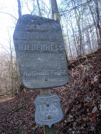
Join me on a hike to Blood Mountain and Mountain Crossings. We will visit the Mountain Crossings Store, the only building the AT goes through between Georgia and Maine. We we will take the trail head for Slaughter Creek to the start of Jarrard Gap Trail (.75 miles). Once on the Jarrard Gap Trail we will meet up with the AT (1.25) and take it towards Bird Gap (1.5). At this spot, after breaking for a short time, we will take the Freeman Trail to Flatrock Gap (1.9) and jump back on the AT to Neels Gap (1.0). We can have lunch and look around/shop at the Mountain Crossings store. The store has modern restrooms, hiking gear, frozen and dehydrated foods (with microwave), beverages, books and souvenirs. We will backtrack on the AT to highest point on the Georgia AT, the top of Blood Mountain (2.4 mi straight up the mountain), to enjoy a nice well deserved break with nearly a 360 degree view of the GA, NC and SC mountains. (total mileage so far 8.8). Hopefully, if the weather holds up, we can sit on top of the rock and enjoy a beautiful view. If it's raining, we can continue moving or take a break in the shelter. This is a long difficult D5 hike. If you have not recently completed some D5 or D6 hikes with the AOC, the leader will likely contact you to determine your abilities for this hike. The leader does reserve the right to remove anyone if warranted.
| |||||||
| |||||||
| How to Get There: | |||||||
| Event Directions: | North on GA 400. Take a left onto SR 60/19 toward Dahlonega. At the fork of SR 60 and SR 19, go straight on SR 60 to Suches. Take a right on SR 180. The entrance to the Lake Winfield Scott Recreation Area is on the right, approximately 7-8 miles on after you turn onto SR 180. As you drive toward the lake, past the campground, the parking lot is located on the left, just before you get to the bridge. The trailhead is located across the bridge and to your right. | ||||||
| Carpool to Event Distance (round trip): | 130Mile(s) | ||||||
| Carpool Departure Time: | 7:51 am | ||||||
| Carpool Location: | Log in for location | ||||||
| Carpool Directions: | Log in for directions | ||||||
| Carpool Cost: | Estimated cost per vehicle for this event is $52.00 using a reimbursement rate guideline of $0.400 per mile. The total amount should be divided by the number of people in the vehicle, including the driver. This is a guideline, not a rule, for drivers but the cost should not be higher unless there are extenuating circumstances. | ||||||
| Notes: | |||||||
|
$5 day use fee per vehical at Lake Winfield * We encourage all members to follow our Etiquette Guidelines while participating in AOC events. | |||||||
Cancellation/Partial Attendance: Please review the AOC cancellation policy. | |||||||
 Calendar of Events
 Event Places