 Print-Friendly Version Print-Friendly Version
|
|
Lose the Turkey and a couple more | |||||||
| The Basics: | |||||||
| Event Type: | Hike | ||||||
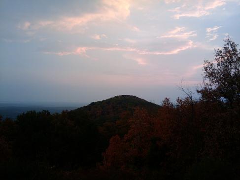
| Event Location: | Kennesaw Mountain National Battlefield Park | ||||||
| Date(s) & Time: | Fri, Nov 23 2012 7:00 am >> Fri, Nov 23 2012 1:30 pm | ||||||
| Registration Opens: | Thu, Nov 22 2012 10:15 am | ||||||
| Registration Cut Off: | Fri, Nov 23 2012 6:00 am | ||||||
| Event Duration: | 6 Hours 30 Minutes | ||||||
| Difficulty Rating: | D5: Difficult | ||||||
| Distance: | 18 Miles | ||||||
| Pace: | Fast | ||||||
| Trip Leader(s): | Danny Email Trip Leader(s) Email Trip Leader(s)
You must be logged in to get the Trip Leader contact information. | ||||||
| Member Cost: | None | ||||||
| Participant Info: | |||||||
| Who's Invited: | Members Only, 21 And Older Only | ||||||
| Maximum Group Size: | 8 | ||||||
| Minimum Group Size: | 1 | ||||||
| Number Registered So Far: | 2 / 0 (To see who's signed up, log in to the Member Area) | ||||||
| Are Dogs Permitted: | Yes | ||||||
| Itinerary: | |||||||
We will do it all using the 18 mile path that I generally take. Will do some jogging on the flats and downs in order to get more out of it. The idea is to break even on the stuff you cram into your mouth on Thanksgiving today and perhaps lose a couple more. We'll go over the mountains to Burnt Hickory Road, cross over and take the first trail on the right, cross the bridge over Noses Creek, then take a right and re-enter the woods. Then we'll cross 120 and enter Cheatham's Hill but take the long way around by taking the first right. We'll take the wide circle and end up scaling Cheatham's Hill from its base and climb the stairs to the Illinois Monument. From there we'll head down the other side of Cheatham's Hill by the unknown soldier and onto Kolb Farm doing the loop clockwise. This will bring us back to Cheatham's Hill and we'll head back to 120 parallelling the road. From there we head back the same way we came. This is roughly 18 miles.
| |||||||
| |||||||
| How to Get There: | |||||||
| Event Directions: | 1) I-75 North to exit 267B Hwy 5 Canton Road Connector | ||||||
| Notes: | |||||||
|
* We encourage all members to follow our Etiquette Guidelines while participating in AOC events. | |||||||
| Cost Includes: | No cost. | ||||||
Cancellation/Partial Attendance: Please review the AOC cancellation policy. *Note: This is a rain or shine hike - we will hike regardless of the weather - except for thunder, tornadoes or earthquakes. I will only cancel this hike if I'm standing at the Visitors Center at 7:00 AM and it's lightning. Even then, I'd try to wait it out in order to get the hike in. | |||||||
 Calendar of Events
 Event Places