 Print-Friendly Version Print-Friendly Version
|
|
Laurel Ridge Trail, Bowman’s Island, and Trout Hatchery | |||||||
| The Basics: | |||||||
| Event Type: | Hike | ||||||
| Event Location: |
Buford, GA


| ||||||
| Date(s) & Time: | Sun, Dec 2 2012 1:30 pm >> Sun, Dec 2 2012 4:44 pm | ||||||
| Registration Opens: | Thu, Nov 29 2012 9:22 pm | ||||||
| Registration Cut Off: | Sat, Dec 1 2012 8:48 pm | ||||||
| Event Duration: | 3 Hours 14 Minutes | ||||||
| Difficulty Rating: | D4: Moderate to Difficult | ||||||
| Distance: | 9.25 Miles | ||||||
| Pace: | Moderate | ||||||
| Trip Leader(s): | Mark Email Trip Leader(s) Email Trip Leader(s)
You must be logged in to get the Trip Leader contact information. | ||||||
| Member Cost: | None | ||||||
| Participant Info: | |||||||
| Who's Invited: | Members Only, 21 And Older Only | ||||||
| Maximum Group Size: | 14 | ||||||
| Minimum Group Size: | 3 | ||||||
| Number Registered So Far: | 9 / 0 (To see who's signed up, log in to the Member Area) | ||||||
| Are Dogs Permitted: | No | ||||||
| Itinerary: | |||||||
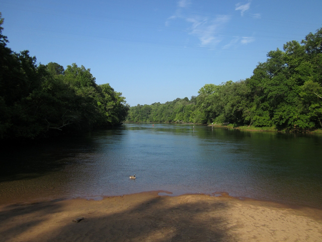
We will begin the hike from the Lower Overlook Park at Buford Dam. We will hike the Laurel Ridge trail down below the dam near the river and then head over to the tailwater raceway, crossing it into the Bowman's Island Unit of the Chattahoochee River National Recreation Area (CRNRA). From here we will head south along the river on a scenic trail until we reach the WRD Buford Trout Hatchery. The hatchery is open 7:30 AM - 4:30 PM daily, so we will take a little time to walk along the trout rearing area to admire some of the most beautiful creatures that swim. We might also stoll along the Hatchery Nature/Bird Trail which terminates in a boardwalk and viewing platform overlooking a beaver swamp. After leaving the Hatchery, we will head back up the river, cross the tailwater raceway, and return to the Laurel Ridge Trail. We will then continue along the Laurel Ridge trail finishing with a nice long walk along the shore of Lake Lanier.
Note: Some of the trails along the river are fishermans' trails and require some ups and downs through potentially muddy areas, so please wear shoes/boots with good traction.
Disclosure: Your TL, who enjoys exploring new places as much as you, has not hiked all of the trails we will be covering. I estimate the distance of this hike to be about 7 miles, however, the distance could be slightly longer. Therefore, please have a sense of adventure and be in sufficient physical condition to hike an extra mile if we miss a turn somewhere as some of these trails are well marked, and some are not marked. I have studied the maps, am familiar with the general area, and will have maps and a GPS at hand.
| |||||||
| |||||||
| How to Get There: | |||||||
| Event Directions: | From I85, head north and take the I 985 exit. Continue a little under 4 miles on I 985 until Exit 4. At the top of the ramp take a left onto SR 20. Proceed about 5.5 miles on SR 20 and take a right onto Suwanee Dam Road, which dead ends after 2.2 miles when it reaches Buford Dam Road. Take a left onto Buford Dam Road, and proceed 1 mile. The Lower Overlook parking will be on your right. If you reach Buford Dam you have gone too far. | ||||||
| Notes: | |||||||
|
Thre is no carpool for this event: some participants will already be in the area, after participating in the morning hike at Elachee Nature Center. * We encourage all members to follow our Etiquette Guidelines while participating in AOC events. | |||||||
Cancellation/Partial Attendance: Please review the AOC cancellation policy. | |||||||
 Calendar of Events
 Event Places