 Print-Friendly Version Print-Friendly Version
|
|
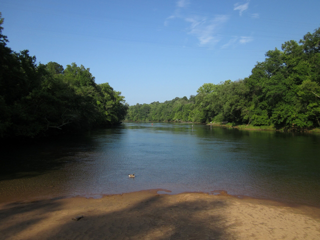
Sunday Afternoon Hike: Laurel Ridge Trail at Buford Dam | |||||||||
| The Basics: | |||||||||
| Event Type: | Hike | ||||||||
| Event Location: |
Buford, GA


| ||||||||
| Date(s) & Time: | Sun, Jan 27 2013 2:00 pm >> Sun, Jan 27 2013 4:30 pm | ||||||||
| Registration Opens: | Wed, Jan 23 2013 10:00 am | ||||||||
| Registration Cut Off: | Sat, Jan 26 2013 10:00 pm | ||||||||
| Event Duration: | 2 Hours 30 Minutes | ||||||||
| Difficulty Rating: | D2: Easy to Moderate (Exploratory) | ||||||||
| Distance: | 4.5 Miles | ||||||||
| Pace: | Moderate | ||||||||
| Trip Leader(s): | Ayo Email Trip Leader(s) Email Trip Leader(s)
You must be logged in to get the Trip Leader contact information. | ||||||||
| Member Cost: | None | ||||||||
| Participant Info: | |||||||||
| Who's Invited: | Members Only, 21 And Older Only | ||||||||
| Maximum Group Size: | 18 | ||||||||
| Minimum Group Size: | 4 | ||||||||
| Number Registered So Far: | 15 / 0 (To see who's signed up, log in to the Member Area) | ||||||||
| Are Dogs Permitted: | No | ||||||||
|
Note: This is an "EXPLORATORY" trip. This means that there are parts of this trip, or perhaps the whole trip, that is new to your Trip Leader(s). However, they are confident that this will not be an issue. This note is here so that you can make an informed decision. When a Trip Leader isn't personally familiar with a trip, there is an increased chance of things not going as planned and you need to be prepared. The Trip Leader may have additional details in the itinerary. | |||||||||
| Itinerary: | |||||||||
Thanks to Richard Zalik for the promotional image and original write-up for this event. | |||||||||
| |||||||||
| How to Get There: | |||||||||
| Event Directions: | From I85, head north and take the I 985 exit. Continue a little under 4 miles on I 985 until Exit 4. At the top of the ramp take a left onto SR 20. Proceed about 5.5 miles on SR 20 and take a right onto Suwanee Dam Road, which dead ends after 2.2 miles when it reaches Buford Dam Road. Take a left onto Buford Dam Road, and proceed 1 mile. The Lower Overlook parking will be on your right. If you reach Buford Dam you have gone too far. | ||||||||
| Notes: | |||||||||
|
* We encourage all members to follow our Etiquette Guidelines while participating in AOC events. | |||||||||
Cancellation/Partial Attendance: Please review the AOC cancellation policy. | |||||||||
 Calendar of Events
 Event Places