 Print-Friendly Version Print-Friendly Version
|
*S*N*O*W* Hike - Tray Mountain (Slow and Steady) | |||||||
| The Basics: | |||||||
| Event Type: | Hike | ||||||
| Event Location: |
Chattahoochee National Forest, near Helen, GA


| ||||||
| Date(s) & Time: | Sun, Feb 3 2013 10:00 am >> Sun, Feb 3 2013 8:00 pm (Carpool Departure: 10:00 am *log in for location*) | ||||||
| Registration Opens: | Sat, Feb 2 2013 3:48 pm | ||||||
| Registration Cut Off: | Sun, Feb 3 2013 9:00 am | ||||||
| Event Duration: | Per Itinerary | ||||||
| Difficulty Rating: | D5: Difficult | ||||||
| Distance: | 10.2 Miles | ||||||
| Pace: | Leisurely | ||||||
| Trip Leader(s): | Tony C John Stirman  Email Trip Leader(s) Email Trip Leader(s)
You must be logged in to get the Trip Leader contact information. | ||||||
| Member Cost: | None | ||||||
| Participant Info: | |||||||
| Who's Invited: | Members Only, 21 And Older Only | ||||||
| Maximum Group Size: | 10 | ||||||
| Minimum Group Size: | 2 | ||||||
| Number Registered So Far: | 7 / 0 (To see who's signed up, log in to the Member Area) | ||||||
| Are Dogs Permitted: | No | ||||||
| Itinerary: | |||||||
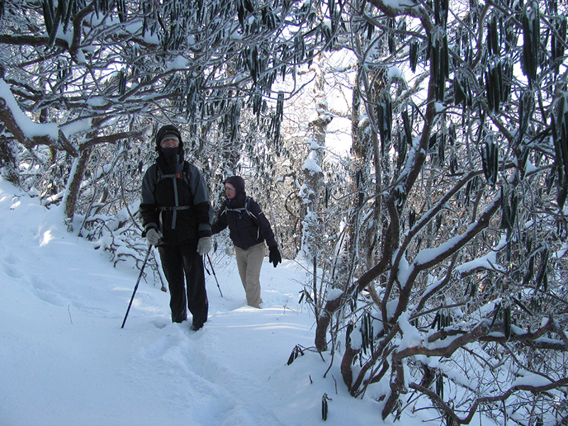
Ok so I know tomorrow is Super Bowl, but no Falcons and no Patriots has caused me to no care. And I just looked at the forecast for N GA and 2-5 inches of snow is forecast at higher elevations tonight and supposed to be sunny tomorrow. We haven't had many (or any?) good snow hiking opportunities in the N GA mtns this winter and who knows when we will get one again. So for those who would rather hike in the snow rather than watch a boring game and anthropomorphic animals trying to sell you things you don't need, join me on a hike up Tray mtn. This is a D5 but i could be a borderline D4 in warmer conditions, just because I plan to hike SLOW. And by SLOW, I mean 1 1/2 to 2mph. So if you are in D4 shape, you can handle this and probably will be ahead of me on the trail. Very fit D3 hikers would probably be ok on this...pace is everything. I don't know how much snow will be up there but hopefully a good bit. A friend of mine sent me pics from Raven Cliff Falls today (Sat) and looks like a lot arlready coming down. There probably won't be as much as in that pic above (that was from Tray in Dec 2010 and my best N GA snow hike ever) but even one or two inches up there would be a lot of fun. The forecast for tomorrow looks great...mostly sunny and high in the 40s at lower elevations and 30s up at the top of Tray. I did a hike two days ago with high in the 20s and we were all very comfortable because we were in the sun and we dressed properly. Once you start going uphill, your body heats up quickly as well. We will start at Andrews Cove which is lower elevations so the roads will hopefully be open and fine. The forecast high in Helen tomorrow is 53. Carpool is at 10 am so we get started at 12pm and more likely to have the roads thawed b then. If we did have any issues with the roads, we could always fall back and hike at Mt Yonah, which is always a good hike and of course even better with some snow. Hopefully we could park off GA75 for that one...but would just have to play it by ear and do whatever is safe, but will give it a shot. ---- Standing at 4430', Tray Mountain is the fifth tallest in GA (using 300' prominence rule). Andrews Cove sits at about 2000', about 900' below Unicoi Gap, (where Tray Mtn hikes often begin). This route has a longer initial climb (and ending descent) but does save you from having to climb Rocky Mtn twice.,..the elevation profile below tells the full story. (And thanks to Sam L for starting this “Slow and Steady” series, and I hope to lead a few more of these myself for those who enjoy a long hike with a leisurely to moderate pace. These are just an alternative to the faster, "fitness" hikes, which are great too, but not always in the mood for one of those. So we will take our time with this one, esp on the uphill sections.) | |||||||
| |||||||
| How to Get There: | |||||||
| Carpool to Event Distance (round trip): | 150Mile(s) | ||||||
| Carpool Departure Time: | 10:00 am | ||||||
| Carpool Location: | Log in for location | ||||||
| Carpool Directions: | Log in for directions | ||||||
| Carpool Cost: | Estimated cost per vehicle for this event is $60.00 using a reimbursement rate guideline of $0.400 per mile. The total amount should be divided by the number of people in the vehicle, including the driver. This is a guideline, not a rule, for drivers but the cost should not be higher unless there are extenuating circumstances. | ||||||
| Notes: | |||||||
|
* We encourage all members to follow our Etiquette Guidelines while participating in AOC events. | |||||||
| Cost Includes: | NA | ||||||
Cancellation/Partial Attendance: Please review the AOC cancellation policy. *Note: NA | |||||||
 Calendar of Events
 Event Places