 Print-Friendly Version Print-Friendly Version
|
|
^^ Summit GA’s Highest Peaks: #6 - Slaughter Mountain (4338’) ^^ | |||||||||||||||||||||||||||||||||||||||||||||||||||||||||
| The Basics: | |||||||||||||||||||||||||||||||||||||||||||||||||||||||||
| Event Type: | Hike | ||||||||||||||||||||||||||||||||||||||||||||||||||||||||
| Event Location: |
Chattahoochee National Forest, near Suches, GA


| ||||||||||||||||||||||||||||||||||||||||||||||||||||||||
| Date(s) & Time: | Sat, Apr 6 2013 10:15 am >> Sat, Apr 6 2013 5:55 pm (Carpool Departure: 8:30 am *log in for location*) | ||||||||||||||||||||||||||||||||||||||||||||||||||||||||
| Registration Opens: | Mon, Apr 1 2013 8:00 pm | ||||||||||||||||||||||||||||||||||||||||||||||||||||||||
| Registration Cut Off: | Fri, Apr 5 2013 10:00 pm | ||||||||||||||||||||||||||||||||||||||||||||||||||||||||
| Event Duration: | 7 Hours 40 Minutes | ||||||||||||||||||||||||||||||||||||||||||||||||||||||||
| Difficulty Rating: | D4: Moderate to Difficult | ||||||||||||||||||||||||||||||||||||||||||||||||||||||||
| Distance: | 10 Miles | ||||||||||||||||||||||||||||||||||||||||||||||||||||||||
| Pace: | Moderate | ||||||||||||||||||||||||||||||||||||||||||||||||||||||||
| Trip Leader(s): | Kristi Andrea Nunn  Email Trip Leader(s) Email Trip Leader(s)
You must be logged in to get the Trip Leader contact information. | ||||||||||||||||||||||||||||||||||||||||||||||||||||||||
| Member Cost: | None | ||||||||||||||||||||||||||||||||||||||||||||||||||||||||
| Participant Info: | |||||||||||||||||||||||||||||||||||||||||||||||||||||||||
| Who's Invited: | Members Only, 21 And Older Only | ||||||||||||||||||||||||||||||||||||||||||||||||||||||||
| Maximum Group Size: | 12 | ||||||||||||||||||||||||||||||||||||||||||||||||||||||||
| Minimum Group Size: | 4 | ||||||||||||||||||||||||||||||||||||||||||||||||||||||||
| Number Registered So Far: | 5 / 0 (To see who's signed up, log in to the Member Area) | ||||||||||||||||||||||||||||||||||||||||||||||||||||||||
| Are Dogs Permitted: | No | ||||||||||||||||||||||||||||||||||||||||||||||||||||||||
| Itinerary: | |||||||||||||||||||||||||||||||||||||||||||||||||||||||||
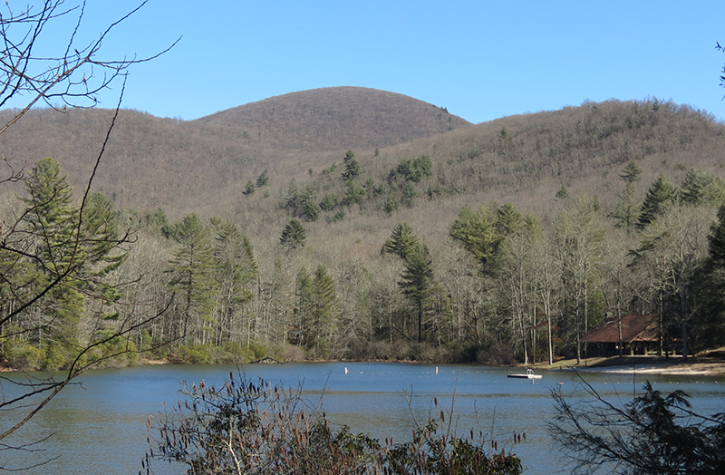
The North Georgia mountains may not be the Himalayas or the Rockies, but do offer many opportunties for challenging and exciting hikes to outstanding scenic views. For this series, we are summiting the 20 highest peaks in Georgia. (For more info on the criteria used, click here.) #6 - Slaughter Mtn
Slaughter Mountain is one of the most impressive in GA, but is often overshadowed by its even taller neighbor, Blood Mtn. Althought there are no developed trails going up, it is only a short hike up from the Duncan Ridge Trail and you are enjoying some beautiful views towards the southeast that one gets from a rocky overlook just off Slaughter's summit. From Lake Winfield Scott, we will hike along the Slaughter Creek Trail, the A.T., and Duncan Ridge Trail. About 1 mile along the Duncan Ridge Trail we will leave it at some point for a short off trail hike to the top of Slaughter. After enjoying our time at the summit and at the overlook, we will head back down and we will also include the summit of Blood Mtn in this hike...it is only about 1 mile away. We will stop for photo ops along the way! Note: This is an EXPLORATORY trip. There is a part of this trip that is new to your Trip Leader(s). However, they are confident that this will not be an issue. This note is here so that you can make an informed decision. When a Trip Leader isn't personally familiar with a trip, then there is an increased chance of things not going as planned, and as such, you need to be prepared for such. The Trip Leader may have additional details in the itinerary. | |||||||||||||||||||||||||||||||||||||||||||||||||||||||||
| |||||||||||||||||||||||||||||||||||||||||||||||||||||||||
| How to Get There: | |||||||||||||||||||||||||||||||||||||||||||||||||||||||||
| Event Directions: |
Sorry for the odd formatting. Easier to read the directions from the link!
| ||||||||||||||||||||||||||||||||||||||||||||||||||||||||
| Carpool to Event Distance (round trip): | 140Mile(s) | ||||||||||||||||||||||||||||||||||||||||||||||||||||||||
| Carpool Departure Time: | 8:30 am | ||||||||||||||||||||||||||||||||||||||||||||||||||||||||
| Carpool Location: | Log in for location | ||||||||||||||||||||||||||||||||||||||||||||||||||||||||
| Carpool Directions: | Log in for directions | ||||||||||||||||||||||||||||||||||||||||||||||||||||||||
| Carpool Cost: | Estimated cost per vehicle for this event is $56.00 using a reimbursement rate guideline of $0.400 per mile. The total amount should be divided by the number of people in the vehicle, including the driver. This is a guideline, not a rule, for drivers but the cost should not be higher unless there are extenuating circumstances. | ||||||||||||||||||||||||||||||||||||||||||||||||||||||||
| Notes: | |||||||||||||||||||||||||||||||||||||||||||||||||||||||||
|
* We encourage all members to follow our Etiquette Guidelines while participating in AOC events. | |||||||||||||||||||||||||||||||||||||||||||||||||||||||||
| Cost Includes: | NA | ||||||||||||||||||||||||||||||||||||||||||||||||||||||||
Cancellation/Partial Attendance: Please review the AOC cancellation policy. *Note: NA | |||||||||||||||||||||||||||||||||||||||||||||||||||||||||
 Calendar of Events
 Event Places