 Print-Friendly Version Print-Friendly Version
|
|
Afterwork at Sweetwater! | |||||||
| The Basics: | |||||||
| Event Type: | Hike | ||||||
| Event Location: |
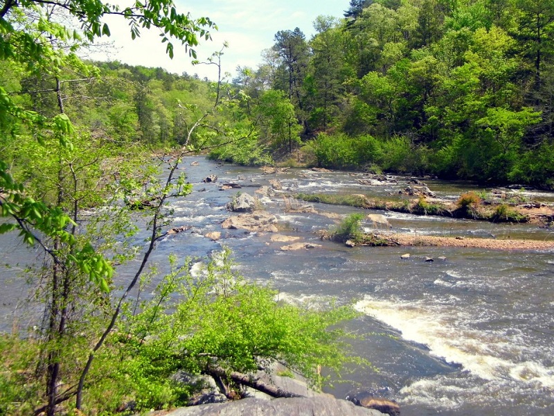
Sweetwater Creek State Park


| ||||||
| Date(s) & Time: | Tue, May 21 2013 5:30 pm >> Tue, May 21 2013 7:30 pm | ||||||
| Registration Opens: | Mon, May 13 2013 8:00 pm | ||||||
| Registration Cut Off: | Mon, May 20 2013 8:00 pm | ||||||
| Event Duration: | 2 Hours | ||||||
| Difficulty Rating: | D3: Moderate | ||||||
| Distance: | 5.5 Miles | ||||||
| Pace: | Moderate | ||||||
| Trip Leader(s): | John Stirman Lauren  Email Trip Leader(s) Email Trip Leader(s)
You must be logged in to get the Trip Leader contact information. | ||||||
| Member Cost: | None | ||||||
| Participant Info: | |||||||
| Who's Invited: | Members Only, 21 And Older Only | ||||||
| Maximum Group Size: | 14 | ||||||
| Minimum Group Size: | 4 | ||||||
| Number Registered So Far: | 5 / 0 (To see who's signed up, log in to the Member Area) | ||||||
| Are Dogs Permitted: | No | ||||||
| Itinerary: | |||||||
Sweetwater State Conservation Park is one of the treasures to be found near metro Atlanta. This park offers beauty and wildlife viewing for visitors all year long in addition to some Civil War history. The park sets atop the Brevard Fault which makes the terrain steeper than the surrounding areas. The creek itself offers many scenic spots as it tumbles over the shoals and the natural dam nearby. We will start on time, so please arrive 5-10 minutes early to check in. Note: there is a $5 per vehicle parking fee if you do not already have a GA Parks State pass. No carpool for this event. http://www.gastateparks.org/Sweetwater | |||||||
| |||||||
| How to Get There: | |||||||
| Event Directions: | Take I-20 west to exit 44 (Thornton Road). Make a left on Thornton Road (South) and then a right onto Blairs Bridge Road. Travel 2.1 miles to Mount Vernon Road and make a left. Drive about one mile to the park entrance and make a left on Factory Shoals Road (just after the bridge). Drive about half a mile to the parking lot near the visitor's center. | ||||||
| Notes: | |||||||
|
* We encourage all members to follow our Etiquette Guidelines while participating in AOC events. | |||||||
Cancellation/Partial Attendance: Please review the AOC cancellation policy. | |||||||
 Calendar of Events
 Event Places