 Print-Friendly Version Print-Friendly Version
|
|
Dick’s Creek Gap to Addis Gap on the AT | |||||||
| The Basics: | |||||||
| Event Type: | Hike | ||||||
| Event Location: |
Chattahoochie National Forest, nr Hiawassee


| ||||||
| Date(s) & Time: | Sat, Jul 13 2013 8:00 am >> Sat, Jul 13 2013 8:00 pm | ||||||
| Registration Opens: | Thu, Jul 11 2013 9:51 am | ||||||
| Registration Cut Off: | Fri, Jul 12 2013 6:00 pm | ||||||
| Event Duration: | per itinerary | ||||||
| Difficulty Rating: | D5: Difficult | ||||||
| Distance: | 11 Miles | ||||||
| Pace: | Moderate | ||||||
| Trip Leader(s): | Dorothea Email Trip Leader(s) Email Trip Leader(s)
You must be logged in to get the Trip Leader contact information. | ||||||
| Member Cost: | None | ||||||
| Participant Info: | |||||||
| Who's Invited: | Members Only, 21 And Older Only | ||||||
| Maximum Group Size: | 9 | ||||||
| Minimum Group Size: | 2 | ||||||
| Number Registered So Far: | 5 / 0 (To see who's signed up, log in to the Member Area) | ||||||
| Are Dogs Permitted: | No | ||||||
| Itinerary: | |||||||
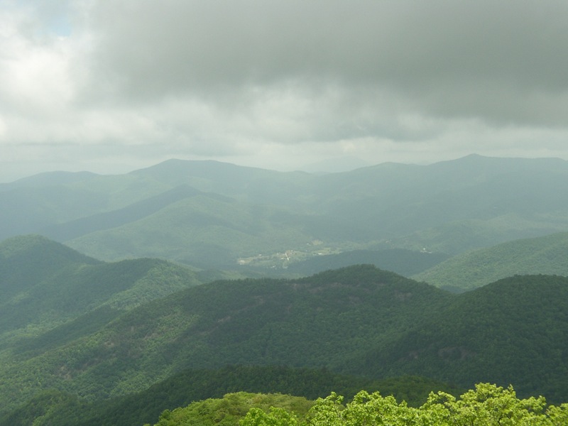
The weather forecast for Saturday, at the moment and for what it's worth, calls for fabulous hiking weather. The threat of showers (weather.com) or T-storms (weather noaa) is 30%, which is not worth thinking about. This stretch of the AT is good for a warm summer's day, because the woods are spacious and breezy and we get three fantastic views. From Dick's Creek Gap we climb about 1200 ft to a sidetrail leading to our first lookout. Returning to the trail we make an undulating descent to Deep Gap and then climb 600 ft to Kelly Knob (aka Double Spring). Here we have a grand view to the east. We then descend about five minutes to a lookout to the west, where we can pause for a moment before descending to Addis Gap, our turn-around point. Now we climb right back up to that same lookout (800 ft) and have lunch. Then it's back the way we came. Total distance is 11 miles and total elevation gain is somewhere over 3000 ft. I am still trying to get a good photo of Kelly's Knob, but this will have to do for now. If you can spot it through all the clouds, Kelly's Knob is left of center on the horizon. I expect to be off the trail by 5:00 at the latest. We will have dinner in Clayton afterwards. Since I will be joining the group in Clayton, I will ask someone to co-ordinate the carpool at the Indian Trail Park and Ride. | |||||||
| |||||||
| How to Get There: | |||||||
| Event Directions: | From Indian Trail park-and-ride, take I-85 North. After 11 miles bear left to tkae I-985 North. This road will change to GA 365, US 441, and US 23. Stay on it for 75 miles, then stop at the Burger King in Clayton (at the turnoff to Warwoman Rd) | ||||||
| Notes: | |||||||
|
Because this is a D5 event, if you have not recently completed some tough AOC hikes, I may be contacting you to determine your level of fitness and experience to make sure this is the right hike for you. * We encourage all members to follow our Etiquette Guidelines while participating in AOC events. | |||||||
Cancellation/Partial Attendance: Please review the AOC cancellation policy. | |||||||
 Calendar of Events
 Event Places