 Print-Friendly Version Print-Friendly Version
|
|
Palisades Loop | |||||||
| The Basics: | |||||||
| Event Type: | Hike | ||||||
| Event Location: |
Atlanta, GA


| ||||||
| Date(s) & Time: | Sun, Sep 29 2013 8:15 am >> Sun, Sep 29 2013 11:45 am | ||||||
| Registration Opens: | Thu, Sep 26 2013 11:15 pm | ||||||
| Registration Cut Off: | Sun, Sep 29 2013 7:45 am | ||||||
| Event Duration: | 3 Hours 30 Minutes | ||||||
| Difficulty Rating: | D4: Moderate to Difficult | ||||||
| Distance: | 6 Miles | ||||||
| Pace: | Fast | ||||||
| Trip Leader(s): | Eric P Email Trip Leader(s) Email Trip Leader(s)
You must be logged in to get the Trip Leader contact information. | ||||||
| Member Cost: | None | ||||||
| Participant Info: | |||||||
| Who's Invited: | Members Only, 21 And Older Only | ||||||
| Maximum Group Size: | 8 | ||||||
| Minimum Group Size: | 2 | ||||||
| Number Registered So Far: | 1 / 0 (To see who's signed up, log in to the Member Area) | ||||||
| Are Dogs Permitted: | No | ||||||
| Itinerary: | |||||||
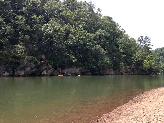
While a large majority of this event is along flat easy terrain you should be aware that the cliff sections along the river includes doing some easy scrambling and walking on narrow ledges. This is probably not advisable to anyone that is truly afraid of heights. In general we will try to stay along the riverside but in places it will be necessary to go up the cliffs which may include the need to pull yourself up steep sections holding onto rocks or trees. You will be expected to be able to get up and down over 4-5ft tall logs and rocks in the more technical sections. Additionally be aware that you may get wet in these sections depending on the route we choose to take and the water level. The pace in these sections will be greatly reduced so that we can carefully make our way through some very technical terrain. Please be aware that roughly 1/3 of the hike takes place on unofficial and unmaintained "trails". The hike will be fairly fast paced in the flat sections but not a fitness hike as we make our way around the river. We will generally be keeping a pace between 3 and 3.5 miles per hour everywhere other than in the technical sections along the river and during brief stops at points of interest. Additionally at the start of the hike from the Whitewater Creek parking lot to the US 41 bridge the trail disappears in places and some very minor bushwacking may be needed to continue along the river. I would strongly recommend having a pair of pants/convertible pants that you can quickly throw on for this part of the hike and some sections with poison ivy very close to the trail. | |||||||
| |||||||
| How to Get There: | |||||||
| Event Directions: | Directions from: From eastbound Interstate 285 From westbound Interstate 285 From northbound Interstate 75 From northbound U.S. 41 From southbound U.S. 41 | ||||||
| Notes: | |||||||
|
There is a $3 parking fee * We encourage all members to follow our Etiquette Guidelines while participating in AOC events. | |||||||
Cancellation/Partial Attendance: Please review the AOC cancellation policy. | |||||||
 Calendar of Events
 Event Places