

 Print-Friendly Version Print-Friendly Version
|
Chattooga River Trail: Russell Bridge to Lick Log Creek | |||||||
| The Basics: | |||||||
| Event Type: | Backpacking | ||||||
| Event Location: |
Chattooga River at Hwy 28


| ||||||
| Date(s) & Time: | Sat, Nov 30 2013 10:30 am >> Sun, Dec 1 2013 5:30 pm (Carpool Departure: 8:00 am *log in for location*) | ||||||
| Registration Opens: | Mon, Nov 25 2013 8:00 pm | ||||||
| Registration Cut Off: | Fri, Nov 29 2013 6:00 pm | ||||||
| Event Duration: | 1 Days 7 Hours | ||||||
| Difficulty Rating: | D3: Moderate (Exploratory) | ||||||
| Distance: | 8 Miles | ||||||
| Pace: | Leisurely | ||||||
| Trip Leader(s): | Laura V Email Trip Leader(s) Email Trip Leader(s)
You must be logged in to get the Trip Leader contact information. | ||||||
| Member Cost: | None | ||||||
| Participant Info: | |||||||
| Who's Invited: | Members Only, 21 And Older Only | ||||||
| Maximum Group Size: | 8 | ||||||
| Minimum Group Size: | 4 | ||||||
| Number Registered So Far: | 8 / 0 (To see who's signed up, log in to the Member Area) | ||||||
| Are Dogs Permitted: | Yes | ||||||
|
Note: This is an "EXPLORATORY" trip. This means that there are parts of this trip, or perhaps the whole trip, that is new to your Trip Leader(s). However, they are confident that this will not be an issue. This note is here so that you can make an informed decision. When a Trip Leader isn't personally familiar with a trip, there is an increased chance of things not going as planned and you need to be prepared. The Trip Leader may have additional details in the itinerary. | |||||||
| Itinerary: | |||||||
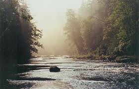
Overview: Section 3 of the Chattooga River Trail runs southeast from Burrells Ford Road to Highway 28. We will cover the lower half of this section starting from Russell Bridge on Highway 28. From the parking lot, we will head upriver 4 miles, where will camp for the night. Details: The CRT parallels its namesake for most of the hike with beautiful views of the Wild and Scenic river. At one point, the trail veers away from the river to bypass a small mountain. There are a few short, steep inclines as the trail winds along the river bank, but nothing too strenous. The total elevation gain is 1,211 feet over 7.9 miles. After approximately 3.5 miles, we will select a suitable campsite for the night. Those who wish to explore some of the falls further on up the river can head out to play, while those who wish to relax and maybe do a little fishing can hang around the campsite. Everyone is welcome to gather firewood for the evening bonfire. On Sunday morning, we will enjoy a leisurely breakfast, break camp and head back downriver to our vehicles. The last half of our return trip will follow a fisherman's trail along the river bank. This trail may have a bit more overgrowth, so if it is too thick for us to pass, we will take the main trail. After arriving back at our vehicles, we will head back to Atlanta. Those who are so inclined are welcome to stop for dinner on Sunday evening - please plan your carpools accordingly. **Please note that this is NOT the exact same section of the CRT that will be covered by the Aaron's backpacking trip planned for the following weekend (December 7 - 8th). http://www.atlantaoutdoorclub.com/events/detai ls.asp?eventid=7993
These are adjoining sections of the same trail, but will not cover the same ground. (Thanks, Aaron, for letting me incorporate a few logistical details into this event description.)
If you are a beginner looking to get into backpacking then this would be a great trip for you. Further suggestions on what to bring can be found on the AOC website here: http://www.atlantaoutdoorclub.com/events/chec klists/backpacking.asp Up to 2 well behaved dogs are welcome on this trip. Must be able to retrieve firewood. | |||||||
| |||||||
| How to Get There: | |||||||
| Event Directions: | Will be provided at the carpool. | ||||||
| Carpool to Event Distance (round trip): | 230Mile(s) | ||||||
| Carpool Departure Time: | 8:00 am | ||||||
| Carpool Location: | Log in for location | ||||||
| Carpool Directions: | Log in for directions | ||||||
| Carpool Cost: | Estimated cost per vehicle for this event is $92.00 using a reimbursement rate guideline of $0.400 per mile. The total amount should be divided by the number of people in the vehicle, including the driver. This is a guideline, not a rule, for drivers but the cost should not be higher unless there are extenuating circumstances. | ||||||
| Notes: | |||||||
|
* We encourage all members to follow our Etiquette Guidelines while participating in AOC events. | |||||||
| Cost Includes: | A small parking fee may be required at the Highway 28 parking area. | ||||||
Cancellation/Partial Attendance: Please review the AOC cancellation policy. | |||||||