 Print-Friendly Version Print-Friendly Version
|
|
Chattahoochee River Lucky 13K Cochran Shoals Unit Fitness Hike | |||||||
| The Basics: | |||||||
| Event Type: | Hike | ||||||
| Event Location: |
Marietta


| ||||||
| Date(s) & Time: | Sat, Jan 18 2014 2:00 pm >> Sat, Jan 18 2014 5:00 pm | ||||||
| Registration Opens: | Sun, Jan 12 2014 6:16 pm | ||||||
| Registration Cut Off: | Sat, Jan 18 2014 2:00 pm | ||||||
| Event Duration: | 3 Hours | ||||||
| Difficulty Rating: | D4: Moderate to Difficult | ||||||
| Distance: | 7 Miles | ||||||
| Pace: | Fast | ||||||
| Trip Leader(s): | Grant Brown Email Trip Leader(s) Email Trip Leader(s)
You must be logged in to get the Trip Leader contact information. | ||||||
| Member Cost: | None | ||||||
| Participant Info: | |||||||
| Who's Invited: | Members Only, 21 And Older Only | ||||||
| Maximum Group Size: | 20 | ||||||
| Minimum Group Size: | 2 | ||||||
| Number Registered So Far: | 12 / 0 (To see who's signed up, log in to the Member Area) | ||||||
| Are Dogs Permitted: | No | ||||||
| Itinerary: | |||||||
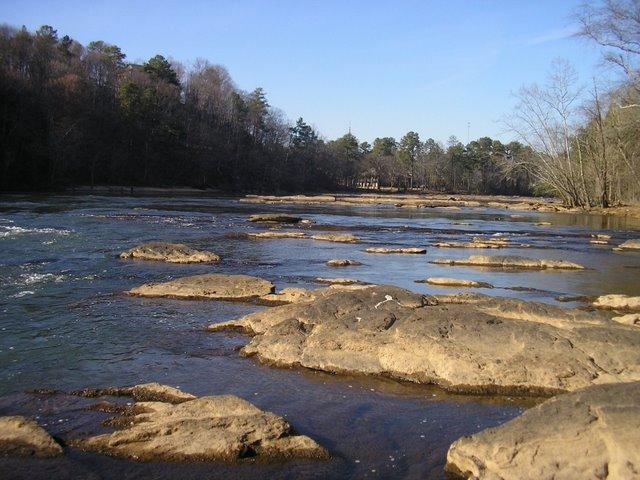
Hi All! Rained out last week, but back for more calorie burnin' good times! I thought we could get a nice work out in three beautiful areas over at the Cochran Shoals/Columns Drive/Sope Creek Units of the Chattahoochee River National Recreation Area. Well, confession, 13 kiometers equal 8.08 miles, but we will actually hike 8.5 miles ; ) - according to last hikes gps reading. Let's meet at the main parking lot pay station at the Interstate North Parkway entrance that is on the south side [I-75 side] of the river at I-285 bridge. There is a $3 daily use fee required. We will head out by 2:05. If you have trouble findig a parking space, there is another parking lot on the north side of the river too [and you get to cross the bridge to get to the other side!]. We will hike out on the main wide trail, and then head away from the river into the backside, less-traveled trails and head up through the kudzu to the hidden pond of Sope Creek! Okay, maybe it's not so hidden, but lots of folks usualy haven't made it ups there. This is intended to be a brisk paced workout. We will try to maintain a 3.5 - 4.0 mph pace for 2-3 hours. Though it is flat in places, it is about one third hill. Grant P.S. A lot of people ask me what app I use for hiking. Sorry, it is an iphone only app I think, but I am sure there is a comparable app for Android. It's called MotionX GPS. It is great for tracking with time, distance, speed, autopause. But, it also uses open street map and open bike map data base, so it actually shows the trails that we hike on in it's maps - even in Cohutta Wilderness. Another key feature that keeps me from getting lost is that you can download maps ahead of time when you know you will be in a bad area for cell reception. Watch out, it's about to get geeky here, your phone often loses it's cellular network connectivity, but, when outdoors, it rarely loses its GPS signal. Cellular signals comes form cell tower sites and GPS signals come from sattelites. Long story longer, you will always be able to locate yourself, even in remote wilderness on a map you've donwloaded to your phone and with the GPS locating feature. Feel free to ask me to explain it better sometime. Last Spring we encounterd two lost GA Tech students in Cohutta. These guys were thirsty, hungary, and scared. They'd misread their map and gone off trail on top of that. They were so relieved to see us and get some food and water, and ask for directions before leaving out the next morning. They really needed this technology! Anyway, clck here for their website. | |||||||
| |||||||
| How to Get There: | |||||||
| Event Directions: | Get your driving directions on google: MAP The GPS coordiantes are: 33° 54' 6.79" N, 84° 26' 38.04" W
Here are trail maps: | ||||||
| Notes: | |||||||
|
* We encourage all members to follow our Etiquette Guidelines while participating in AOC events. | |||||||
Cancellation/Partial Attendance: Please review the AOC cancellation policy. | |||||||
 Calendar of Events
 Event Places