 Print-Friendly Version Print-Friendly Version
|
|
Over the Hill and Up the Mountain to Rabun Bald’s Summit | |||||||
| The Basics: | |||||||
| Event Type: | Hike | ||||||
| Event Location: |
Near Dillard/Clayton GA


| ||||||
| Date(s) & Time: | Sun, Jan 19 2014 8:30 am >> Sun, Jan 19 2014 1:30 pm (Carpool Departure: 7:00 am *log in for location*) | ||||||
| Registration Opens: | Mon, Jan 13 2014 6:00 pm | ||||||
| Registration Cut Off: | Sat, Jan 18 2014 12:00 pm | ||||||
| Event Duration: | 5 Hours | ||||||
| Difficulty Rating: | D4: Moderate to Difficult | ||||||
| Distance: | 6 Miles | ||||||
| Pace: | Moderate | ||||||
| Trip Leader(s): | Chad C John Stirman  Email Trip Leader(s) Email Trip Leader(s)
You must be logged in to get the Trip Leader contact information. | ||||||
| Member Cost: | None | ||||||
| Participant Info: | |||||||
| Who's Invited: | Members Only, 21 And Older Only | ||||||
| Maximum Group Size: | 12 | ||||||
| Minimum Group Size: | 4 | ||||||
| Number Registered So Far: | 8 / 0 (To see who's signed up, log in to the Member Area) | ||||||
| Are Dogs Permitted: | No | ||||||
| Itinerary: | |||||||
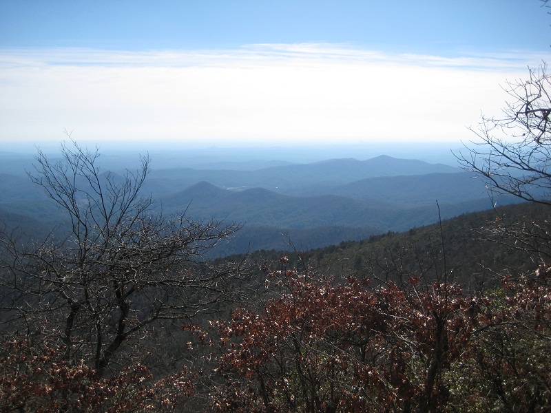
This will be a moderately paced hike that those who have consistently done D3s may find a Good Challenge while still being a nice hike for those who regularly do D4 and above. The elevation is the real challenge here! Please contact me if you are not sure if you are up for this hike BEFORE signing up. We will start out at around 2,500 feet and climb to the summit of Rabun Bald (approx. 2.9 miles), which is the second tallest mountain in Georgia at 4,696 feet. The trail ascends steeply and we will go at a moderate pace. We will stop at the top for lunch and to take in the views of the surrounding area. Then we will head back down the trail. We will try to accommodate hikers of differing levels, but you will need to consider if you are up for a 2500 ft. climb before signing up. Due to limited parking we will need to keep it to as few vehicles as possible, so please plan on carpooling with the group.
| |||||||
| |||||||
| How to Get There: | |||||||
| Event Directions: |
Trail head will be on the left with minimal parking along the road. | ||||||
| Carpool to Event Distance (round trip): | 205Mile(s) | ||||||
| Carpool Departure Time: | 7:00 am | ||||||
| Carpool Location: | Log in for location | ||||||
| Carpool Directions: | Log in for directions | ||||||
| Carpool Cost: | Estimated cost per vehicle for this event is $82.00 using a reimbursement rate guideline of $0.400 per mile. The total amount should be divided by the number of people in the vehicle, including the driver. This is a guideline, not a rule, for drivers but the cost should not be higher unless there are extenuating circumstances. | ||||||
| Notes: | |||||||
|
The coordinates shown for the weather are from the tower on top of Rabun Bald - NOT any of the parking spots! This allows for a more accurate forecast. * We encourage all members to follow our Etiquette Guidelines while participating in AOC events. | |||||||
Cancellation/Partial Attendance: Please review the AOC cancellation policy. | |||||||
 Calendar of Events
 Event Places