 Print-Friendly Version Print-Friendly Version
|
|
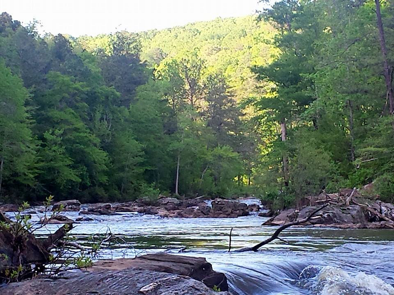
Sweetwater Creek - Hitting the Hills! | |||||||
| The Basics: | |||||||
| Event Type: | Hike | ||||||
| Event Location: |
Sweetwater Creek State Park


| ||||||
| Date(s) & Time: | Sun, May 4 2014 8:00 am >> Sun, May 4 2014 12:30 pm | ||||||
| Registration Opens: | Fri, May 2 2014 3:00 pm | ||||||
| Registration Cut Off: | Sat, May 3 2014 10:00 pm | ||||||
| Event Duration: | 4 Hours 30 Minutes | ||||||
| Difficulty Rating: | D4: Moderate to Difficult | ||||||
| Distance: | 12 Miles | ||||||
| Pace: | Moderate | ||||||
| Trip Leader(s): | John Stirman Email Trip Leader(s) Email Trip Leader(s)
You must be logged in to get the Trip Leader contact information. | ||||||
| Member Cost: | None | ||||||
| Participant Info: | |||||||
| Who's Invited: | Members Only, 21 And Older Only | ||||||
| Maximum Group Size: | 12 | ||||||
| Minimum Group Size: | 2 | ||||||
| Number Registered So Far: | 6 / 0 (To see who's signed up, log in to the Member Area) | ||||||
| Are Dogs Permitted: | No | ||||||
| Itinerary: | |||||||
Ready to hit some of the ridge lines and tougher unmarked trails in Sweetwater? We'll start promptly at 8 AM with the Yellow trail (hitting the lollipop loop from BOTH directions) then hit most of the Red, White, and mix in few un-blazed trails! I'm not slowing down for many pics on this one and will hit the trails with a goal of maximizing the elevation gain. If you can't maintain a good moderate pace uphill or you are looking for a liesurely paced hike then this is not for you. This is NOT a hike for beginners. I did this same route in November and gained a total of almost 3,000' elevation overall! *We will pause for a short break at the visitor's center about the halfway mark. **You will not get credit for this hike if you do not complete the hike. Note: there is a $5 per vehicle parking fee. No carpool for this event. Website for Park: | |||||||
| |||||||
| How to Get There: | |||||||
| Event Directions: | Take I-20 west to exit 44 (Thornton Road). Make a left on Thornton Road (South) and then a right onto Blairs Bridge Road. Travel 2.1 miles to Mount Vernon Road and make a left. Drive about one mile to the park entrance and make a left on Factory Shoals Road. Drive about half a mile to the parking lot near the visitor's center. Sweetwater Creek State Park | ||||||
| Notes: | |||||||
|
Here is the link to this same route from November of last year: http://www.endomondo.com/workouts/273249163/6324147 * We encourage all members to follow our Etiquette Guidelines while participating in AOC events. | |||||||
Cancellation/Partial Attendance: Please review the AOC cancellation policy. | |||||||
 Calendar of Events
 Event Places