 Print-Friendly Version Print-Friendly Version
|
|
In Search Of . . . Cohutta’s Sugar Cove Giant! | |||||||
| The Basics: | |||||||
| Event Type: | Hike | ||||||
| Event Location: |
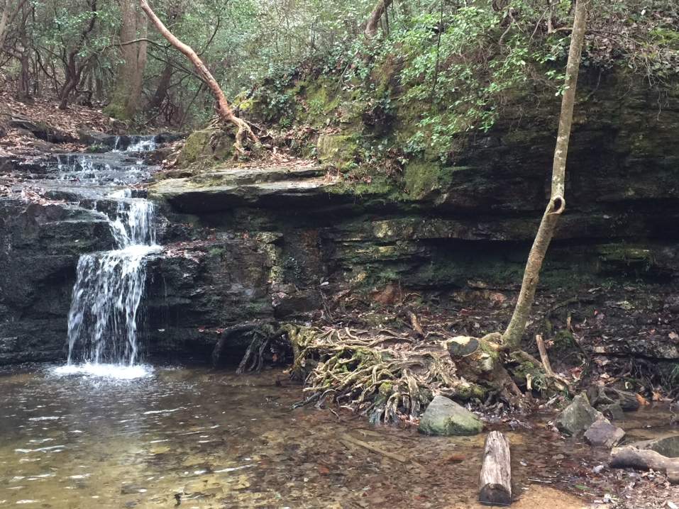
Three Forks Mountain, GA


| ||||||
| Date(s) & Time: | Sun, May 25 2014 8:00 am >> Sun, May 25 2014 6:00 pm (Carpool Departure: 8:15 am *log in for location*) | ||||||
| Registration Opens: | Sun, May 4 2014 10:52 am | ||||||
| Registration Cut Off: | Sun, May 25 2014 10:52 am | ||||||
| Event Duration: | 10 Hours | ||||||
| Difficulty Rating: | D5: Difficult (Exploratory) | ||||||
| Distance: | 11 Miles | ||||||
| Pace: | Moderate | ||||||
| Trip Leader(s): | Grant Brown Email Trip Leader(s) Email Trip Leader(s)
You must be logged in to get the Trip Leader contact information. | ||||||
| Member Cost: | None | ||||||
| Participant Info: | |||||||
| Who's Invited: | Members Only, 21 And Older Only | ||||||
| Maximum Group Size: | 12 | ||||||
| Minimum Group Size: | 3 | ||||||
| Number Registered So Far: | 12 / 0 (To see who's signed up, log in to the Member Area) | ||||||
| Are Dogs Permitted: | No | ||||||
|
Note: This is an "EXPLORATORY" trip. This means that there are parts of this trip, or perhaps the whole trip, that is new to your Trip Leader(s). However, they are confident that this will not be an issue. This note is here so that you can make an informed decision. When a Trip Leader isn't personally familiar with a trip, there is an increased chance of things not going as planned and you need to be prepared. The Trip Leader may have additional details in the itinerary. | |||||||
| Itinerary: | |||||||
This hike is for experienced members only who are comfortable with D5 scrambling and bushwacking. We will not be using climbing gear, but the off-trail nature of the hike will involve manoeuvring over and under rocks and downed trees. At times, we will be moving around steep hillsides of approximately 45-65 degree angles. It is very possible that we will encounter yellow jacket nests and snakes. It is truly exploratory. We can see the trail on GPS and opencyclemap.org. But, it is not physically visible before us as we proceed through the wilderness. If you have been to California and have seen the majestic Redwoods and Sequoias, you are probably as jealous as I am that we just don’t have trees of that magnitude here in Georgia. Nevertheless, we do have some trees that are quite special within our state. On this exploratory, off-trail, D5 hike we will search not only for a way into the cove [a small valley/canyon like area between mountains] , but also for one of our State Champion specimen trees and the trail’s namesake: a Sugar Maple [reference: nativetreesociety.org, Jess Riddle, 2004 and Georgia Forestry Commission, 2014]. I have contacted the Native Tree Society and am trying to get coordinates and description that will assist us in actually locating the tree specifically. But, we may be relying on our own observations for this. The ‘04 height measurement for it was 105’ which means it must be substantially taller with ten more years of growth on it. I explored the Sugar Cove in September 2011, but that trip was cut short due to injury. Please seriously heed the description in the opening paragraph. In Cohutta Wilderness, medical evacuation by emergency personnel could take several hours. I have wanted to see this area for a long time. It is off of the established Rough Ridge Trail. The Sugar Cove is supposed to be one of the most remote and beautiful areas in the Wilderness. It boasts having the largest old growth trees around. This hike involves about a thousand feet of altitude gain/loss. We will depart at 8:00 a.m. from the Cobb County Transit Busbee Park n Ride lot off of the I-75 north Chastain Road exit. Then we will drive to Elijay - then, north on Hyw 52 to Cohutta’s East Cowpen Trailhead at Three Forks Mountain. We will hike up East Cowpen, then right on Rough Ridge, then right onto Sugar Cove for some exploring up until we reach the Jacks River Trail where we will turn back. All of this is around 5 miles one way. We will consider just turning around about half way down into the cove though. We can stop in at Muchos Kaliente on the drive back for a celebration margarita : ) Article regarding the unique record old growth trees found in the cove:http://www.nativetreesociety.org/fieldtrips/georgia/sugar_cove.htm I will be bringing my iphone with the MotionX GPS app that I use to locate trails. I will also bring my Cohutta map and a compass as a back-up. It would be good if others bring a GPS smart phone app and make sure you have downloaded the area map of Sugar Cover onto the phone as data network won't be available. GPS signal will work, but not data/phone signals. | |||||||
| |||||||
| How to Get There: | |||||||
| Event Directions: |
| ||||||
| Carpool to Event Distance (round trip): | 154Mile(s) | ||||||
| Carpool Departure Time: | 8:15 am | ||||||
| Carpool Location: | Log in for location | ||||||
| Carpool Directions: | Log in for directions | ||||||
| Carpool Cost: | Estimated cost per vehicle for this event is $61.60 using a reimbursement rate guideline of $0.400 per mile. The total amount should be divided by the number of people in the vehicle, including the driver. This is a guideline, not a rule, for drivers but the cost should not be higher unless there are extenuating circumstances. | ||||||
| Notes: | |||||||
|
* We encourage all members to follow our Etiquette Guidelines while participating in AOC events. | |||||||
Cancellation/Partial Attendance: Please review the AOC cancellation policy. | |||||||
 Calendar of Events
 Event Places