
 Print-Friendly Version Print-Friendly Version
|
|
Jones Gap to Wolf Rock Mtn | |||||||
| The Basics: | |||||||
| Event Type: | Hike | ||||||
| Event Location: |
Jones Gap


| ||||||
| Date(s) & Time: | Sat, May 24 2014 8:00 am >> Sat, May 24 2014 6:00 pm (Carpool Departure: 8:00 am *log in for location*) | ||||||
| Registration Opens: | Mon, May 19 2014 8:10 pm | ||||||
| Registration Cut Off: | Fri, May 23 2014 6:00 pm | ||||||
| Event Duration: | Per Itinerary | ||||||
| Difficulty Rating: | D3: Moderate | ||||||
| Distance: | 7 Miles | ||||||
| Pace: | Moderate | ||||||
| Trip Leader(s): | Beth H John Stirman  Email Trip Leader(s) Email Trip Leader(s)
You must be logged in to get the Trip Leader contact information. | ||||||
| Member Cost: | None | ||||||
| Participant Info: | |||||||
| Who's Invited: | Members Only, 21 And Older Only | ||||||
| Maximum Group Size: | 12 | ||||||
| Minimum Group Size: | 4 | ||||||
| Number Registered So Far: | 12 / 0 (To see who's signed up, log in to the Member Area) | ||||||
| Are Dogs Permitted: | No | ||||||
| Itinerary: | |||||||
The 1st stop is a short walk from the Jones Gap parking lot for a view of Scaly Mtn. Returning to the parking lot we hike another mile on a side trail to Jones Knob to over look the Tessentee Valley. Hiking another 2 miles we come to the trail to the summit of Whiterock Mtn, aptly named for it's rocky face. We plan to spend some time here to explore a bit. We will pass through a pleasant forest area to Wolf Rock Overlook & return the way we came. If time permits we will stop in Clayton for dinner. If you do not wish to join us please carpool accordingly.
| |||||||
| |||||||
| How to Get There: | |||||||
| Event Directions: | From Indian Trail travel I-85 North To I-985. Continue on GA-365/US-23 N toward Clayton. Just past Dillard turn Right onto State Rte 106 toward Highlands, NC This road turns into NC-246 W when you enter NC. Stay on this road for 6.3 miles. Turn Left onto Turtle Pond Rd. (There are 2 enterances as there is a blind drive) At .2 miles approach Y intersection. Keep Right to stay on Turtle Pond Rd. At 3.1 mile go Left onto Dendy Orchard Rd. Road will become gravel. At 4.8 miles turn Left onto FS 4522 At 6.7 miles arrive at parking lot. | ||||||
| Carpool to Event Distance (round trip): | 220Mile(s) | ||||||
| Carpool Departure Time: | 8:00 am | ||||||
| Carpool Location: | Log in for location | ||||||
| Carpool Directions: | Log in for directions | ||||||
| Carpool Cost: | Estimated cost per vehicle for this event is $88.00 using a reimbursement rate guideline of $0.400 per mile. The total amount should be divided by the number of people in the vehicle, including the driver. This is a guideline, not a rule, for drivers but the cost should not be higher unless there are extenuating circumstances. | ||||||
| Notes: | |||||||
|
* We encourage all members to follow our Etiquette Guidelines while participating in AOC events. | |||||||
Cancellation/Partial Attendance: Please review the AOC cancellation policy. *Note: Please review our Cancellation Policy carefully! Note: The registration cutoff for this hike is Friday May 23rd at 6pm. If you need to change your RSVP after this time you will need to contact the trip leaders directly. | |||||||
 Calendar of Events
 Event Places
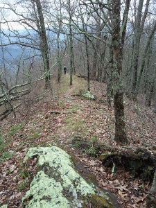 This is a hike on the beautiful Bartram Trail involving several side trails to overlooks & summits. We had so much fun scouting this & we hope you enjoy it as much as we did!