 Print-Friendly Version Print-Friendly Version
|
|
Kennesaw Mountain Work Out Hike | |||||||
| The Basics: | |||||||
| Event Type: | Hike | ||||||
| Event Location: |
Kennesaw Mountain National Battlefield Park, 900 Kennesaw Mountain Dr., Kennesaw, GA 30152


| ||||||
| Date(s) & Time: | Tue, May 27 2014 6:00 pm >> Tue, May 27 2014 8:10 pm | ||||||
| Registration Opens: | Thu, May 22 2014 8:00 pm | ||||||
| Registration Cut Off: | Tue, May 27 2014 2:00 pm | ||||||
| Event Duration: | 2 Hours 10 Minutes | ||||||
| Difficulty Rating: | D4: Moderate to Difficult | ||||||
| Distance: | 6 Miles | ||||||
| Pace: | Fast | ||||||
| Trip Leader(s): | David M Email Trip Leader(s) Email Trip Leader(s)
You must be logged in to get the Trip Leader contact information. | ||||||
| Member Cost: | None | ||||||
| Participant Info: | |||||||
| Who's Invited: | Members Only, 21 And Older Only | ||||||
| Maximum Group Size: | 10 | ||||||
| Minimum Group Size: | 1 | ||||||
| Number Registered So Far: | 3 / 0 (To see who's signed up, log in to the Member Area) | ||||||
| Are Dogs Permitted: | Yes | ||||||
| Itinerary: | |||||||
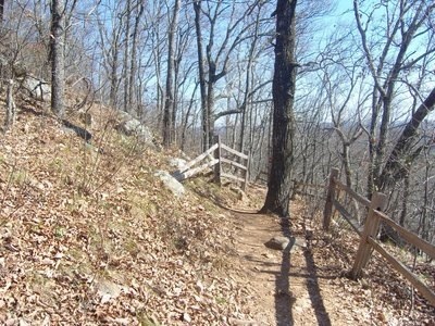
Come join us at the best place in Atlanta to keep your lungs toned for those weekend D4 and D5 hikes. If everyone is there early, we will move on out. After introductions (if you are new) and a quick briefing (go to the other side of Burnt Hickory Rd and back, stay right at forks in the path on the way there) we will ascend 1.2 m to the 1808ft top of Big Kennesaw, a climb of 657 ft. From there we will drop down about 500 ft to the gap between Little and Big Kennesaw mountains, up and over the hump in the middle, then down about 300 ft to the base of Little Kennesaw, then up to the top of Little Kennesaw at 1601 ft. Then we'll descend down to Burnt Hickory Rd on the other side of Little Kennesaw for a short break. Then we'll come back the same way to the Visitor Center. Total distance is a little under 6 miles. You should be familiar with this mountain, as there may be times when the group will hike at different speeds and separate. We will NOT re-group at trail junctions throughout this hike. If you are new, study the map. We will be hiking on the West trail, which goes over the mountains. The East trail goes around the mountains on the east side. This will be a moderately fast paced hike, with a target of 3 mph. The goal is to have everyone off the mountain by the 2 hour mark. There are water fountains at both the Visitor Center and Burnt Hickory Rd for you and your dog if you bring one.
| |||||||
| |||||||
| How to Get There: | |||||||
| Event Directions: | 1) I-75 North to exit 267B Hwy 5 Canton Road Connector | ||||||
| Notes: | |||||||
|
VERY IMPORTANT NOTES: Traffic will be a mess too. There is ALWAYS standstill traffic the last mile or so before the park. Please allow for this extra time when figuring out your driving time. * We encourage all members to follow our Etiquette Guidelines while participating in AOC events. | |||||||
| Cost Includes: | No cost. | ||||||
Cancellation/Partial Attendance: Please review the AOC cancellation policy. | |||||||
 Calendar of Events
 Event Places