 Print-Friendly Version Print-Friendly Version
|
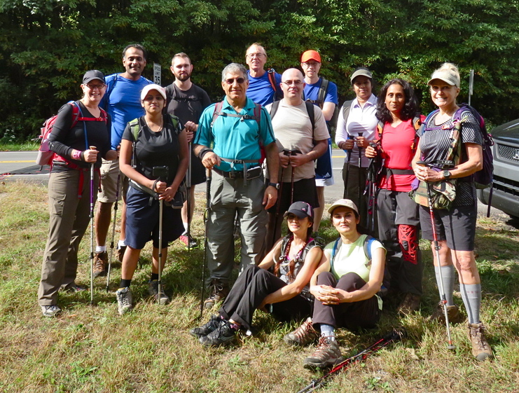
Sunday Hikes the Entire GA Appalachian Trail Series-Week 6 | |||||||
| The Basics: | |||||||
| Event Type: | Hike | ||||||
| Event Location: |
Unicoi Gap to Dicks Creek Gap


| ||||||
| Date(s) & Time: | Sun, Oct 5 2014 7:30 am >> Sun, Oct 5 2014 9:00 pm (Carpool Departure: 7:30 am *log in for location*) | ||||||
| Registration Opens: | Mon, Sep 29 2014 6:00 pm | ||||||
| Registration Cut Off: | Sat, Oct 4 2014 10:00 pm | ||||||
| Event Duration: | 13 Hours 30 Minutes | ||||||
| Difficulty Rating: | D6: Advanced (Exploratory) | ||||||
| Distance: | 16.5 Miles | ||||||
| Pace: | Moderate | ||||||
| Trip Leader(s): | Victor Joyce T.  Email Trip Leader(s) Email Trip Leader(s)
You must be logged in to get the Trip Leader contact information. | ||||||
| Member Cost: | None | ||||||
| Participant Info: | |||||||
| Who's Invited: | Members Only, 21 And Older Only | ||||||
| Maximum Group Size: | 12 | ||||||
| Minimum Group Size: | 4 | ||||||
| Number Registered So Far: | 11 / 0 (To see who's signed up, log in to the Member Area) | ||||||
| Are Dogs Permitted: | No | ||||||
|
Note: This is an "EXPLORATORY" trip. This means that there are parts of this trip, or perhaps the whole trip, that is new to your Trip Leader(s). However, they are confident that this will not be an issue. This note is here so that you can make an informed decision. When a Trip Leader isn't personally familiar with a trip, there is an increased chance of things not going as planned and you need to be prepared. The Trip Leader may have additional details in the itinerary. | |||||||
| Itinerary: | |||||||
Are You Ready For Another Fun and challenging Sunday on the AT? This is the 6th of series of day hikes that will cover entire GA Appalachian Trail from Springer Mountain to just past NC border to Bly Gap. Week 1: Springer Mtn to Hightower Gap ~ 11 miles and over 1000' Ascent completed on 8/31/14 Week 2: Hightower Gap to Woody Gap ~ 12 miles and 3000' Ascent Completed on 9/7/2014 Week 3: Woody Gap to Neel Gap ~ 11 miles and 2700' Ascent Completed 9/14/2014 Week 4: Neel Gap to Hogpen Gap and back ~ 14.6 miles and 4000' Ascent Completed 9/21/2014 Week 5: Hogpen Gap to Unicoi Gap ~ 14.5 Miles and 2500' Ascent Completed 9/28/2014 Week 6: Unicoi Gap to Dicks Creek Gap ~ 16.5 Miles and 5000' Ascent Week 7: Dicks Creek Gap to Bly Gap and RT to Blue Ridge Gap ~ 12.3 miles 3000' Ascent ( Celebration dinner and GA 80 miler's thru hiker patch ceremony for those that completed all events.) Week 6: Unicoi Gap to Dicks Creek GapThis is arguably the toughest of the seven sections in this series. While it has a fairly flat middle section, the long climbs at the start up Rocky Mtn and Tray mtn, plus the total distance just make it very challenging. It will be a rather grueling hike, but definitely an adventure and well worth the effort. This section includes views from Tray Mtn plus a nice overlook near Kelly Knob. This being a point-to-point hike, we will begin by shuttling cars...dropping some vehicles off at Dicks Creek Gap and taking the remaining ones to the start at Unicoi Gap. Once that bit of logistics is taken care of, we are stepping back onto the AT, headed east from Unicoi Gap at 2949'. We start with a 1050' climb up to Rocky Mtn over about 1.3 mi...then descend about 1300' to Indian Grave Gap. From there it is up 1300' over the next 2.4 mi to the summit of Tray Mtn (4430'), the 2nd hightest mtn on the GA AT. The views from Tray mtn are decent, but there are better views from near the Tray mtn shelter just past it..so we'll take the .2 mile side trail and our first long lunch break here. Over the next 5 miles, there are no major climbs. This area is known as the "Swag of the Blue Ridge". According to the Appalachian trail conference guide: “This area is called a “swag” or “low point” and is a long, broad ridgecrest with only moderate elevation change, extending for more than three miles- among the remotest areas of the Georgia Trail.” At 10.8 mi, we reach Addis Gap and it is a 900' climb over 1.1 miles to the shoulder of Kelly Knob. This is the one of the two peaks of Double Spring Knob and the highest mtn between the NC line and Tray mtn on the AT. We don't pass directly over the summit, but there is a nice overlook near here that we try to find.. After another lunch break here, we will start heading down...there will be an optional .3 mile side trip to the Deep Gap shelter but those who are too tired at this point can skip it. But it is mostly downhill (but with a few short climbs) from Kelly Knob over the last 4.2 miles to Dick Creek Gap to end section 6. We will return to Unicoi Gap to pick up the other car, and head home, with an optional to stop for dinner...two nice family restaurants on the way, a Thai and Italian to choose from. To summarize, the three big climbs in this section are: Unicoi Gap to Rocky Mtn 1050’ in 1.3 mi PLEASE NOTE: I LIKE EVERYONE TO STAY TOGETHER IN THIS HIKE. FAST HIKERS ARE WELCOME BUT MUST STAY WITH THE GROUP, SLOW HIKERS MUST BE ABLE TO HIKE 2.5 MILES AN HOUR. THIS HIKE IS DESIGNED FOR MODERATE SPEED HIKERS. | |||||||
| |||||||
| How to Get There: | |||||||
| Event Directions: | Please note: because of shuttle requirement this event is car pool only, if you are planning to drive by yourself alone this hike is not for you.(This hike only) Here is how it works: We take 3 cars preferably SUVs with each carrying 4 persons including driver. At point A (Unicoi Gap) we leave 1 car; then 2 fast volunteer hikers will take 2 other cars and drop 1 car at point B (Dicks creek Gap) and return with other car, they will meet us on or before Tray MTN, this means we will wait for them on top of Tray MTN if needed. After our hike only drivers ride with the car that we left at point B to bring back the rest of the cars. This means 2 cars will drive 220 miles and 1 car 180 miles. so the cost will be distributed accordingly. Approximate cost per person will be $22. We will adjust this cost base on actual final number. North on GA 400 from the park and ride. When GA 400 ends at Chevron station. continue on GA 115. Go 4.8 miles where GA 115 meets GA 52. Turn right. Continue on GA 115 for 12.5 miles and turn left on Wilford Ash Parkway. After 0.4 miles, Wilford Ash Parkway becomes GA-75. Stay on GA-75 thru Helen. From Helen it is about six miles to Unicoi Gap, where you will see hiker crossing signs. This means the AT is coming up. You will see the parking lot on the right. If you start going much downhill, you have gone too far.
| ||||||
| Carpool to Event Distance (round trip): | 220Mile(s) | ||||||
| Carpool Departure Time: | 7:30 am | ||||||
| Carpool Location: | Log in for location | ||||||
| Carpool Directions: | Log in for directions | ||||||
| Carpool Cost: | Estimated cost per vehicle for this event is $88.00 using a reimbursement rate guideline of $0.400 per mile. The total amount should be divided by the number of people in the vehicle, including the driver. This is a guideline, not a rule, for drivers but the cost should not be higher unless there are extenuating circumstances. | ||||||
| Notes: | |||||||
|
Sunday * We encourage all members to follow our Etiquette Guidelines while participating in AOC events. | |||||||
Cancellation/Partial Attendance: Please review the AOC cancellation policy. | |||||||
 Calendar of Events
 Event Places