 Print-Friendly Version Print-Friendly Version
|
|
Standing Indian Day Hike | |||||||
| The Basics: | |||||||
| Event Type: | Hike | ||||||
| Event Location: | 11 miles west of Franklin NC | ||||||
| Date(s) & Time: | Fri, Jan 9 2015 8:00 am >> Fri, Jan 9 2015 9:00 pm (Carpool Departure: 8:00 am *log in for location*) | ||||||
| Registration Opens: | Fri, Jan 2 2015 7:00 pm | ||||||
| Registration Cut Off: | Thu, Jan 8 2015 9:00 am | ||||||
| Event Duration: | 13 Hours | ||||||
| Difficulty Rating: | D5: Difficult | ||||||
| Distance: | 10 Miles | ||||||
| Pace: | Moderate | ||||||
| Trip Leader(s): | Dirk Email Trip Leader(s) Email Trip Leader(s)
You must be logged in to get the Trip Leader contact information. | ||||||
| Member Cost: | None | ||||||
| Participant Info: | |||||||
| Who's Invited: | Members Only, 21 And Older Only | ||||||
| Maximum Group Size: | 10 | ||||||
| Minimum Group Size: | 3 | ||||||
| Number Registered So Far: | 10 / 0 (To see who's signed up, log in to the Member Area) | ||||||
| Are Dogs Permitted: | No | ||||||
| Itinerary: | |||||||
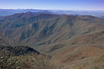
Standing Indian Mountain @ 5500', the highest point in the Southern Nantahala Wilderness stands as a sentinel, watching over the diverse range of habitats and wildlife on its descending slopes and in the wetlands and river basin below. It is a horseshoe-shaped drainage formed by the Nantahala and Blue Ridge mountains, which include several peaks higher than 5,000 feet. If you want a good workout, some great views, and a variety of countryside, this is the hike to make.
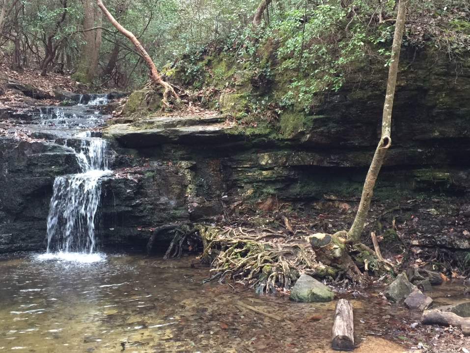
We'll start our hike up the (steep) 4.2 mile Lower Ridge trail, connecting with the AT for 1 mile to the summit of SI. Hiking another mile after lunch to the Kimsey Creek trailhead & continue down this trail for 3.7 miles back to the campground< | |||||||
| |||||||
| How to Get There: | |||||||
| Event Directions: | From the Indian Trail park & ride, take I-85 North. After 11 miles bear left to take I-985 North. This road will change to GA 365, US 441, and US 23. Stay on it for 75 miles, then stop at the Burger King in Clayton for a pit-stop and to meet the trip coordinator. Once back on the 441, continue 21 miles to Franklin, NC. Make a left (west) onto US 64 West and travel 10 miles, then turn left on to S.R. 1448 (Old US 64). Continue on S.R. 1448 to Wallace Gap and turn right, following the sign to Standing Indian Campground. Do not turn into the campground but continue on S.R. 1448 to the parking area at the Backcountry Information Center (just a big sign). We'll be driving on paved road the entire way. Travel time: 1.5 hours to Clayton + 45 minutes to the trailhead at the Backcountry Information Center. | ||||||
| Carpool to Event Distance (round trip): | 248Mile(s) | ||||||
| Carpool Departure Time: | 8:00 am | ||||||
| Carpool Location: | Log in for location | ||||||
| Carpool Directions: | Log in for directions | ||||||
| Carpool Cost: | Estimated cost per vehicle for this event is $99.20 using a reimbursement rate guideline of $0.400 per mile. The total amount should be divided by the number of people in the vehicle, including the driver. This is a guideline, not a rule, for drivers but the cost should not be higher unless there are extenuating circumstances. | ||||||
| Notes: | |||||||
|
This looks like the warmest day of the week, hopefully with plenty of sunshine. We will probably stop for dinner, in Franklin or Clayton. Depending on our time. Weather in Franklin has the low & high temp at 27/48, which it could be 10 degress colder on top the mountain or more. * We encourage all members to follow our Etiquette Guidelines while participating in AOC events. | |||||||
| Cost Includes: |
| ||||||
Cancellation/Partial Attendance: Please review the AOC cancellation policy. | |||||||
 Calendar of Events
 Event Places