 Print-Friendly Version Print-Friendly Version
|
|
Foothills Chattooga River Trail Loop | |||||||
| The Basics: | |||||||
| Event Type: | Backpacking | ||||||
| Event Location: |
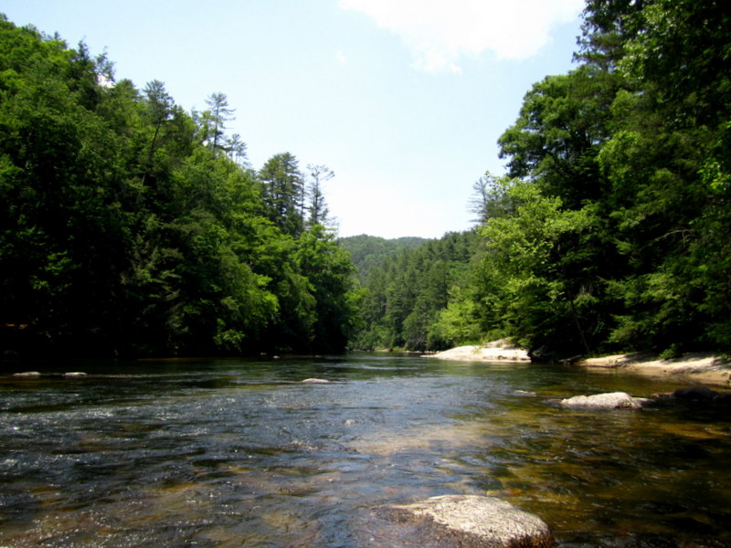
Ellicott Rock Wilderness


| ||||||
| Date(s) & Time: | Sat, Jan 17 2015 7:30 am >> Sun, Jan 18 2015 5:00 pm (Carpool Departure: 7:30 am *log in for location*) | ||||||
| Registration Opens: | Sat, Jan 10 2015 8:00 pm | ||||||
| Registration Cut Off: | Fri, Jan 16 2015 7:00 pm | ||||||
| Event Duration: | Per Itinerary | ||||||
| Difficulty Rating: | D5: Difficult (Exploratory) | ||||||
| Distance: | 18 Miles | ||||||
| Pace: | Moderate | ||||||
| Trip Leader(s): | Aaron Jennifer S  Email Trip Leader(s) Email Trip Leader(s)
You must be logged in to get the Trip Leader contact information. | ||||||
| Member Cost: | None | ||||||
| Participant Info: | |||||||
| Who's Invited: | Members Only, 21 And Older Only | ||||||
| Maximum Group Size: | 8 | ||||||
| Minimum Group Size: | 4 | ||||||
| Number Registered So Far: | 4 / 0 (To see who's signed up, log in to the Member Area) | ||||||
| Are Dogs Permitted: | Yes | ||||||
|
Note: This is an "EXPLORATORY" trip. This means that there are parts of this trip, or perhaps the whole trip, that is new to your Trip Leader(s). However, they are confident that this will not be an issue. This note is here so that you can make an informed decision. When a Trip Leader isn't personally familiar with a trip, there is an increased chance of things not going as planned and you need to be prepared. The Trip Leader may have additional details in the itinerary. | |||||||
| Itinerary: | |||||||
After leaving from Burrell Ford campground parking area and heading
east, this overnight trip into the Ellicott Rock Wilderness will take us up the
Medlin Mountain section of the Foothills trail where will we will gain several
hundred feet in the first few miles. We then level out as we approach the
fish hatchery for an overall gain of 580' over 7 miles. This section does not
have water, but hopefully the creek we will encounter on the next section
will supply our bottles and bladders. | |||||||
| |||||||
| How to Get There: | |||||||
| Event Directions: | From the SC Visitor Center we will take scenic highway 11 into Walhalla, we will then take SC 28 for 7.5 miles then bear right on SC 107, drive 10 miles then turn left on Burrells Ford Road. The parking area is approximately 3 miles ahead on the left. We will hand out driving directions. Plan on stopping at the SC Visitor exit for a bio break and to regroup. | ||||||
| Carpool to Event Distance (round trip): | 245Mile(s) | ||||||
| Carpool Departure Time: | 7:30 am | ||||||
| Carpool Location: | Log in for location | ||||||
| Carpool Directions: | Log in for directions | ||||||
| Carpool Cost: | Estimated cost per vehicle for this event is $98.00 using a reimbursement rate guideline of $0.400 per mile. The total amount should be divided by the number of people in the vehicle, including the driver. This is a guideline, not a rule, for drivers but the cost should not be higher unless there are extenuating circumstances. | ||||||
| Notes: | |||||||
|
* We encourage all members to follow our Etiquette Guidelines while participating in AOC events. | |||||||
Cancellation/Partial Attendance: Please review the AOC cancellation policy. | |||||||
 Calendar of Events
 Event Places